

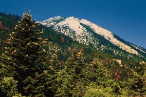
THIS RANGE LIES BETWEEN HERAKLION AND LASSITHI.
Its highest summit is Spathi (2.148 m) and there are two more peaks at an altitude of more than 2000m. Lassithi Plateau, the largest in Crete, lies at the heart of the range at an altitude of 850 m. It is surrounded by a series of smaller plateaus such as Katharo, Limnakaro, Mari, Lapathos, Omalos, Erganos and Nisimos. There is a mountain shelter at Limnakaro from where hikers ascend to Spathi.
Several gorges are found in the range of Lassithi. Apart from the two gorges named Havgas at Katharo and Kalamafka, there are more canyons such as Sarakina, Adrianos, Ambelos, Roza and Kritsa.
The Dikti range has shows a significant diversity in flora and fauna. The lower mountain sides are covered by olive, carob and pine trees. To the south-east, Selakano is the largest pine wood of Crete and close to the village Krasi lies the holm oak wood of Azilakodasos.
The fertile plateaus and valleys of the Dikti range produce a large variety of agricultural products: potatoes, vegetable, pears, apples, walnuts, cherries, etc. Livestock breeding (sheep and goats) is yet another traditional activity in this region. The famous Diktaean Cave where Zeus is said to have been born is open to the public.
Source: www.incrediblecrete.gr
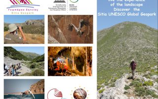
The new aspect of tourism, Sitia Geopark
When the Sitia region became a member of the UNESCO Geopark family, we had no idea just how much positive change this would bring! This new aspect of tourism “Sitia Geopark”, is proving to be a considerable point of interest, especially in the alternative tourism market. The natural environment is no longer an obstacle for tourism development, on the contrary it is a great attraction for visitors. We... read more
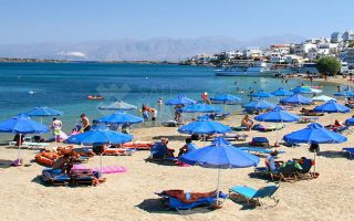
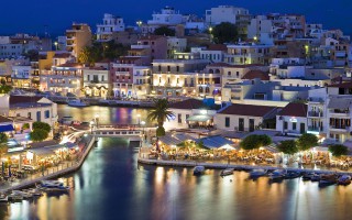
Elouda beach
The nice sandy beach northern to the small port of Elounda is situated at a distance of 11 kilometers far from Aghios Nicolaos at the North, and 70 -77 kilometers eastern to the International Airport of Heraklion, via the New or the Old National road respectively. Protected by the Spinalonga peninsula, the beach is not affected by the winds. Fully organised, the beach offers a wide range of accommodation,... read more
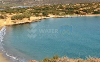
Voulisma beach
Voulisma is the second of the three bays in the beautiful village Istron, about 12km east of Agios Nikolaos and 22km north of Ierapetra. The Voulisma Beach or Golden Sands is located approximately 500m from the village (east). Its length is about 700m and is the largest municipal beach of Kalo Chorio.Voulisma is a very well-organized beach, with rare beauty for a beach located in the Northern part... read more
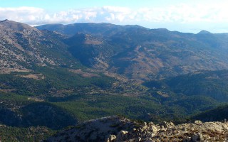
The Dikti Range
THIS RANGE LIES BETWEEN HERAKLION AND LASSITHI. Its highest summit is Spathi (2.148 m) and there are two more peaks at an altitude of more than 2000m. Lassithi Plateau, the largest in Crete, lies at the heart of the range at an altitude of 850 m. It is surrounded by a series of smaller plateaus such as Katharo, Limnakaro, Mari, Lapathos, Omalos, Erganos and Nisimos. There is a mountain shelter at Limnakaro... read more
Lassithi
Any place in Crete is sure to fascinate visitors. The island is reputed for its amazing mosaic of landscapes – each one, however, retaining its own character, its own identity and beauty. The eastern part of Lassithi is considered to be the low-key aspect of Crete, one of peace, quiet, things being done in a relaxed way, hospitality. It is the corner of Crete with the even-tempered mountains,... read more
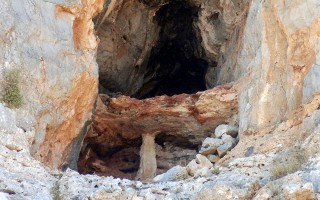
Cave of Pelekita or Cave of the Fig Tree
It lies to the North-Northeast of Kato Zakros. We arrive at the cave either after a one-hour walk from Kato Zakros or from the beach of the same settlement by engine-vessel (20-25 minutes) and after that, we follow a tiresome ascending route (15 minutes walk). The elevation at the entrance attains 105 metres. Stones consist of limestones from the upper Cretaceous and of dolomites from the Triassic... read more
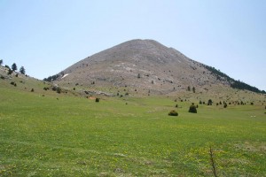
 Parnonas also known as “Malevos” is the mountain range which divides two large counties of Peloponnese, Arcadia and Laconia. The highest peak of Parnonas is called “Megali Tourla” also known as “Kronio” and has 1936 meters altitude. The mountain ends in Laconia at the Cape Maleas, south of Peloponnese.
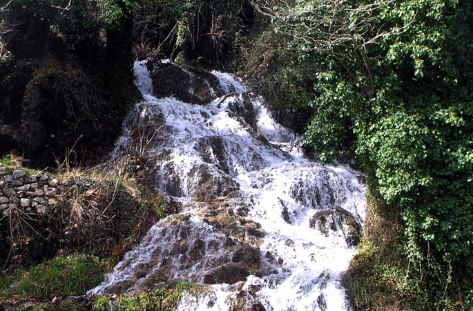
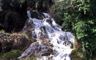
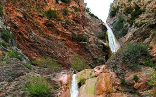
The natural beauty of the mountain and the traditional villages attract many travelers throughout the year. The best time to visit the area is during the spring season when the snow melts and forms small waterfalls. There are many signposted hiking routes which allow the visitor to admire the gorges, the caves, the waterfalls, the springs and the rivers of this amazing mountain. Climbers will love the challenge of reaching the top of the mountain. “Megali Tourla” (1936m altitude) can be reached through a large path which crosses an amazing gorge. In the beautiful villages of Parnonas you will find places where you can rent mountain bikes or four-wheel drives to explore the amazing locations of this mountain.
Parnonas has five gorges (Loulougas, Mazias, Zarbanitsas, Spilakion, Lepidas) where rare species of flowers blossom. Mazias gorge is the easiest for hiking whereas the Lepidas gorge is very demanding and you will need special equipment and knowledge to cross it.
 The name Parnonas existed already since the ancient period and the name meant “the ridge which shines”. During the ancient times the mountain was also called “Kronion” because it was considered to be the sacred mountain of Cronus, who was the leader of the Titans.
There are signs of inhabitation already since the Paleolithic Period which continued throughout the antiquity until the byzantine years. The monastic life is quite strong here and the visitor can still visit some beautiful monasteries, like the known monasteries of Malevi, Loukous and the monastery of Elonas.
Parnonas is also a very important ecological zone in Peloponnese as it is covered with forests of firs, black pine trees, plane trees etc. Around the monastery of Malevi there is the “Juniperus drupacea” (Δενδρόκεδρος) tree forest which is the only one in Europe and has been classified as protected area of the “Natura 2000”. At this mountain there are also many rare species of flora, some of them are known for their healing powers.
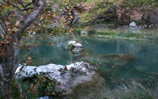
The “Wetland of Moustou” is a small lake with two artificial waterways and is located about 2km northeast of Astros. The wetland is also a protected area of the “Natura 2000” as the flora and the fauna here is extremely interesting. During the winter the wetland gathers millions of migratory birds which create a beautiful image. The artificial waterways flow to the shores of the nearby beach where the rare species of “Careta- Careta turtle” can be seen.
Source: www.discover-peloponnese.com/
Mt. Parnonas
Parnonas also known as “Malevos” is the mountain range which divides two large counties of Peloponnese, Arcadia and Laconia. The highest peak of Parnonas is called “Megali Tourla” also known as “Kronio” and has 1936 meters altitude. The mountain ends in Laconia at the Cape Maleas, south of Peloponnese. The natural beauty of the mountain and the traditional villages attract many travelers... read more
Alfeios
Peloponnese’s longest river (111km long) has its source in Arcadia and its mouth in the Prefecture of Elis. According to mythology, Apheus was one of the river-gods of antiquity, worshiped mainly in the regions of Arcadia, Elis and Messinia. Son of Oceanus and Tethys, he killed his brother Cercaphus and haunted by the Erinyes, he leapt into the river which was later named after him. Source: www.mythicalpeloponnese.gr [vc_row][vc_column][ivi_nbcaj... read more
The Gorge of Lepida
The gorge of Lepida is one of the numerous, impressive natural formations of Mount Parnon, which stands between the prefectures of Arcadia and Laconia. Its length is 500 metres and it is relatively flat. Two hours are required to cross it, during which visitors will have the opportunity to enjoy the unique natural beauty of the landscape, which is filled with rich flora and fauna and boasts two gorgeous... read more
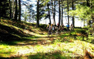
Mountain biking
A great way to discover a new place is actually on two wheels. Arcadia, with its stunning nature, does offer visitors this unique opportunity. The changes in the landscape, the lush vegetation, the dense forests and the hidden traditional settlements are only few of the natural attractions a visitor can enjoy with just a bike and the desire for exploration. Around the city of Tripolis, as well as in the Arcadian... read more
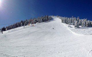
The Ski Center in Mainalo
The Mainalo ski center is situated in the location Ostrakina of the homonymous mountain, approximately 30 kilometres from Tripolis and 162 kilometres from Athens. The roads and consequently the access to the ski centre are easy, making it a very popular destination. It isn’t one of the biggest ski centres; however, it is ideal for families with children, since the mountain is not steep and is perfect... read more
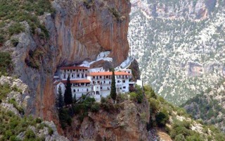
The Monastery of Eloni and the Gorge of Leonidio
The Monastery of Eloni is a pretty old convent in the prefecture of Arcadia, built in the steep slope of Mount Parnon, at an altitude of 650 metres and about 17 kilometres from the town of Leonidio. Due to its exceptional natural beauty, the area around the monastery has been declared as a protected zone and it’s included in the European Network Natura 2000 under the code GR2520005. It has a long... read more