

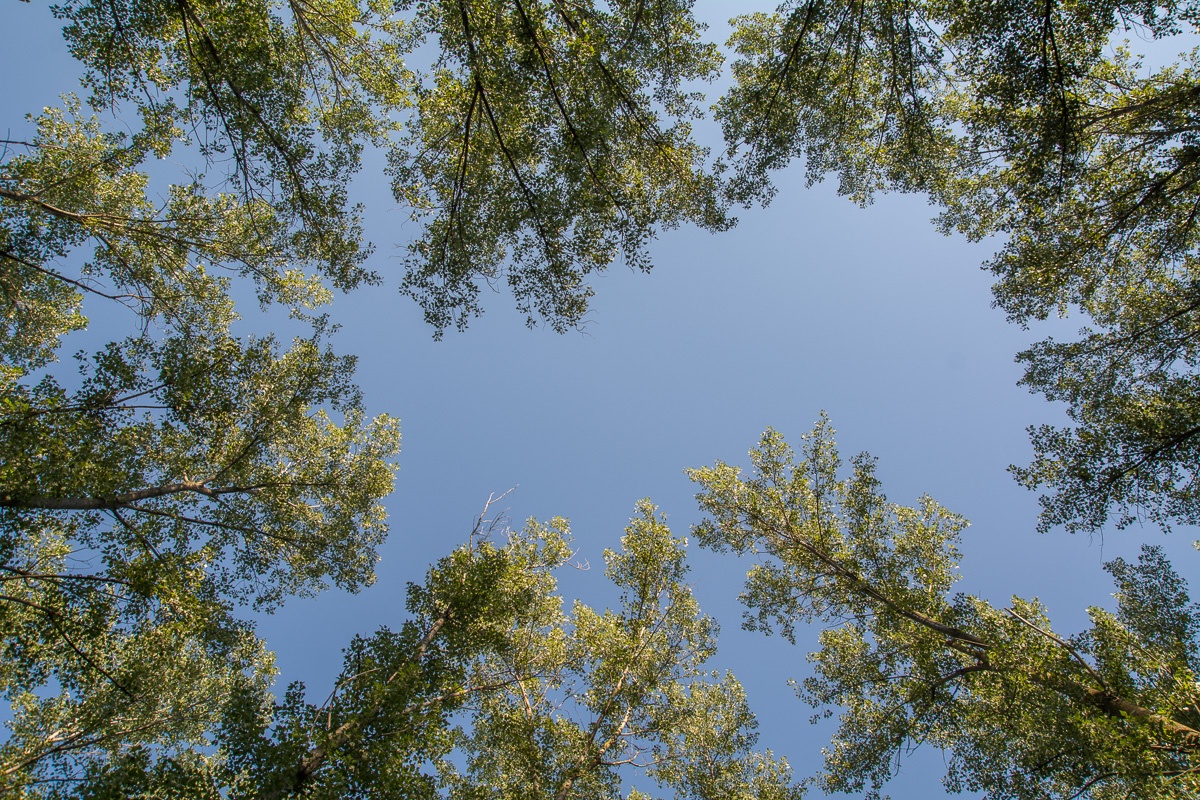
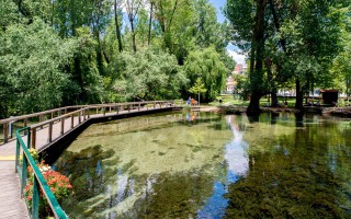
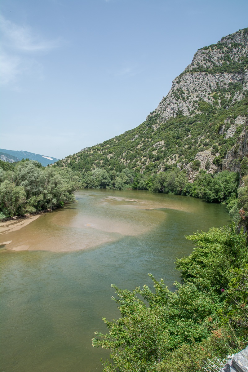
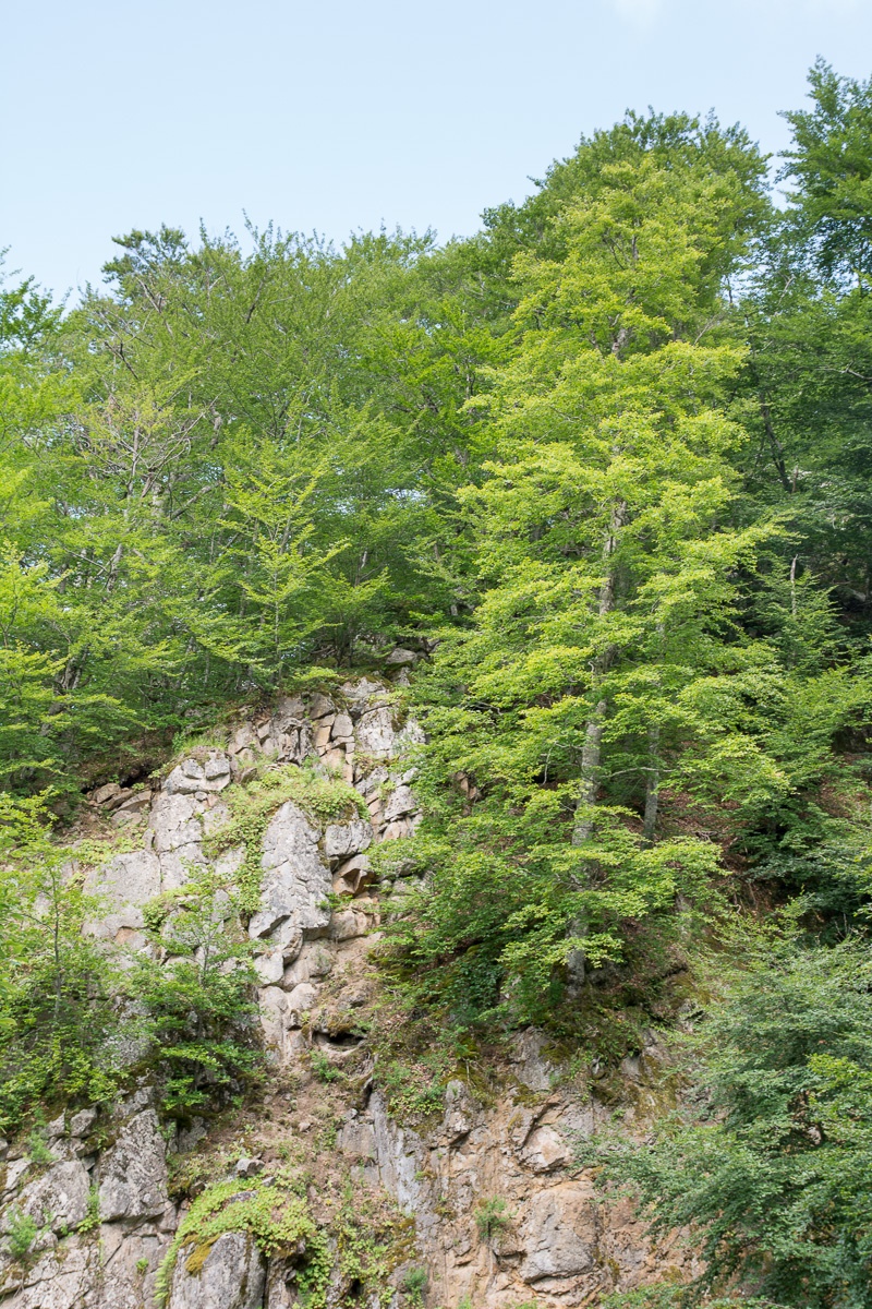
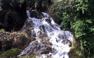
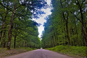
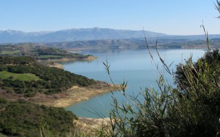
 The riparian forest Kotza Orman or Large Forest isa priceless landscape of ecological value and beauty. It was once one of the largest aquatic of Europe, since the “50s there had been recorded 74,000 acres.
However,in 1946, 54,000 acres were out of it and given to farmers for cultivation, leaving a small part, which the Forest Service of Kavala is trying to preserve by fencing perimeter stretches of land and prohibiting any human activity.
The plants are dominated by willows, the alders, oaks, elms, factions and creepers (the Agrambeli, hops, ivy, etc.). Several species of wildlife are recording such as wild boar, jackal, fox, deer, hare, badger and the only wild pheasant population of kolchikos pheasant in Europe. The Forest Service in an area of about 15,000 acres cultivated poplars, targeting both in timber production and in the regeneration of the natural riparian forest.
Source: Eastern Macedonia & Thrace

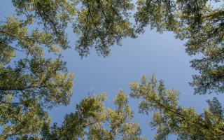
Riverside forest Kotza Orman or Large Forest
The riparian forest Kotza Orman or Large Forest isa priceless landscape of ecological value and beauty. It was once one of the largest aquatic of Europe, since the "50s there had been recorded 74,000 acres. However,in 1946, 54,000 acres were out of it and given to farmers for cultivation, leaving a small part, which the Forest Service of Kavala is trying to preserve by fencing perimeter stretches... read more
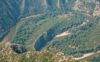
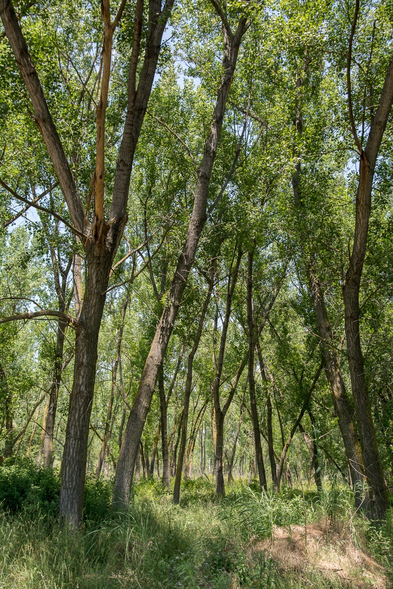
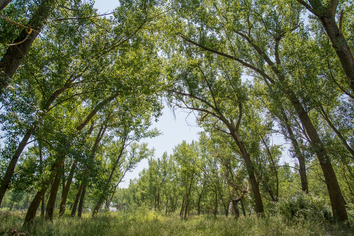
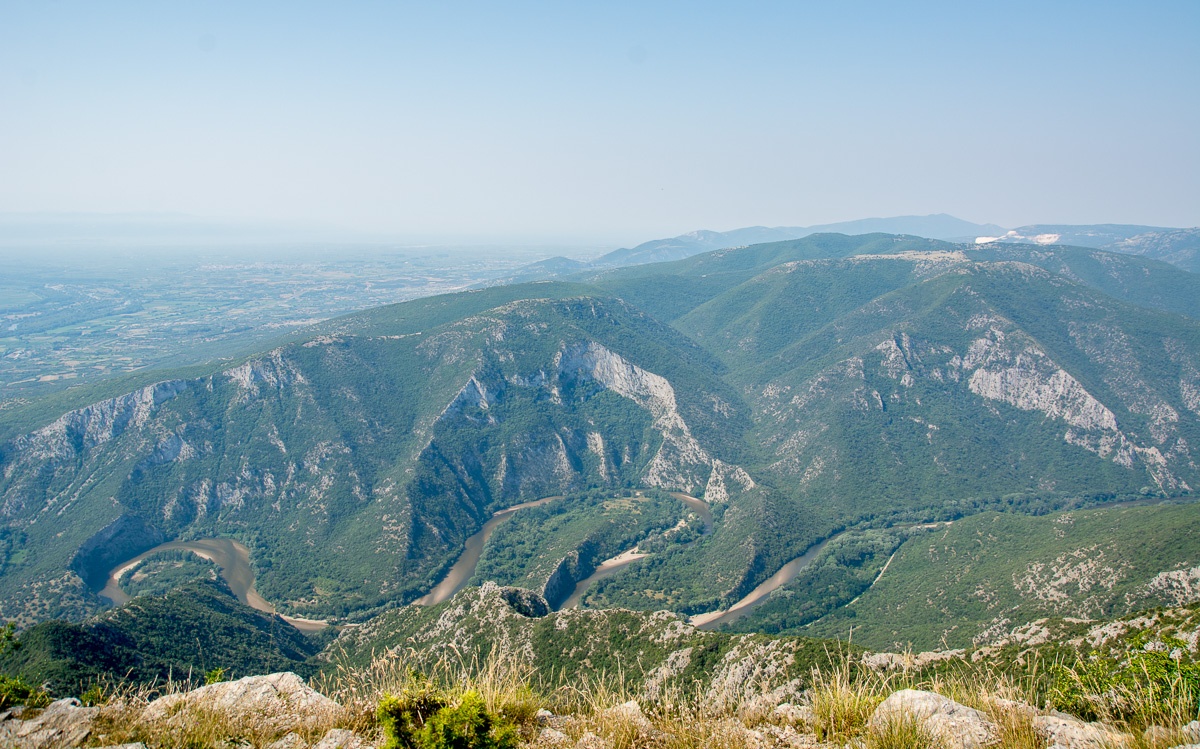
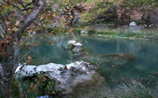
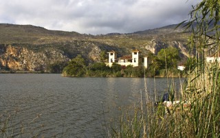
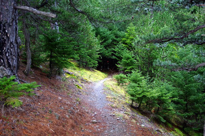
Aesthetic Forest of Strait of Nestos River
It is located at the borders of Kavala and Xanthi prefectures, south of the town of Stavroupoli, with area of 2,380 hectares. It is one of the most beautiful landscapes of Greece with great ecological interest. The visitors can see the plurality of rare plants such as the agriopaschalia, champerlea, red peony and ramnis of Rhodope. At the same time, the region is rich in fauna, with nesting wolves,... read more
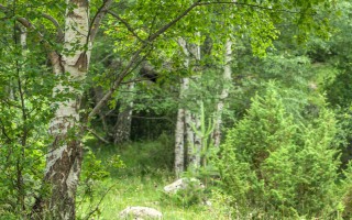
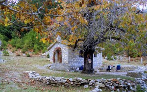
Forest of Chaidou
In the Rhodope Mountains, on the border with Bulgaria, there is the Drimos Forest, also known as Chaidou. The forest Chaidou is an earthly paradise with huge centennial beech of over 30 meters height. Apart from the beech forest there is also a large variety of vegetation that grows in the mountains of Rhodope, such as pines, firs, spruces and yellow lilies. It is also a habitat of bears, wolves... read more
Curative Natural Resource Genisaia (Potamia)
The thermal city of Potamia is situated at the 18th kilometre of the road Xanthi – Komotini. People of the intellect, the arts and literature, like Dimokritos, Protagoras, Leykippos were born and thrived in the historical area of Avdira. In a small distance, lies Vistonida lake, one of the most important wetlands of Greece and a little further is the picturesque port of Porto Lagos. The visitor can combine... read more
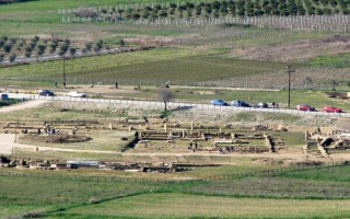
Archaeological site of Avdira
Archaeological site of Avdira, in the cape of Bouloustra includes the northern and southern precincts, the acropolis of the ancient city and its cemeteries, extending mainly to the NW, N and NE, dating from the Archaic, Classical and Hellenistic periods. Place in the northern precinct preserved sections of the wall and one room buildings prior Clazomenia city of Asia Minor, 7th century BC., parts... read more
Old Town of Xanthi
The Old Town of Xanthi is located in the north of Xanthi constituting its historic core and covers an area of 380.000m2. The city is built after 1829. The year that large earthquakes fully deplete the previous settlement. The city is built on the ruins and with core the churches, which were probably from the era of Byzantine Xanthia, as it was called from ancient time the city of Xanthi. During... read more
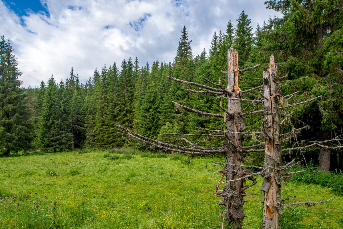
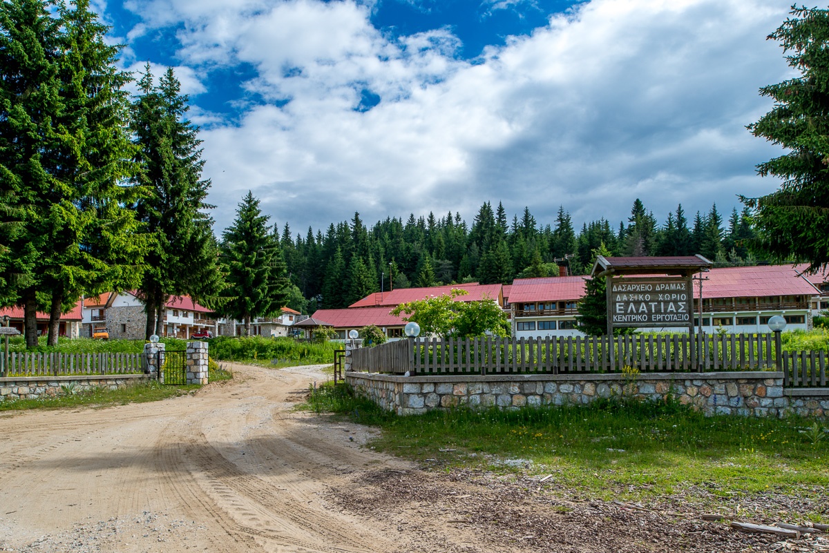
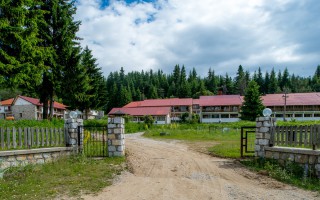
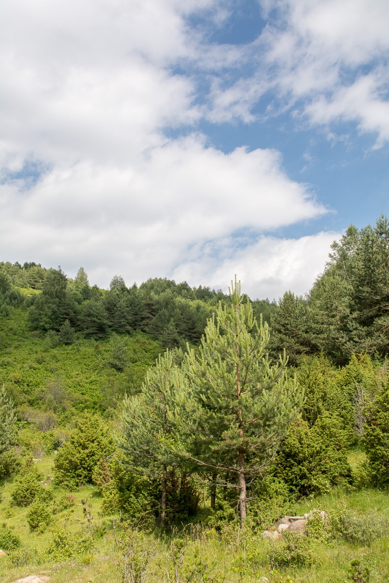
Drama is gifted with rich woodland. In the sierra of Central Rodopi distinguished the forests of Elatia or Kara Dere, in Sidironero district – Skalotis. The place is located in the central and northern part of the county and extends along the Greek-Bulgarian border.
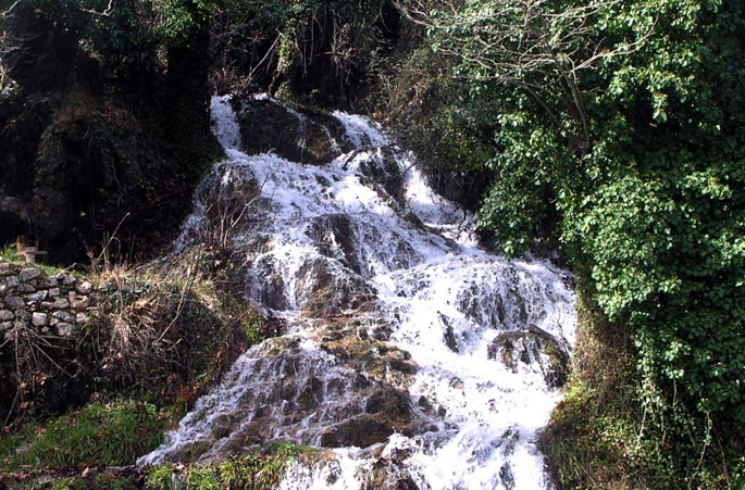
Forests cover 37% of the total area of the county and Elatia Forest is the largest forest complex in the country. The rare fir with red trunk (red spruce) grows up only here at an altitude of 1200m. lower Downy will meet with Leaved Oak, while higher is the zone of Beech, the Black Pine and Fir. The forest village is a base from which they can be made trips to Stravorema and to the neighboring beautiful forest, where inside a wonderful environment roll gurgling icy waters allowing everyone to enjoy the wonderful feeling of direct contact with nature. (NESTOS – MESTA 001) The fir forest located in the central and northern part of the county and extends along the Greek-Bulgarian border. Characterized by a forest cover of 90% and the existence of the village of Elatia. In place Koutras and in distance of 72km from Drama there is unique beauty”s spruce forest and in the surrounding area of Elatia in a place called Magoula there is a birch forest. Other tree species found are beech, scots pine, hornbeam etc., and there is a multitude of herbaceous plants, and mushrooms.
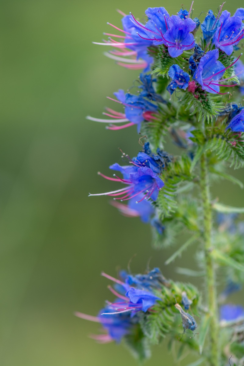
Generally, the flora in Elatias is rich of species (more than 700), with many rare for Greek area. The fauna of the area is also rich in species such as the brown bear, wild boar, elk, deer, wolves and many species of birds, eg eagles and hawks.
Source: Eastern Macedonia & Thrace

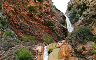
Curative Natural Resource Thermia
The curative spring of Thermia Paranestiou of Drama gushes in an alternating environment, clean and healthy, with lush vegetation and excellent climate conditions. The curative spring is at a distance of 25 km north of Paranesti and the old stone hydrotherapy centre testifies the human presence throughout the centuries. The area is ideal for nature lovers, as it offers routes and excursions to nature.... read more
Elatia forest or Kara Dere
Drama is gifted with rich woodland. In the sierra of Central Rodopi distinguished the forests of Elatia or Kara Dere, in Sidironero district - Skalotis. The place is located in the central and northern part of the county and extends along the Greek-Bulgarian border. Forests cover 37% of the total area of the county and Elatia Forest is the largest forest complex in the country. The rare fir with... read more
Sources of St. Barbara
Symbol of Drama, sources of Santa Barbara are exposed in recent years among the 60 best parks in Europe. It is a magical wetland, a beautiful recreation area about 60 acres in the heart of the city, where residents of Drama often enjoy stroll in the magnificent formed paths that crossing wooden bridges. Πηγή: Eastern Macedonia & Thrace [su_slider source="media: 9941,9942,9943" link="lightbox"... read more
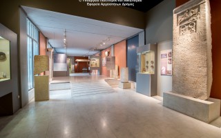
Archaeological Museum of Drama
The Drama Archaeological Museum was built by the Municipality of Drama and beguested to the Ministry of Culture. In this way the local community managed to speed up the procedure for the founding of an Archaeological Museum in the town. Even though the museum is small, marks the beginning of a major effort to systematize archaelogical research and promote the cultural identity of the area. The archaelogical... read more
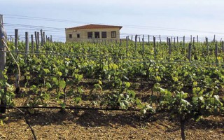
The Wine Route of Dionysus
In ancient times, Mount Pangeon, famous for its gold and silver mines, was the centre of Dionysian worship. According to the legend, this is where god Dionysus was raised and got the horses of King Lycourgos drunk with local wine. The Route of Dionysus starts at mount Pangeon, from the ancient city of Amphipolis, continuing at Kariani, ta Hatzigeorgiou Estate and at Kokkinohori, at Ktima Vivlia... read more
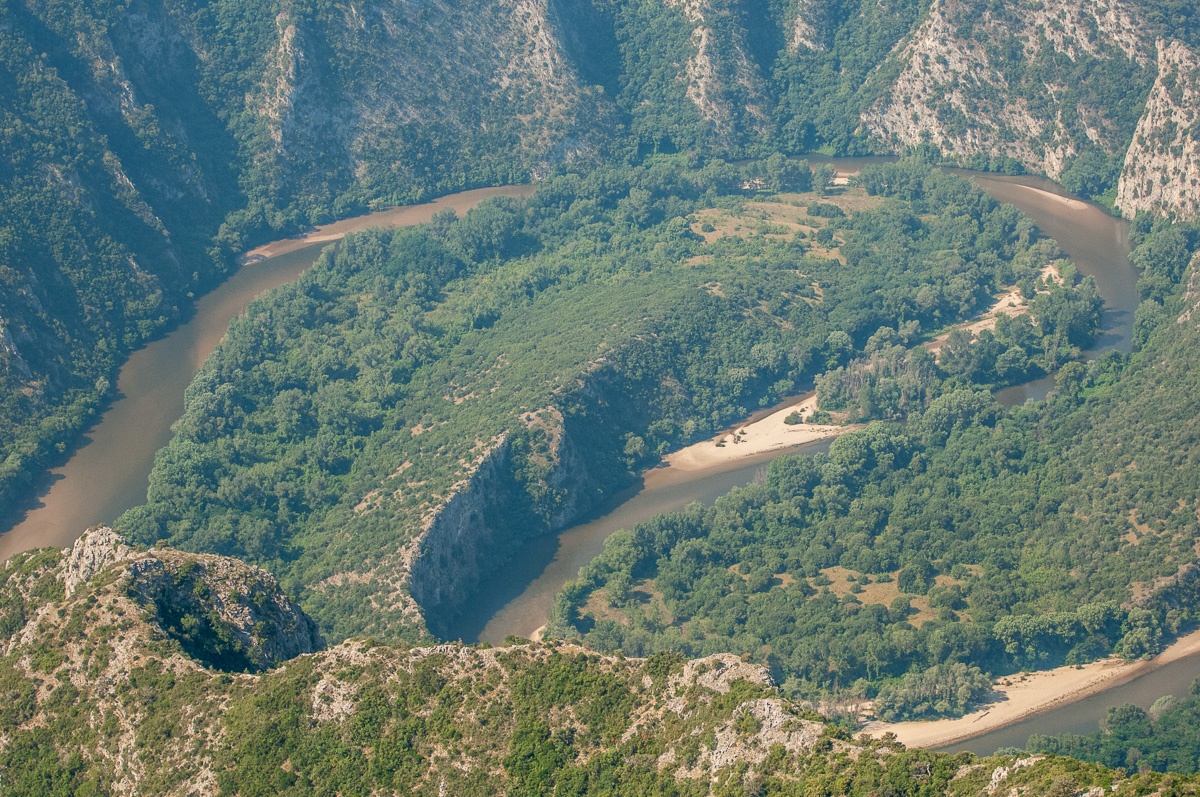
 It is located at the borders of Kavala and Xanthi prefectures, south of the town of Stavroupoli, with area of 2,380 hectares. It is one of the most beautiful landscapes of Greece with great ecological interest. The visitors can see the plurality of rare plants such as the agriopaschalia, champerlea, red peony and ramnis of Rhodope.
At the same time, the region is rich in fauna, with nesting wolves, wild cats – which are an endangered species – otters, ferrets, and rare birds such as the black stork, the vulture, the Alkyon, the brown goose and the pygmy cormorant.
Through the Straits of the river passes the railway line that connects Thessaloniki with the cities of Thrace, following an enchanting landscape. But apart from the train there is an etched path, which starts from the village of Galanis and reaches the Stavroupoli and Livaditi.
Source: Eastern Macedonia & Thrace

Riverside forest Kotza Orman or Large Forest
The riparian forest Kotza Orman or Large Forest isa priceless landscape of ecological value and beauty. It was once one of the largest aquatic of Europe, since the "50s there had been recorded 74,000 acres. However,in 1946, 54,000 acres were out of it and given to farmers for cultivation, leaving a small part, which the Forest Service of Kavala is trying to preserve by fencing perimeter stretches... read more
Aesthetic Forest of Strait of Nestos River
It is located at the borders of Kavala and Xanthi prefectures, south of the town of Stavroupoli, with area of 2,380 hectares. It is one of the most beautiful landscapes of Greece with great ecological interest. The visitors can see the plurality of rare plants such as the agriopaschalia, champerlea, red peony and ramnis of Rhodope. At the same time, the region is rich in fauna, with nesting wolves,... read more
Forest of Chaidou
In the Rhodope Mountains, on the border with Bulgaria, there is the Drimos Forest, also known as Chaidou. The forest Chaidou is an earthly paradise with huge centennial beech of over 30 meters height. Apart from the beech forest there is also a large variety of vegetation that grows in the mountains of Rhodope, such as pines, firs, spruces and yellow lilies. It is also a habitat of bears, wolves... read more
Curative Natural Resource Genisaia (Potamia)
The thermal city of Potamia is situated at the 18th kilometre of the road Xanthi – Komotini. People of the intellect, the arts and literature, like Dimokritos, Protagoras, Leykippos were born and thrived in the historical area of Avdira. In a small distance, lies Vistonida lake, one of the most important wetlands of Greece and a little further is the picturesque port of Porto Lagos. The visitor can combine... read more
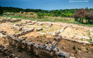
Archaeological site of Avdira
Archaeological site of Avdira, in the cape of Bouloustra includes the northern and southern precincts, the acropolis of the ancient city and its cemeteries, extending mainly to the NW, N and NE, dating from the Archaic, Classical and Hellenistic periods. Place in the northern precinct preserved sections of the wall and one room buildings prior Clazomenia city of Asia Minor, 7th century BC., parts... read more
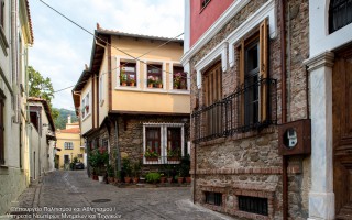
Old Town of Xanthi
The Old Town of Xanthi is located in the north of Xanthi constituting its historic core and covers an area of 380.000m2. The city is built after 1829. The year that large earthquakes fully deplete the previous settlement. The city is built on the ruins and with core the churches, which were probably from the era of Byzantine Xanthia, as it was called from ancient time the city of Xanthi. During... read more
 In the Rhodope Mountains, on the border with Bulgaria, there is the Drimos Forest, also known as Chaidou. The forest Chaidou is an earthly paradise with huge centennial beech of over 30 meters height. Apart from the beech forest there is also a large variety of vegetation that grows in the mountains of Rhodope, such as pines, firs, spruces and yellow lilies.
It is also a habitat of bears, wolves and deers. In the 80’s the 180 acres of forest was declared “Natural Monument” and protected area. It can be seen several endemic plants of Rhodope, and other rare species of flora of Greece. There are also rare species of mammals and birds.
In Chaidou threre are bare fields and meadows and bare mountain slopes. Many streams and small rivers flow with fast and cold waters that constitute the zone of trout. It is a centuries-old beech forest, an area of 18 hectares and is located in the mountain Chaidou in the Central Rhodope Mountains, north of the city of Xanthi.
Source: Eastern Macedonia & Thrace
Riverside forest Kotza Orman or Large Forest
The riparian forest Kotza Orman or Large Forest isa priceless landscape of ecological value and beauty. It was once one of the largest aquatic of Europe, since the "50s there had been recorded 74,000 acres. However,in 1946, 54,000 acres were out of it and given to farmers for cultivation, leaving a small part, which the Forest Service of Kavala is trying to preserve by fencing perimeter stretches... read more
Aesthetic Forest of Strait of Nestos River
It is located at the borders of Kavala and Xanthi prefectures, south of the town of Stavroupoli, with area of 2,380 hectares. It is one of the most beautiful landscapes of Greece with great ecological interest. The visitors can see the plurality of rare plants such as the agriopaschalia, champerlea, red peony and ramnis of Rhodope. At the same time, the region is rich in fauna, with nesting wolves,... read more
Forest of Chaidou
In the Rhodope Mountains, on the border with Bulgaria, there is the Drimos Forest, also known as Chaidou. The forest Chaidou is an earthly paradise with huge centennial beech of over 30 meters height. Apart from the beech forest there is also a large variety of vegetation that grows in the mountains of Rhodope, such as pines, firs, spruces and yellow lilies. It is also a habitat of bears, wolves... read more
Curative Natural Resource Genisaia (Potamia)
The thermal city of Potamia is situated at the 18th kilometre of the road Xanthi – Komotini. People of the intellect, the arts and literature, like Dimokritos, Protagoras, Leykippos were born and thrived in the historical area of Avdira. In a small distance, lies Vistonida lake, one of the most important wetlands of Greece and a little further is the picturesque port of Porto Lagos. The visitor can combine... read more
Archaeological site of Avdira
Archaeological site of Avdira, in the cape of Bouloustra includes the northern and southern precincts, the acropolis of the ancient city and its cemeteries, extending mainly to the NW, N and NE, dating from the Archaic, Classical and Hellenistic periods. Place in the northern precinct preserved sections of the wall and one room buildings prior Clazomenia city of Asia Minor, 7th century BC., parts... read more
Old Town of Xanthi
The Old Town of Xanthi is located in the north of Xanthi constituting its historic core and covers an area of 380.000m2. The city is built after 1829. The year that large earthquakes fully deplete the previous settlement. The city is built on the ruins and with core the churches, which were probably from the era of Byzantine Xanthia, as it was called from ancient time the city of Xanthi. During... read more
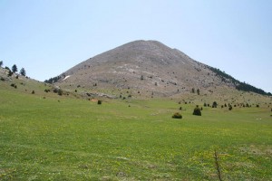
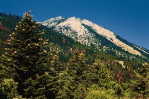 Parnonas also known as “Malevos” is the mountain range which divides two large counties of Peloponnese, Arcadia and Laconia. The highest peak of Parnonas is called “Megali Tourla” also known as “Kronio” and has 1936 meters altitude. The mountain ends in Laconia at the Cape Maleas, south of Peloponnese.
The natural beauty of the mountain and the traditional villages attract many travelers throughout the year. The best time to visit the area is during the spring season when the snow melts and forms small waterfalls. There are many signposted hiking routes which allow the visitor to admire the gorges, the caves, the waterfalls, the springs and the rivers of this amazing mountain. Climbers will love the challenge of reaching the top of the mountain. “Megali Tourla” (1936m altitude) can be reached through a large path which crosses an amazing gorge. In the beautiful villages of Parnonas you will find places where you can rent mountain bikes or four-wheel drives to explore the amazing locations of this mountain.
Parnonas has five gorges (Loulougas, Mazias, Zarbanitsas, Spilakion, Lepidas) where rare species of flowers blossom. Mazias gorge is the easiest for hiking whereas the Lepidas gorge is very demanding and you will need special equipment and knowledge to cross it.
 The name Parnonas existed already since the ancient period and the name meant “the ridge which shines”. During the ancient times the mountain was also called “Kronion” because it was considered to be the sacred mountain of Cronus, who was the leader of the Titans.
There are signs of inhabitation already since the Paleolithic Period which continued throughout the antiquity until the byzantine years. The monastic life is quite strong here and the visitor can still visit some beautiful monasteries, like the known monasteries of Malevi, Loukous and the monastery of Elonas.
Parnonas is also a very important ecological zone in Peloponnese as it is covered with forests of firs, black pine trees, plane trees etc. Around the monastery of Malevi there is the “Juniperus drupacea” (Δενδρόκεδρος) tree forest which is the only one in Europe and has been classified as protected area of the “Natura 2000”. At this mountain there are also many rare species of flora, some of them are known for their healing powers.
The “Wetland of Moustou” is a small lake with two artificial waterways and is located about 2km northeast of Astros. The wetland is also a protected area of the “Natura 2000” as the flora and the fauna here is extremely interesting. During the winter the wetland gathers millions of migratory birds which create a beautiful image. The artificial waterways flow to the shores of the nearby beach where the rare species of “Careta- Careta turtle” can be seen.
Source: www.discover-peloponnese.com/
Mt. Parnonas
Parnonas also known as “Malevos” is the mountain range which divides two large counties of Peloponnese, Arcadia and Laconia. The highest peak of Parnonas is called “Megali Tourla” also known as “Kronio” and has 1936 meters altitude. The mountain ends in Laconia at the Cape Maleas, south of Peloponnese. The natural beauty of the mountain and the traditional villages attract many travelers... read more
Alfeios
Peloponnese’s longest river (111km long) has its source in Arcadia and its mouth in the Prefecture of Elis. According to mythology, Apheus was one of the river-gods of antiquity, worshiped mainly in the regions of Arcadia, Elis and Messinia. Son of Oceanus and Tethys, he killed his brother Cercaphus and haunted by the Erinyes, he leapt into the river which was later named after him. Source: www.mythicalpeloponnese.gr [vc_row][vc_column][ivi_nbcaj... read more
The Gorge of Lepida
The gorge of Lepida is one of the numerous, impressive natural formations of Mount Parnon, which stands between the prefectures of Arcadia and Laconia. Its length is 500 metres and it is relatively flat. Two hours are required to cross it, during which visitors will have the opportunity to enjoy the unique natural beauty of the landscape, which is filled with rich flora and fauna and boasts two gorgeous... read more
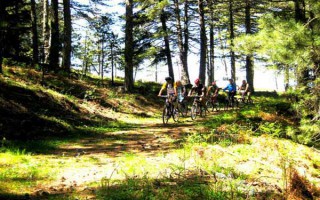
Mountain biking
A great way to discover a new place is actually on two wheels. Arcadia, with its stunning nature, does offer visitors this unique opportunity. The changes in the landscape, the lush vegetation, the dense forests and the hidden traditional settlements are only few of the natural attractions a visitor can enjoy with just a bike and the desire for exploration. Around the city of Tripolis, as well as in the Arcadian... read more
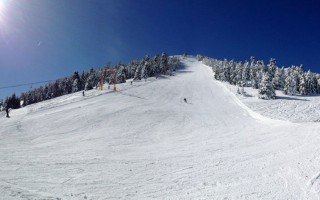
The Ski Center in Mainalo
The Mainalo ski center is situated in the location Ostrakina of the homonymous mountain, approximately 30 kilometres from Tripolis and 162 kilometres from Athens. The roads and consequently the access to the ski centre are easy, making it a very popular destination. It isn’t one of the biggest ski centres; however, it is ideal for families with children, since the mountain is not steep and is perfect... read more
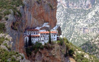
The Monastery of Eloni and the Gorge of Leonidio
The Monastery of Eloni is a pretty old convent in the prefecture of Arcadia, built in the steep slope of Mount Parnon, at an altitude of 650 metres and about 17 kilometres from the town of Leonidio. Due to its exceptional natural beauty, the area around the monastery has been declared as a protected zone and it’s included in the European Network Natura 2000 under the code GR2520005. It has a long... read more
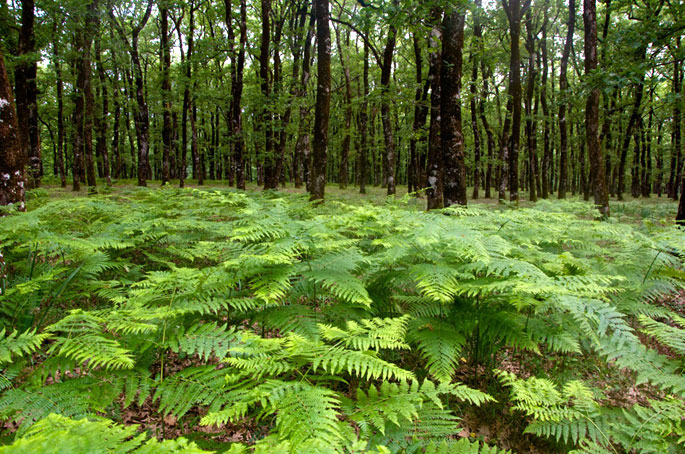
Foloi oak forest is a designated site under NATURA 2000 that dates back to ancient times. It’s the only flat forest in Greece situated on the boundaries between Elis, Arcadia and Achaia, at an altitude of 600meters. It covers a total surface of 218.000 acres and it consists mainly of broadleaf oaks.
 Foloi oak forest is a designated site under NATURA 2000 that dates back to ancient times. It’s the only flat forest in Greece situated on the boundaries between Elis, Arcadia and Achaia, at an altitude of 600meters. It covers a total surface of 218.000 acres and it consists mainly of broadleaf oaks.According to mythology, the forest was named after the Centaur Pholus, who gave roof to his friend, Hercules, on his way to locate the Erymanthian Boar. Pholus offered Hercules a divine wine which excited the rest of the Centaurs who attacked the two friends. During the battle, Pholus was injured by mistake from one of Hercules’ arrows. The hero decided then to name the forest Foloi after his friend.
 In antiquity, the plateau of Foloi was covered by a dense plantation; namely, oaks, pines, kermes oaks, strawberry trees etc. as well as wild animals such as wolves, deer, boars, foxes, francolins, woodcocks, and numerous other species. The town of Akroria, Aasion, was situated on the west side of the plateau. The town was completely destroyed by Alarichos in 396 B.C. At the present, a true relic of the past, the oak forest of Filoi with its ancient trees starts in a distance of 15km from the village Lala. Wander into the magnificent forest and admire the breathtaking view to the plain of Alfeios and to the mountains.
Source: www.mythicalpeloponnese.gr
Kaiafas
To the west of the prefecture of Ilia, 27 km from its capital, Pyrgos, lies the area known as Kaiafas, comprising a vast beach on the side of the Ionian sea, a coastal pine forest and the homonymous lake, which is the centre of health tourism in the area. The healing properties of the Kaiafa lake waters have been known since antiquity; according to the ancient Greeks, they owed their properties to the nymphs... read more
Ancient Ilida
Ilida or Ilis was a city-state in ancient Ilia, very near ancient Olympia, and took up the area which today extends from the village of Paliopoli (or Nea Ilida) to the southeast, Bouchioti (or Avgeio) to the southwest and Kalyvia to the west. According to myth, it was founded by Oxylus, son of Aemon and Gorgi, who is also mentioned in some traditions as the founder of the Olympic Games. Oxylus, who hailed... read more
Foloi oak forest
Foloi oak forest is a designated site under NATURA 2000 that dates back to ancient times. It’s the only flat forest in Greece situated on the boundaries between Elis, Arcadia and Achaia, at an altitude of 600meters. It covers a total surface of 218.000 acres and it consists mainly of broadleaf oaks. Foloi oak forest is a designated site under NATURA 2000 that dates back to ancient times. It’s... read more
Pineios River and Pineios artificial lake
Pineios is one of the Peloponnese’s most significant rivers, its total length is 70 km. Also known as Gastouni River, it has its sources in the mount Erymanthos and empties in the Ionian Sea near town bearing the same name. According to mythology, Hercules diverted the flow of Pineios and Alfeios rivers in order to clean the Augean Stables in his fifth labor. After having demolished the stables’... read more
Alfeios
Peloponnese’s longest river (111km long) has its source in Arcadia and its mouth in the Prefecture of Elis. According to mythology, Apheus was one of the river-gods of antiquity, worshiped mainly in the regions of Arcadia, Elis and Messinia. Son of Oceanus and Tethys, he killed his brother Cercaphus and haunted by the Erinyes, he leapt into the river which was later named after him. Source: www.mythicalpeloponnese.gr [vc_row][vc_column][ivi_nbcaj... read more

Ancient Olympia
During classical times Olympia was the city of Ilia best known as the area where the Olympic Games took place, the greatest athletic event of the then-Greek world. Today Ancient Olympia is a village and a municipality of Ilia, built in the valley of river Alpheus. Nearby lies the archaeological site, one of the most popular ones in Greece, which attracts every year tourists from all over the world.... read more
 The forest of Vassiliki is located at the southern part of the Taygetus mountain range, 8 km south of its summit, and has an expanse of approximately 11,000 stremmata. It is a relatively secluded forest, surrounded by summits. You can reach it from Eksochori and there is a road in the forest you can follow for 21 km.
Here you will mostly come across fir trees and black pines. During the Italian Occupation a great fire destroyed large expanses of the forest, which managed, however, to resurrect itself. Today one may see there trees as old as 300 years.
Source: www.mythicalpeloponnese.gr

Kalamata Gastronomic Destination
Professionals in the field of gastronomy in its broadest sense – the agricultural sector, processing, hospitality, restaurants – have joined forces and created a society called the Gastronomic Community of Kalamata. Their goal is to enlist the best food-related businesses in the region, to set up a parallel structured link between Tourism and the Gastronomic Culture of Messinia, and to promote... read more
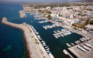
Kalamata Marina
The marina offers a full range of technical services covering a wide range of maintenance and repair works. Kalamata marina is situated in Peloponnesus in Kalamata city on the west of Kalamata harbour in the Messinian Gulf, and is considered by many to be the ideal location to take refuge and rest as it is the passage from the Mediterranean and the Ionian Sea to the Aegean Sea. Kalamata is a modern... read more
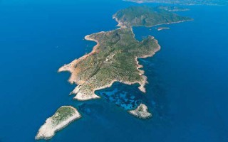
Sapientza and the Perennial Broadleaf Forest
Sapientza is an islet of the Messinian Oinousses cluster and is the second biggest after Schiza. It’s an island with lush vegetation, a rare flora and a total area of 9 square kilometres. In 1986, Sapientza was declared as a “listed natural monument” and it was included in the European Network Natura 2000, together with the neighboring Schiza and the area around cape Akritas.Sapientza in Italian... read more
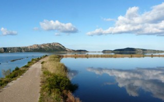
Gialova Lagoon
Gialova lagoon is located in Messinia and is one of the most important wetlands not only in Greece, but also in Europe. It probably dates to prehistoric times and owes its creation both to tectonic activity and to a rise in sea level, phenomena which created this ecological zone of unique importance.The Gialova lagoon is the first station in the Balkans that the migratory birds from Africa come across;... read more
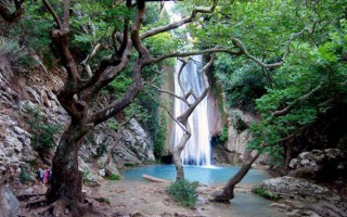
The Gorge of Neda
Neda is the only “female” river in Greece. It stems from the foot of Mount Lykaion and flows into the Ionian Sea, more specifically into the Kyparissiakos Gulf. Neda is approximately 32 kilometres long and passes through a stunning fairytale-like landscape.The Valley of Neda was of particular importance to the ancient Greeks and was often mentioned in various myths, while it is surrounded by archaeological... read more
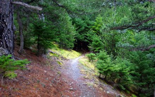
Vassiliki Forest
The forest of Vassiliki is located at the southern part of the Taygetus mountain range, 8 km south of its summit, and has an expanse of approximately 11,000 stremmata. It is a relatively secluded forest, surrounded by summits. You can reach it from Eksochori and there is a road in the forest you can follow for 21 km. Here you will mostly come across fir trees and black pines. During the Italian... read more