


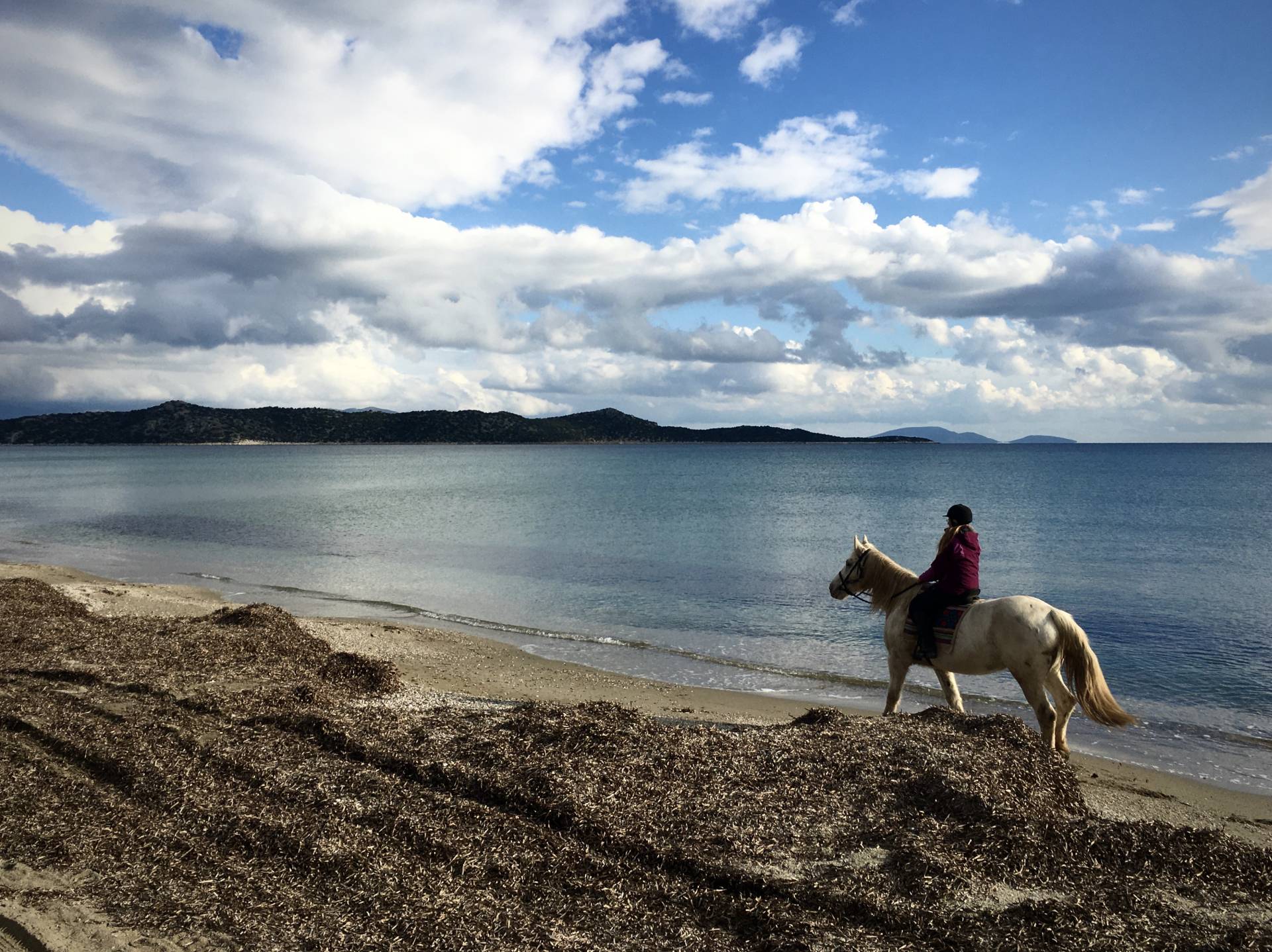
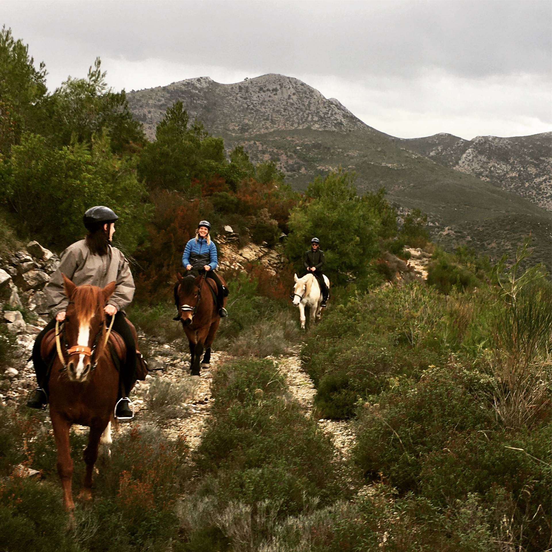
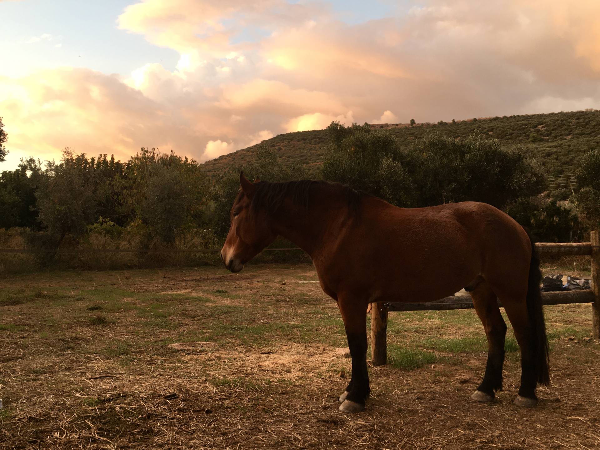
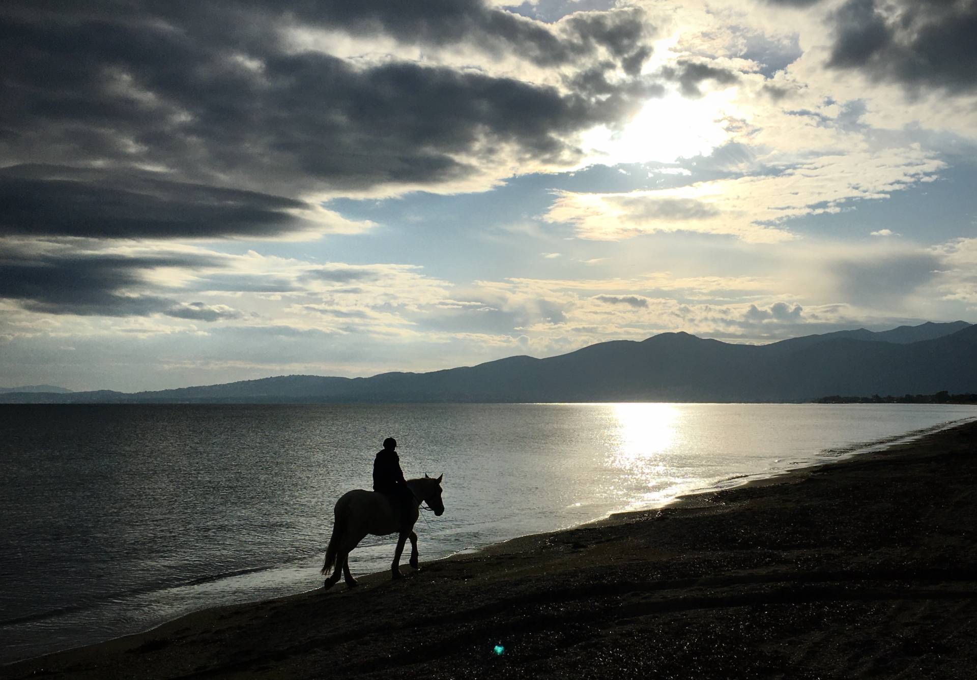
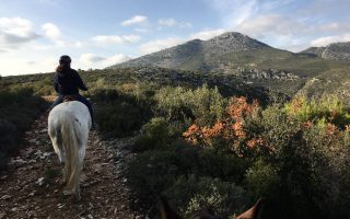
We are a Greek equine tourism and recreation business based just one hour outside the city of Athens in Atticas historical area of Marathonas. We offer a vary of equine activities and experiential workshops also horseback holidays, combined outdoor activities and tour packages.
Our horses are part of the family and their heart and spirit the core of all our activities. We are passionate about our work and horse life style there for we love sharing with our guests our experience and passion for them also nature, history, outdoor activities ,adventure and travelling.
Visit our fb page https://www.facebook.com/Equitrek-Attica-106209160767582/
Find out more about our activities and don’t hesitate to contact us 693 869 7034
We are also very happy to announce that from now on we will share part of our space in the farm with Ippothesis equine welfare organization so rescued horses can live in big paddocks together until they find lovely homes to adopt them.
Our goal is to help https://www.ippothesis.gr/ with the rehabilitation and training of the horses but we also see the opportunity to spread awareness to people about equine abuse and welfare !!!


Source: https://www.unlimited-adrenaline.gr/equitrek-attica/p/en/138
Equitrek Attica
We are a Greek equine tourism and recreation business based just one hour outside the city of Athens in Atticas historical area of Marathonas. We offer a vary of equine activities and experiential workshops also horseback holidays, combined outdoor activities and tour packages. Our horses are part of the family and their heart and spirit the core of all our activities. We are passionate about our work... read more
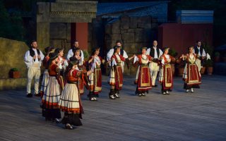
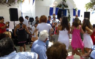
“Dora Stratou” Performance Information...
PERFORMANCE INFORMATION 2020 "Dora Stratou" Greek Dances Theatre, Philopappou Hill Garden Theatre - The living museum of Greek dance www.grdance.org OPENING NIGHT 27 May 2020 CLOSING NIGHT 20 September 2020 PERFORMANCES Wednesday, Thursday, Friday 21:30. Saturday and Sunday 20:30. Monday, Tuesday (27, 28 June, 1-5 July and 12-23 August) closed or organizes additional... read more

DARKSCHOOL ESCAPE ROOMS
A well-kept secret lies inside the secret facilities at the heart of Silk City. The people are starting to ask questions. Something’s not right about this building. For years, all they would see were strange, secretive human figures, meeting with the scientist who had made this building his permanent residence, only rarely leaving the premises. The object of those meetings was kept entirely secret,... read more

The Museum of Illusions in Athens
If a picture is worth a thousand words, be sure that an illusion hides more than a million Enter the fascinating world of illusions which will trick your confidence in senses, but amaze you by doing it; the world that will confuse you completely, but also educate you… Visit us and you will be thrilled because nothing is what it seems, especially not HERE! Are you ready for an even bigger, better,... read more

Liar Wanted by Dimitris Psathas
Liar Wanted by Dimitris Psathas brought to you by THEATRIKES SKINES and Petros Zoulias from 15 MARCH AT THE PALLAS THEATRE SURTITLES IN PALLAS THEATER THEATRIKES SKINES SA offer the opportunity to all foreign visitors and residents of Athens as well as theater-lovers with hearing difficulties to watch the performances at PALLAS Theater. In Athens, a city rightly described as the theatrical... read more
Ancient Symposium, A theme site full of knowledge...
“SYMPOSIUM” was established by Georgios and Emmanouel Roussis. We are a family of artists, a father and his son, who have had a passion for sculpture and, lately, for ancient Greek wine-making. Both Georgios and Emmanouel Roussis studied at the School of Fine Arts in Athens and Florina respectively, at the Department of Sculpture, with a scholarship. They are ordinary members of the Greek Chamber... read more
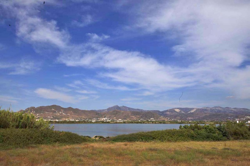
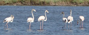
The small wetlands, salt marshes and dunes of Naxos are a haven for birds, fish and reptiles. The most important wetland is that of Alyki which comprises a large lake southwest of the airport runway. It is the largest salt lake in the Cyclades and retains enough water. The vegetation includes reeds, aquatic plants and clumps of cedar trees. 166 bird species have been observed and it is enlisted in the protected areas of NATURA 2000 network.
Four wetlands of the island have been also included in the list of small island wetlands of up to 80 acres, of the Ministry of Environment. According to the Presidential Decree of 2012, the marsh in Pyrgaki, the mouth of Skoulikaria springs in Ammitis, the marsh of Agiassos and the marsh of Kalandos joined the list among 380 small wetlands and came under protection.
Source: aegeanislands.gr
Customs and Festivals of Naxos
Music, dancing with traditional costumes, songs, arts, feasts and festivals are part of the Naxian daily life. The island is famous all over Greece for its rich musical tradition and there are important composers/musicians from Naxos, including Konitopouleoi, Fyrogenides, Stamatonanolides, Vrontogiorgides, Koukoularides, Hatzopouloi. “Kotsakia” (folk poems of two or eight verses that were created... Read more
The mount and cave of Zas
This is the highest peak of Naxos, usually covered with clouds and named Myti of Za (Nose of Zeus). It has namely the name of Zeus and maybe this was also its name in the antiquity, as they used to worship the father of gods on this very mountain. The archaic inscription carved on a rock in the path that leads to the top of the mountain says “Oros Dios Milosiou” (Mountain of Zeus of Milon), which... Read more
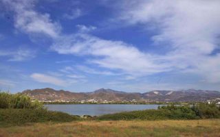
Naxos wetlands
The small wetlands, salt marshes and dunes of Naxos are a haven for birds, fish and reptiles. The most important wetland is that of Alyki which comprises a large lake southwest of the airport runway. It is the largest salt lake in the Cyclades and retains enough water. The vegetation includes reeds, aquatic plants and clumps of cedar trees. 166 bird species have been observed and it is enlisted in the protected... Read more
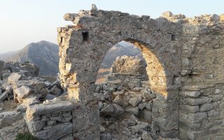
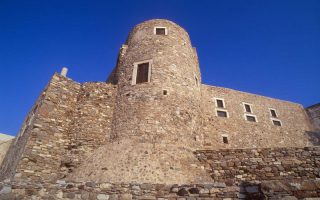
Apaliros castle
This is a very important castle, built on a steep hill in the fields of Sangri and Agiassos. According to researchers, it took its name after the abundant “apaliries”, a kind of bush that sprouts there. It was erected in the first years of the Byzantine era, though probably there was already a fortification in the antiquity, because part of the wall is prehistoric. It was abandoned in the 13th... Read more
Naxos towers
Today about 30 towers are preserved in the countryside of the island. They have been built by feudal Venetians in particular (and other Latin nobles) who used them as a base to exploit the real estate of the field they held. Their defensive line included battlements, murder holes, turrets, huge doors and small windows to protect the defenders. They were made of stone and had many floors and thick walls. Bazeos... Read more
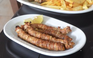
Gardoumia
Gardoumia is a special meze from lamb intestines that is made on the island of Naxos, just like in Crete; besides, the strong connections between the two islands are well-known. Meze holds a special place in the Greek culinary tradition and could be described as an appetizer, a treat to share with friends in a relaxed environment. Gardoumia is a popular dish among mountain and pastoral farming/shepherds’... Read more
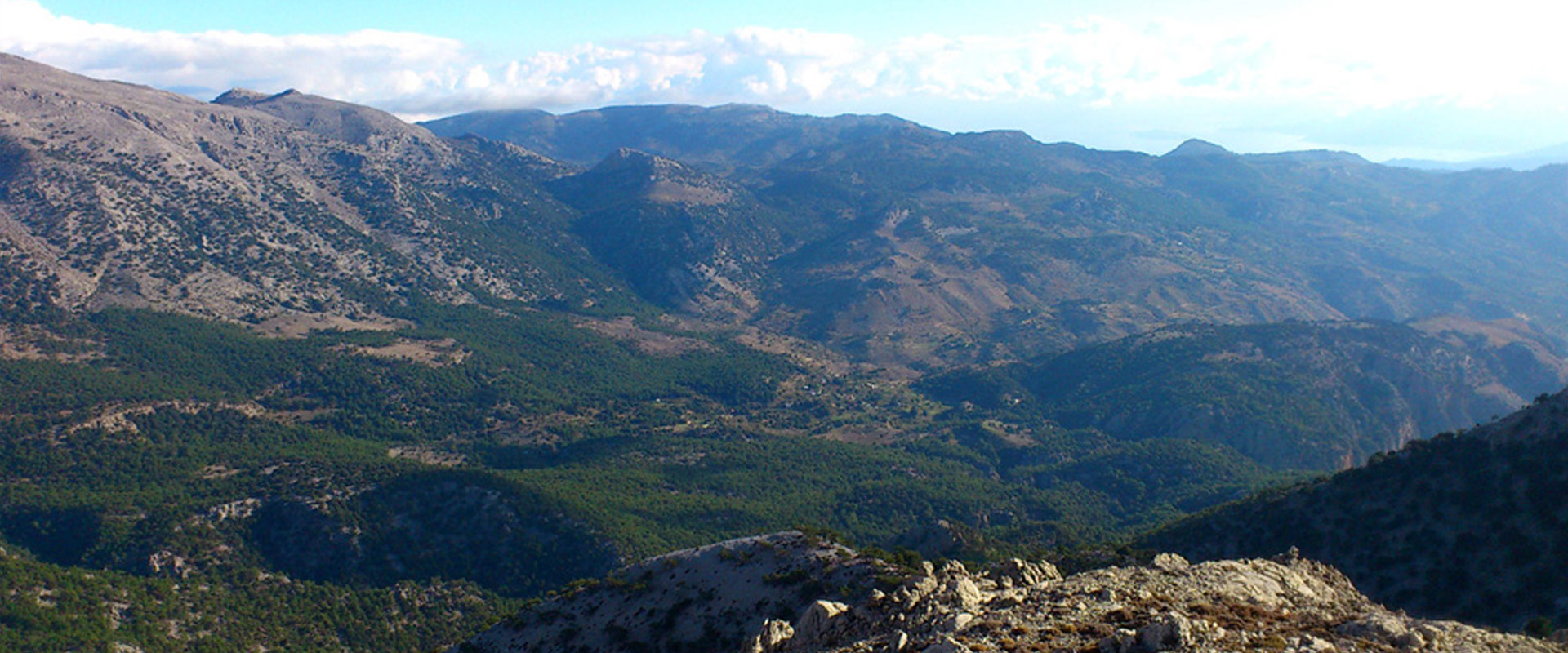
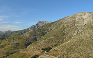
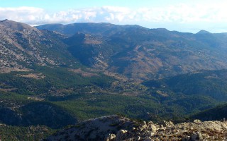
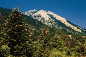
THIS RANGE LIES BETWEEN HERAKLION AND LASSITHI.
Its highest summit is Spathi (2.148 m) and there are two more peaks at an altitude of more than 2000m. Lassithi Plateau, the largest in Crete, lies at the heart of the range at an altitude of 850 m. It is surrounded by a series of smaller plateaus such as Katharo, Limnakaro, Mari, Lapathos, Omalos, Erganos and Nisimos. There is a mountain shelter at Limnakaro from where hikers ascend to Spathi.
Several gorges are found in the range of Lassithi. Apart from the two gorges named Havgas at Katharo and Kalamafka, there are more canyons such as Sarakina, Adrianos, Ambelos, Roza and Kritsa.
The Dikti range has shows a significant diversity in flora and fauna. The lower mountain sides are covered by olive, carob and pine trees. To the south-east, Selakano is the largest pine wood of Crete and close to the village Krasi lies the holm oak wood of Azilakodasos.
The fertile plateaus and valleys of the Dikti range produce a large variety of agricultural products: potatoes, vegetable, pears, apples, walnuts, cherries, etc. Livestock breeding (sheep and goats) is yet another traditional activity in this region. The famous Diktaean Cave where Zeus is said to have been born is open to the public.
Source: www.incrediblecrete.gr
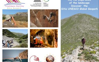
The new aspect of tourism, Sitia Geopark
When the Sitia region became a member of the UNESCO Geopark family, we had no idea just how much positive change this would bring! This new aspect of tourism “Sitia Geopark”, is proving to be a considerable point of interest, especially in the alternative tourism market. The natural environment is no longer an obstacle for tourism development, on the contrary it is a great attraction for visitors. We... read more
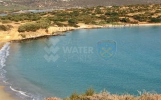
Elouda beach
The nice sandy beach northern to the small port of Elounda is situated at a distance of 11 kilometers far from Aghios Nicolaos at the North, and 70 -77 kilometers eastern to the International Airport of Heraklion, via the New or the Old National road respectively. Protected by the Spinalonga peninsula, the beach is not affected by the winds. Fully organised, the beach offers a wide range of accommodation,... read more
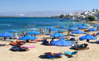
Voulisma beach
Voulisma is the second of the three bays in the beautiful village Istron, about 12km east of Agios Nikolaos and 22km north of Ierapetra. The Voulisma Beach or Golden Sands is located approximately 500m from the village (east). Its length is about 700m and is the largest municipal beach of Kalo Chorio.Voulisma is a very well-organized beach, with rare beauty for a beach located in the Northern part... read more
The Dikti Range
THIS RANGE LIES BETWEEN HERAKLION AND LASSITHI. Its highest summit is Spathi (2.148 m) and there are two more peaks at an altitude of more than 2000m. Lassithi Plateau, the largest in Crete, lies at the heart of the range at an altitude of 850 m. It is surrounded by a series of smaller plateaus such as Katharo, Limnakaro, Mari, Lapathos, Omalos, Erganos and Nisimos. There is a mountain shelter at Limnakaro... read more
Lassithi
Any place in Crete is sure to fascinate visitors. The island is reputed for its amazing mosaic of landscapes – each one, however, retaining its own character, its own identity and beauty. The eastern part of Lassithi is considered to be the low-key aspect of Crete, one of peace, quiet, things being done in a relaxed way, hospitality. It is the corner of Crete with the even-tempered mountains,... read more
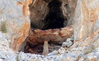
Cave of Pelekita or Cave of the Fig Tree
It lies to the North-Northeast of Kato Zakros. We arrive at the cave either after a one-hour walk from Kato Zakros or from the beach of the same settlement by engine-vessel (20-25 minutes) and after that, we follow a tiresome ascending route (15 minutes walk). The elevation at the entrance attains 105 metres. Stones consist of limestones from the upper Cretaceous and of dolomites from the Triassic... read more
 Parnonas also known as “Malevos” is the mountain range which divides two large counties of Peloponnese, Arcadia and Laconia. The highest peak of Parnonas is called “Megali Tourla” also known as “Kronio” and has 1936 meters altitude. The mountain ends in Laconia at the Cape Maleas, south of Peloponnese.
The natural beauty of the mountain and the traditional villages attract many travelers throughout the year. The best time to visit the area is during the spring season when the snow melts and forms small waterfalls. There are many signposted hiking routes which allow the visitor to admire the gorges, the caves, the waterfalls, the springs and the rivers of this amazing mountain. Climbers will love the challenge of reaching the top of the mountain. “Megali Tourla” (1936m altitude) can be reached through a large path which crosses an amazing gorge. In the beautiful villages of Parnonas you will find places where you can rent mountain bikes or four-wheel drives to explore the amazing locations of this mountain.
Parnonas has five gorges (Loulougas, Mazias, Zarbanitsas, Spilakion, Lepidas) where rare species of flowers blossom. Mazias gorge is the easiest for hiking whereas the Lepidas gorge is very demanding and you will need special equipment and knowledge to cross it.
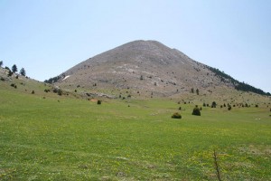 The name Parnonas existed already since the ancient period and the name meant “the ridge which shines”. During the ancient times the mountain was also called “Kronion” because it was considered to be the sacred mountain of Cronus, who was the leader of the Titans.
There are signs of inhabitation already since the Paleolithic Period which continued throughout the antiquity until the byzantine years. The monastic life is quite strong here and the visitor can still visit some beautiful monasteries, like the known monasteries of Malevi, Loukous and the monastery of Elonas.
Parnonas is also a very important ecological zone in Peloponnese as it is covered with forests of firs, black pine trees, plane trees etc. Around the monastery of Malevi there is the “Juniperus drupacea” (Δενδρόκεδρος) tree forest which is the only one in Europe and has been classified as protected area of the “Natura 2000”. At this mountain there are also many rare species of flora, some of them are known for their healing powers.
The “Wetland of Moustou” is a small lake with two artificial waterways and is located about 2km northeast of Astros. The wetland is also a protected area of the “Natura 2000” as the flora and the fauna here is extremely interesting. During the winter the wetland gathers millions of migratory birds which create a beautiful image. The artificial waterways flow to the shores of the nearby beach where the rare species of “Careta- Careta turtle” can be seen.
Source: www.discover-peloponnese.com/
Mt. Parnonas
Parnonas also known as “Malevos” is the mountain range which divides two large counties of Peloponnese, Arcadia and Laconia. The highest peak of Parnonas is called “Megali Tourla” also known as “Kronio” and has 1936 meters altitude. The mountain ends in Laconia at the Cape Maleas, south of Peloponnese. The natural beauty of the mountain and the traditional villages attract many travelers... read more
Alfeios
Peloponnese’s longest river (111km long) has its source in Arcadia and its mouth in the Prefecture of Elis. According to mythology, Apheus was one of the river-gods of antiquity, worshiped mainly in the regions of Arcadia, Elis and Messinia. Son of Oceanus and Tethys, he killed his brother Cercaphus and haunted by the Erinyes, he leapt into the river which was later named after him. Source: www.mythicalpeloponnese.gr [vc_row][vc_column][ivi_nbcaj... read more
The Gorge of Lepida
The gorge of Lepida is one of the numerous, impressive natural formations of Mount Parnon, which stands between the prefectures of Arcadia and Laconia. Its length is 500 metres and it is relatively flat. Two hours are required to cross it, during which visitors will have the opportunity to enjoy the unique natural beauty of the landscape, which is filled with rich flora and fauna and boasts two gorgeous... read more
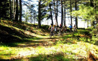
Mountain biking
A great way to discover a new place is actually on two wheels. Arcadia, with its stunning nature, does offer visitors this unique opportunity. The changes in the landscape, the lush vegetation, the dense forests and the hidden traditional settlements are only few of the natural attractions a visitor can enjoy with just a bike and the desire for exploration. Around the city of Tripolis, as well as in the Arcadian... read more
The Ski Center in Mainalo
The Mainalo ski center is situated in the location Ostrakina of the homonymous mountain, approximately 30 kilometres from Tripolis and 162 kilometres from Athens. The roads and consequently the access to the ski centre are easy, making it a very popular destination. It isn’t one of the biggest ski centres; however, it is ideal for families with children, since the mountain is not steep and is perfect... read more
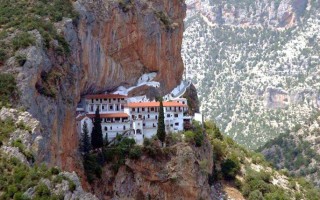
The Monastery of Eloni and the Gorge of Leonidio
The Monastery of Eloni is a pretty old convent in the prefecture of Arcadia, built in the steep slope of Mount Parnon, at an altitude of 650 metres and about 17 kilometres from the town of Leonidio. Due to its exceptional natural beauty, the area around the monastery has been declared as a protected zone and it’s included in the European Network Natura 2000 under the code GR2520005. It has a long... read more
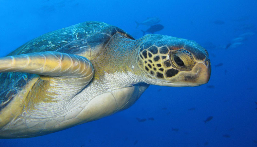
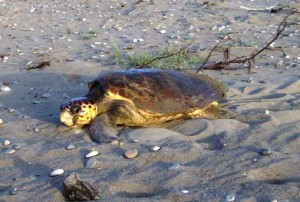
Zakynthos island is situated in the Ionian Sea off the west coast of mainland Greece. The climate is warm with plenty of sunshine. The island has an area of 406,000 ha and its coastline is approximately 110km long. However, only a small part of the coast is sandy beach. In Zakynthos, loggerhead sea turtles nest mainly on the beaches within the Bay of Laganas, which is on the southern part of the island. ARCHELON’s systematic surveys have confirmed that the Bay of Laganas is the most important nesting area for the loggerhead sea turtle (Caretta caretta) in the Mediterranean Sea. This led to the establishment of the National Marine Park of Zakynthos in 1999.
Historical background to the legal protection of the nesting beaches of Zakynthos and the marine zone of the Bay of Laganas.
Due to the importance of Zakynthos as a reproduction area for the loggerhead sea turtle in the Mediterranean, the state introduced measures for its protection since 1984. The purpose of the legislation was to control and regulate development while maintaining the quality of the nesting beaches so that the sea turtles can continue visiting Zakynthos for generations to come. The 1984 measures were further strengthened in 1990 with the signing of a Presidential Decree. Based on this legislation, in addition to specific limitations relative to visitor numbers and the use of sunbeds and umbrellas, the following are mentioned:
- Tourist developments are not permitted behind nesting beaches and the building of residences is strictly regulated
- Artificial lighting is not permitted to affect nesting beaches
- Vehicle use is not allowed on the beach
In 1988, by Ministerial Rule two marine zones were established. These occupy a large proportion of Laganas Bay. Within zone A, no boats or fishing activity are allowed. Accordingly, in zone B the speed limit is 6 knots, while anchoring is not allowed. Fish farms are prohibited in both zones. In 1994, after sustained effort by ARCHELON and other environmental organizations a third zone was established, zone C, in which anchoring is allowed but the speed limit of 6 knots applies. Consequently, speed boats were almost completely prohibited from the Bay of Laganas. These marine zones are marked with buoys in order to be visible to boat users.
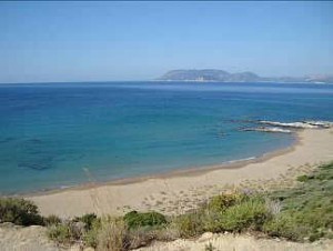
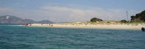 The uninhabited islet of Marathonissi is in the west of the Bay of Laganas. It has a small, 370m long beach made of pale thick sand on its north-west end. There are sand dunes on the back of the beach, which at some locations reach more than 50m inland. The steep hill behind the beach is covered by Mediterranean vegetation. The remains of an old monastery, belonging to the Church of Lithakia, is the only building on this islet. Tourists visit the beach during the day, on organised boat trips and by rented or private boats. Lights and noise from the residential areas of Laganas and Lithakia affect the beach during the night. Organized tours are allowed between 7:00am to 7:00pm from the 1st of May to the 31st of October. Visitors are only allowed to remain on the first 5m from the sea, as sea turtle nests are located on the back of the beach.
While most beaches within the Bay of Laganas mainly produce female hatchlings, the small beach on Marathonissi, with a mere length of 370 metres, produces mainly male sea turtles. This is caused by the slightly lower temperature of the beach sand on Marathonissi. The sex of sea turtle hatchlings is determined by the average temperature of the eggs during incubation. If the incubation temperature is above 29oC, the hatchlings will be females, while if it is below 29oC, they will be male. Indeed the pale colour of the sand on Marathonissi strongly reflects solar radiation, causing slightly lower sand temperature at the egg clutch depth. So while the beach of Marathonissi only receives 9% of the nests in Zakynthos, the fact they exclusively produce male turtles raises it to a crucial reproductive habitat for the survival of the Mediterranean loggerhead sea turtles.
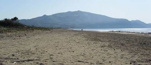 East Laganas beach stretches eastwards from the last hotel of the developed part of Laganas (Louis Zante Beach Hotel), up to the Rock of Hipsolithos. East Laganas is characterised by fine sand mixed with small-sized pebbles and a landward extensive dune field. Visitors are allowed on the beach between 7:00am and 7:00pm from the 1st of May to the 31st of October.
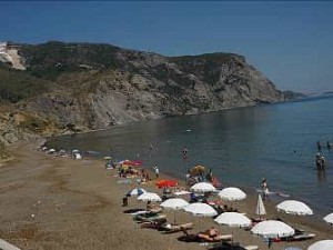 The beach of Kalamaki, with a length of 500m, is the eastward extension of the East Laganas beach, separated from it by the cliffs of Hipsolithos. Behind the beach there are low clay cliffs. A hotel has been constructed above the western part of the beach. The area has an easy access and it is visited by many people during the day. Visitors are allowed between 7:00am and 7:00pm from the 1st of May to the 31st of October. Visitors are only allowed to remain within a 5m distance from the sea, as sea turtle nests are located on the back of the beach.
According to legislation only 150 umbrellas and 300 sunbeds are allowed on the nesting beaches of E. Laganas and Kalamaki. These are to be removed every night. Despite this progress in legislation, problems with sunbeds and umbrellas still exist.
 Sekania beach (650m) is the one that stands out for its natural beauty and the highest nesting density for loggerheads in the Mediterranean. Sekania supports well over 50% of the total number of nests made in the whole Bay. Due to its importance, ARCHELON has been urging the Government to expropriate or buy the private land behind the beach, in order to declare it a site of absolute protection. Finally in 1994, WWF Greece, following recommendations by ARCHELON, purchased a large part of the land behind the nesting beach. This was achieved with partial funding from the European Union and the support of the Greek Ministry of Environment. According to existing legislation public access is prohibited.
 Daphni stands out as the beach with the most problems. All 15 illegal buildings constructed behind the beach of Daphni have not been removed. Following recommendations by the Council of Europe, the removal of illegal buildings at Daphni has been an obligation of the Greek Government since 1986, when only two prefabricated buildings existed. Unfortunately, nothing has been done so far towards this end on behalf of the state. Illegal embankments, street laying, planting of exotic species, and corrosion of the beach have destroyed the beach profile on many locations. Since 2006, the Management Agency of the Park came into agreement with the owners and imposed measures on the operation of the buildings and the beach management. Visitors are allowed from 7:00am to 7:00pm from the 1st of May to the 31st of October and must not exceed 100 at any one time. Visitors are only allowed within the first 5m from the sea, as sea turtle nests are located on the back of the beach.
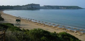 Gerakas is a 15-30m wide beach, with fine and soft sand, and a length of 600m. The beach is backed by clay cliffs which shield off the lights of the two tavernas and the few houses that have been recently built further inland. A paved road comes very close to the beach and vehicles are parked there. There is only one access to the beach by a trail coming down through the cliffs. Due to its fair access, Gerakas attracts hundreds of visitors every day during the summer season. According to legislation only 60 umbrellas and 120 sunbeds are allowed at the western end of Gerakas, and the number of visitors on the beach at any one time should not exceed 350. Visitors are allowed from 7:00am to 7:00pm between the 1st of May and the 31st of October. They have to remain within the first 5m from the sea, as sea turtle nests are located on the back of the beach.
Zakynthos has the privilege to host a very large number of sea turtles in the Bay of Laganas every summer. They migrate thousands of kilometres to reproduce within the bay. Turtle spotting by beach visitors and tour boats is a compatible ecotourism activity with positive prospectives, as it empowers public awareness about sea turtles and therefore their protection, as long as this experience takes place under certain conditions that primarily respect the sea turtles.
On every encounter with a sea turtle in the water, it is very important to seek the least possible disturbance of the animal (as in every other wildlife encounter). This can be achieved when turtle spotting fulfils at least some basic standards that guarantee the calmness of the sea turtle, such as:
- doesn’t exceed 10-15 minutes near the same turtle,
- holds a distance of 10-15 metres from the animal,
- avoids crowding near it (by beach users or boats, with no more than two boats at any one time) and the observers remain calm (e.g. Low-voiced conversation),
- observations are made at a low speed in order not to disturb the animal (no more than two knots),
- any physical contact with the animal is avoided,
- the animal is not approached from the front (and the boat does not pass over it)
- the observers move away on the first indication that the animal is disturbed (e.g. Sudden change of direction, acceleration, sudden diving while basking, often emergences to breathe)
- observations are made during the day (and not during the night).
However, sea turtle observation activities carried out in the Bay of Laganas do not always follow the above basic rules of sustainable observation, nor do they follow the regulations for this special area (e.g. the speed limit of 6 knots to avoid collision with a sea turtle), often placing the turtles in danger.
All visitors of the National Marine Park of Zakynthos should be fully informed about the existing regulations to ensure the well-being of this important sea turtle population concentrated in the Bay of Laganas. Because these regulations have been set to ensure the coexistence of humans and sea turtles to the benefit of both.
Source: www.archelon.gr
διαβάστε περισσότερα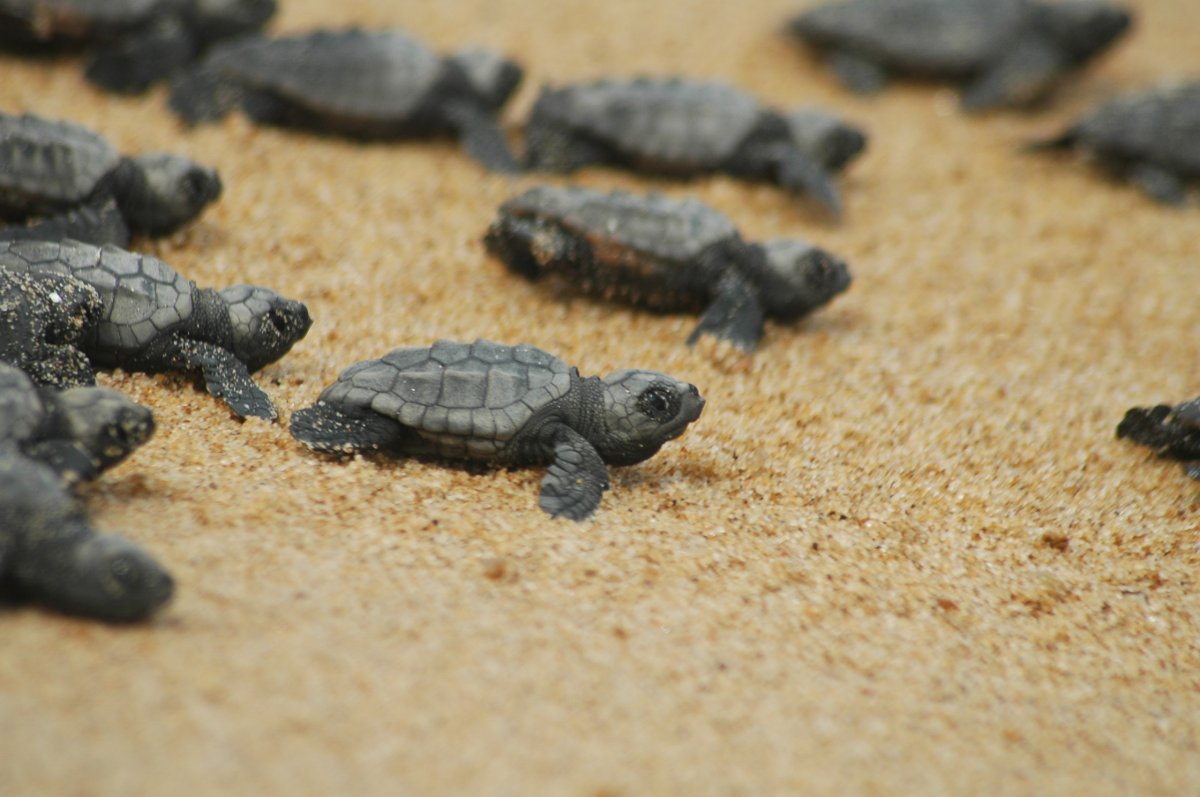
The Gulf of Kyparissia
Kyparissiakos Bay is the second biggest Mediterranean reproduction habitat of the Caretta caretta sea turtle. It is situated in West Peloponnesse, and extends from Katakolo cape, in the north, to Kounelos cape in the south. The magnificent sandy beach is 46 km long and it is only interrupted by Alfios River and two smaller ones – Neda and Arkadikos. The really magnificent scenery is characterized by the pine trees coastal forest all along the upper part of the beach, by the biggest and richest zone of sand dunes in Greece and by the intense ripple of the Ionian Sea that offers moments of peace and relaxation.
 In Kyparissiakos Bay there are almost 700 Caretta caretta nests on a yearly basis, the majority of which (86%) is mainly found in the southest part of the bay, and more specifically, in a 10 km area, between Neda estuary and Kalo Horio village, which constitutes the heart of the habitat. This area has been included in the European network Natura 2000 under the code GR2550005 “Thines Kyparissias: Noehori – Kyparissia” mainly due to the reproduction of the sea turtles and the protected flora in the sand dunes zone. The sea area round the bay has also been included in the same network of protected areas under the code GR2330008 “Kyparissia bay sea area: Katakolo cape – Kyparissia” due to the existence of widespread Poseidonia meadows which constitute feeding and reproduction places for plenty and various organisms.
“Neda” Project in Giannitsochori of Ilia Prefecture
 Kyparissiakos Bay is the second biggest Mediterranean reproduction habitat of the Caretta caretta sea turtle. It is situated in West Peloponnesse, and extends from Katakolo cape, in the north, to Kounelos cape in the south. The magnificent sandy beach is 46 km long and it is only interrupted by Alfios River and two smaller ones – Neda and Arkadikos. The really magnificent scenery is characterized by the pine trees coastal forest all along the upper part of the beach, by the biggest and richest zone of sand dunes in Greece and by the intense ripple of the Ionian Sea that offers moments of peace and relaxation.
In Kyparissiakos Bay there are almost 700 Caretta caretta nests on a yearly basis, the majority of which is mainly found in the southest part of the bay, and more specifically, in a 10 km area, between Neda estuary to the North and Kalo Nero village to the South, which constitutes the heart of the habitat. A significant number of nests, however, are found in the section of the bay which is located north of Neda estuary, until Giannitsochori of Ilia Prefecture, length of 4 km. The entire area has been included in the European network Natura 2000 under the code GR2550005 “Thines Kyparissias: Noehori – Kyparissia” mainly due to the reproduction of the sea turtles and the protected flora in the sand dunes zone. The sea area round the bay has also been included in the same network of protected areas under the code GR2330008 “Kyparissia bay sea area: Katakolo cape – Kyparissia” due to the existence of widespread Poseidonia meadows which constitute feeding and reproduction places for plenty and various organisms.
Since 1983 ARCHELON conducts a project of recording and protecting reproduction activity in the area between Neda estuaries and Kalo Horio village. In addition to this project and due to the celebration of 30 years since its foundation, ARCHELON opens a new project in Kyparissiakos Bay named “Neda”. The new project is placed in Giannitsoxori of Ilia Perfecture and will cover the area between Neda estuary to the South and Giannitsoxori to the North. Reproduction period starts late May and lasts till October. During this period, and more specifically from June 1 till September 30, with the participation of volunteers from around the world.
Lakonikos Bay
The Lakonikos Bay project is conducted at the beaches surrounding Gytheio, a beautiful town characterized by its picturesque port, neoclassical houses, narrow uphill alleys, stone paved streets and marble stairs. According to the Greek mythology here is the place where god Apollon fought with Hercules for the magic tripod of the Delphic oracle and where at the end they reconciled, giving the area its current name (Gytheio from the words gh and theos, which mean earth of the gods)
 These unique, both in natural wealth and beauty, beaches of Lakonikos Bay have a total length of about 23 km and accommodate, in average, 200 Caretta caretta nests every year, whereas the sea area is the only spot in Greece where an other species of sea turtle, the green turtle (Chelonia mydas), is frequently encountered. A part of this area has been included in the european network Natura 2000 under the code GR2540003 “EVROTAS DELTA” as it constitutes not only a reproduction area for the sea turtles but serves as rest, reproduction and nourishment area for many bird species as well. Also, the sand dunes zone accommodates protected plant species such as the sea daffodil (Pancratium maritimum). The marine ecosystems of Lakonikos Bay include vast Posidonia meadows which serve as a reproduction area and a feeding ground for many organisms and fishes of commercial significance.
ARCHELON, noting that the area of Lakonikos Bay is an important nesting habitat of Caretta caretta sea turtles, first began a project about recording and protecting the nests in 1985, which carries on to the present day. Specifically reproductive activity is recorded at 4 beaches in the region (Mavrovouni, Vathy, Selinitsa, Valtaki), of total length of about 8.5 km, which are used as an “index area” for the rest of the region. The reproductive activity begins in early June and ends in the last days of September. During this period, with the participation of volunteers from around the world.
Koroni
Koroni, a beautiful coastal town of Messinia, is located at the southwestern end of the Messinian Gulf and is about 50 km away from Kalamata. It has about 2,000 inhabitants, most of who are engaged in agriculture, fishing and tourism, while it is estimated that during the summer months its population exceeds the 10,000, since because of its beauty, it is one of the major tourist destinations of Messinia. Koroni is famous for its Venetian castle that looms over the city, its special picturesqueness which is due to not only its unique geographical position, but also its architectural composition and the golden beaches that surround it.
 The significance of the Zaga – Memi beach in Koroni (2.7 km long) for the reproduction of the sea-turtle Caretta caretta had been identified since the late 80’s. It is a crowded beach that hosts an average of 40 nests every year. Since 1995 ARCHELON conducts each summer a project aiming the record and the protection of the nests. The reproductive activity begins in early June and ends in the middle of September. During this period, especially from 5 June through 15 September, with the participation of volunteers from around the world.
Volunteers can spend their free time having sea baths, attend one of each kind of cultural events that take place daily in Koroni, carefree browse the quaint streets of the city with their special houses and cobblestone streets and of course visit the neighboring beautiful cities in the region (Methoni Finikounda, Pylos, Gialova) where history and ancient monuments meet the rich natural beauty with many protected species of flora and fauna.
Information and activities
Since 1983 ARCHELON conducts a project of recording and protecting reproduction activity in the area between Neda estuaries and Kalo Horio village. Reproduction period starts late May and lasts till October. During this period, and more specifically from May 15 till September 30, with the participation of volunteers all over the world, ARCHELON runs the following activities:
- Morning observation, during which reproductive activity is recorded daily.
- Night observation and marking of adult sea turtles
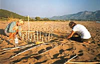
- Nest protection from human activity and predation by mammals (foxes, dogs etc), which is done by enclosing and marking the nests and by shading them, where necessary.
- Excavation of nests after the exit of the hatchlings in order to estimate the number of them that left the nest.
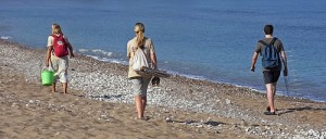
- Public awareness by operating a seasonal information station in Kalo Nero village, by organizing information slide shows in tourist facilities and camping of the area, as well as by conducting beach patrols in order to raise the bathers’ awareness.
In the frame of the European Community LIFE – Nature program, conducted in the area by ARCHELON, two main actions should be noted:
- A special Environmental Study and Managerial Project for the coastal zone have been worked out in the aim of promoting – in collaboration with local society – a sustainable management for the efficient protection of the physical environment and the controlled development of the local economy
- A Scientific and Environmental Station has been founded in Agiannakis area which, in the range of environmental education program, organizes guided tours for schools and visitors.
Source: www.archelon.gr
διαβάστε περισσότερα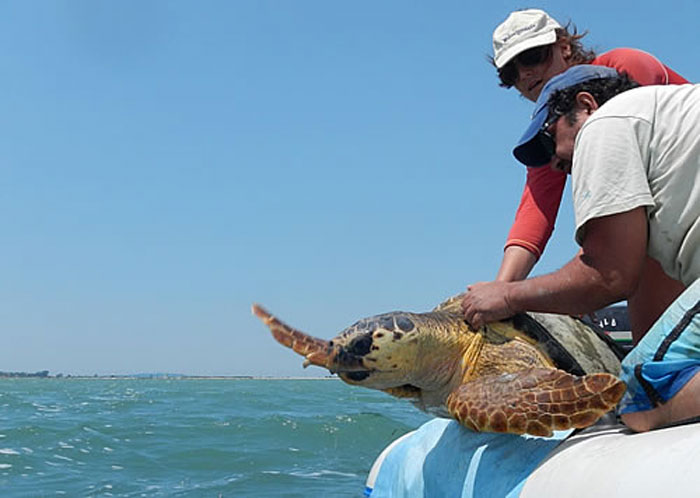
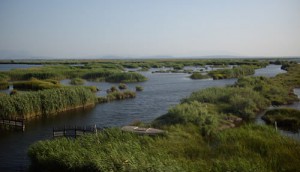
Amvrakikos Gulf is semi-closed sea in the north-west part of Greece. It is watered by plenty of fresh waters and sediments, thanks to the rivers Arachthos, Louros, Vovos and Krikeliotis. It has a warm climate, shallow waters, many lagoons of a small depth and marshlands. All these favour the development of local flora and fauna, making the gulf one the most important wetlands of Europe. ARCHELON’s activity the past years has confirmed a significant presence of turtles in the area, especially near the estuaries of the rivers in the north-east part of the Gulf, although there has not been a record of a nesting site within the Gulf.
 Protection of the region
The ecosystem of the Amvrakikos gulf is one of the 11 wetland regions of our country that have been characterized “of international importance” and are protected by the international treaty RAMSAR.
Due to the rarity of the morphology of the area, and also due to the presence of rare and endangered species, the wetlands have been included in the NATURA 2000 Network, the Barcelona convention (a convention on the protection of the Mediterranean Sea from pollution) and is protected by virtue of the Berne convention (regarding the conservation of European wildlife and natural habitats) and the Bonne convention.
The need to protect and preserve the area’s unique ecosystem, has led to the establishment of the National Park and the Amvrakikos Management Body, in 2008, that specifies usages, conditions and restrictions for the terrestrial, aquatic and sea regions of the Amvrakikos Gulf.
 The work of ARCHELON
ARCHELON has been monitoring the area for the past decade in order to research the turtle presence by spotting, tagging and satellite tracking the population.
Last year’s positive data has led us to establish a full season project in the area for the first time, in order to gather more information on the population’s activity. The field work consists of turtle monitoring and raising public awareness in the local community. Volunteers will have a closed contact with the turtles as they will be trained to spot and capture them in order to gather all the data needed.
Source: www.archelon.gr
διαβάστε περισσότερα
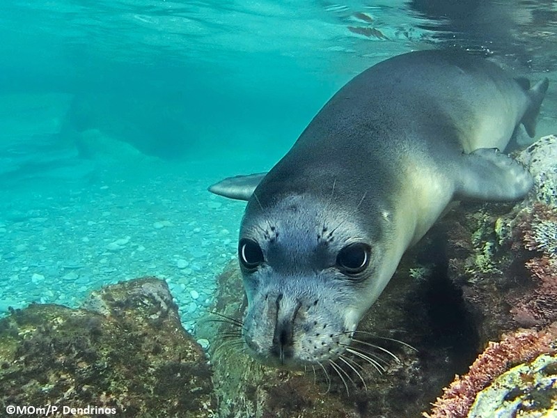
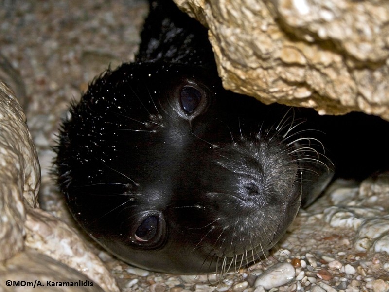
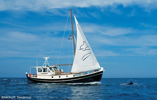
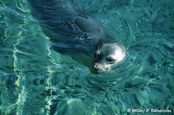
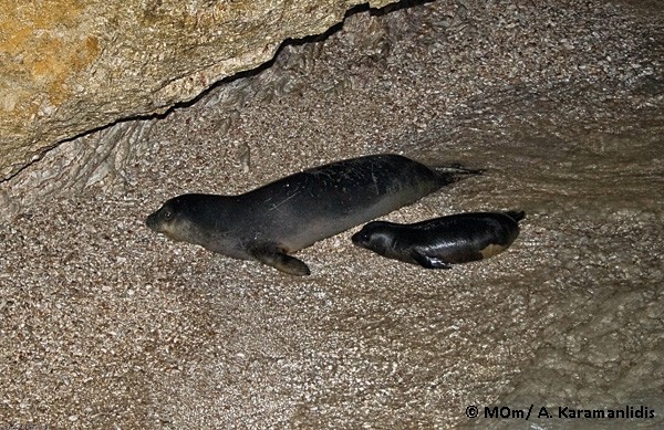
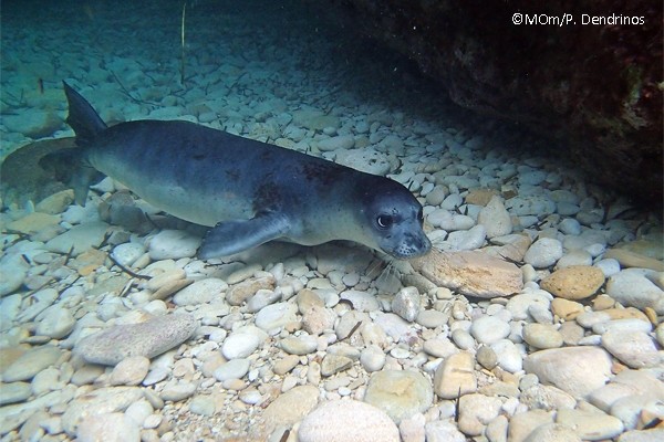
![]() MOm/ The Hellenic Society for the Study and Protection of the Monk seal is a Greek non–governmental environmental organization with the legal status of a Non–profit association. MOm is active in the protection and promotion of the coastal and marine environment of Greece, through the protection of the Mediterranean monk seal, which is the only seal species in the Mediterranean Sea and the most endangered seal on earth.
MOm/ The Hellenic Society for the Study and Protection of the Monk seal is a Greek non–governmental environmental organization with the legal status of a Non–profit association. MOm is active in the protection and promotion of the coastal and marine environment of Greece, through the protection of the Mediterranean monk seal, which is the only seal species in the Mediterranean Sea and the most endangered seal on earth.
The financial resources of MOm originate from the memberships of our supporters, donations from private entities, selected partnerships with national, European and international bodies, and from nationally and European-funded programs. MOm is subject to regular financial auditing by Certified Public Accountants – Auditors.
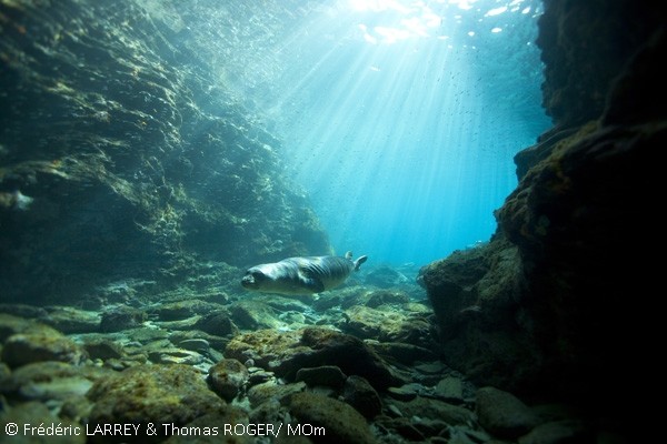
 The main goal of MOm/ Hellenic Society for the Study and Protection of the Monk Seal is the conservation of the natural environment and the biodiversity of Greek seas, through the protection of the critically endangered Mediterranean monk seal (Monachus monachus). MOm strives for the survival of the only seal species in the Mediterranean Sea and for a healthy marine environment for the present and future generations!
In order to achieve the above, MOm works tirelessly on two different, but highly related fronts. Our aim is to:
• Reduce human – related monk seal mortality
• Preserve the last remaining habitat for the critically endangered Mediterranean monk seal
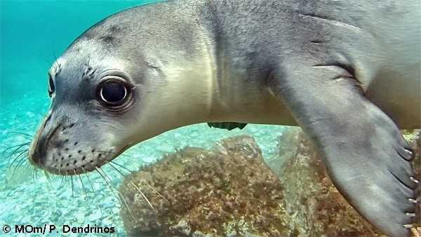
Important Areas
The largest population of the critically endangered Mediterranean monk seal lives in Greece and is estimated to number approximately 300 individuals. Monk seals are widely distributed throughout the entire coastline of the country and show a strong preference for isolated and inaccessible islands, islets or parts of the coastline on the mainland. The largest and most closely monitored populations are those at the Northern Sporades Islands and at the Kimolos – Polyaigos island complex. The population at the Northern Sporades Islands (which includes the National Marine Park of Alonissos, Northern Sporades) has been closely monitored by MOm since 1988 and is considered to number more than 50 individuals. Another 50 individuals are also believed to live at the Kimolos – Polyaigos island complex in the southwestern Cyclades islands. Important reproductive populations of the species can also be found at the islands of Northern Karpathos and Saria (this population is estimated to number approximately 25 individuals) and at the Ionian Islands (i.e., Zakynthos and Cephalonia). In recent years, the largest population of Mediterranean monk seals in Greece was discovered at the island of Gyaros, in the northern Cyclades Islands, and has been estimated to number approximately 60 individuals.
Studying the distribution of the Mediterranean monk seal in Greece is conducted mainly through the evaluation and mapping of information received by the Hellenic Rescue and Information Network of MOm (RINT) and through the collection of on-site information during the monitoring of important monk seal populations in the country.
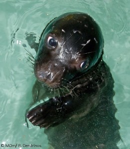
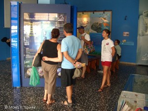 Environmental Education
Environmental education is one of the most useful tools in the effective conservation of the natural environment, and is therefore also a cornerstone of MOm’s activities. MOm carries out environmental education activities throughout Greece with a special focus on coastal and insular areas. The goal is to educate school children, our future generation, about the critically endangered status of the Mediterranean monk seal and its habitat and how they can become active in their protection. This is done by challenging their learning process and their critical thinking. The environmental education programs of MOm have been officially approved by the Hellenic Ministry of Education and have been attended so far by more than 250,000 school children in the country.
Furthermore, each year MOm carries out during the summer months the environmental program “The school of the monk seal”. At the Information Center of MOm at the island of Alonissos young children learn about environmental protection through a variety of interactive activities, such as theatrical plays, treasure hunts etc. The Environmental Center has also a children’s library with more than 1,300 different books.
Acknowledging the increasing role of the internet in the education process, MOm has also developed several educational websites:
• www.monachoulis.gr. This is the main environmental education website of MOm, containing information about the Mediterranean monk seal and the environmental education material of MOm. The target group of the site are school children but also teachers seeking to enrich their curriculum with information regarding the protection of the Mediterranean monk seal and the marine environment in general.
• www.thalassapedia.gr/en/. This website was created within the framework of the European program Life “Thalassa” and contains information regarding the marine mammals in Greece, the threats they face and ways to help save them.
• http://mofi.mom.gr/ekpaideysi.htm: This is the educational outlet of the project MOFI that was carried out by MOm in 2006 – 2009 throughout coastal and insular Greece with the aim of mitigating monk seal – fishery conflicts. This website contains a link to a book on sustainable fisheries.
If you want to learn more about the environmental education programs of MOm, please contact MOm by phone at +30 210 5222888 or by email at info@mom.gr.
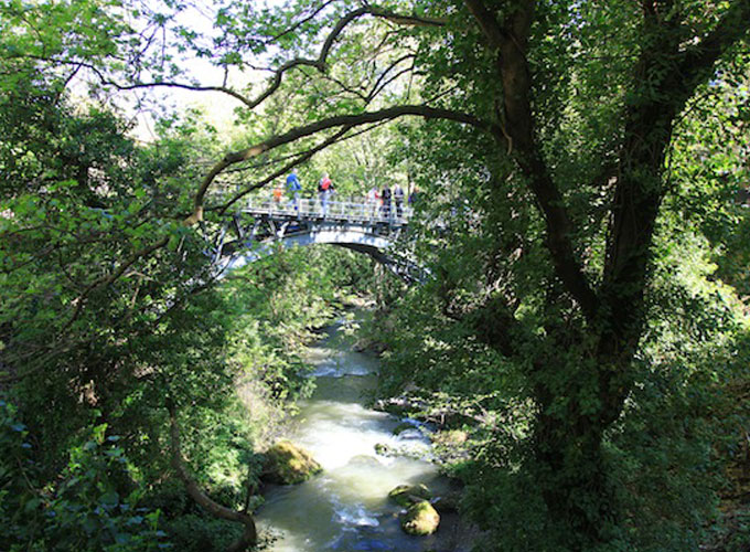
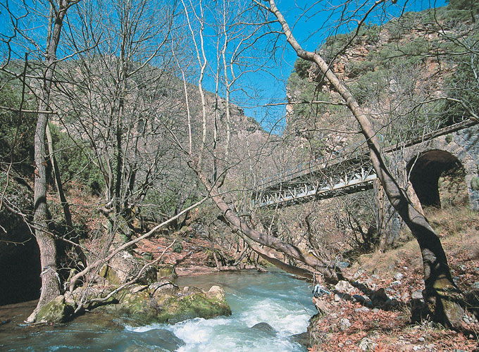
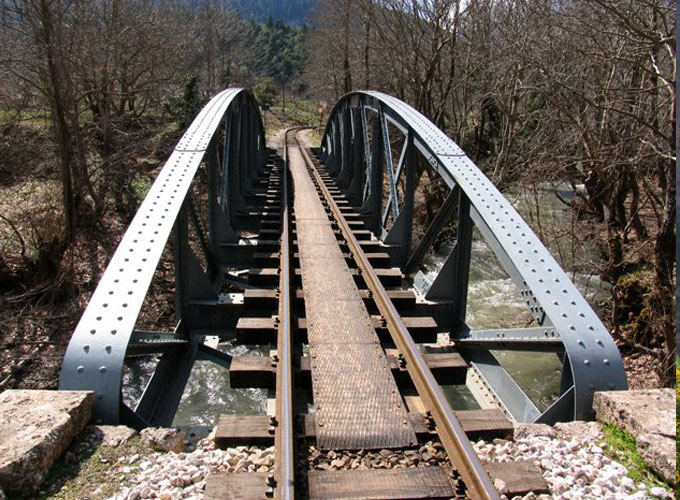
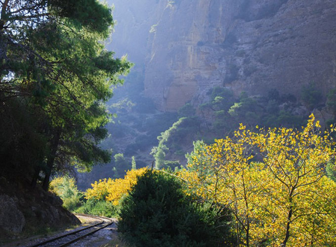
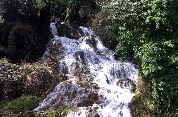
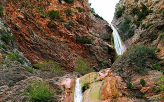
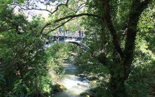
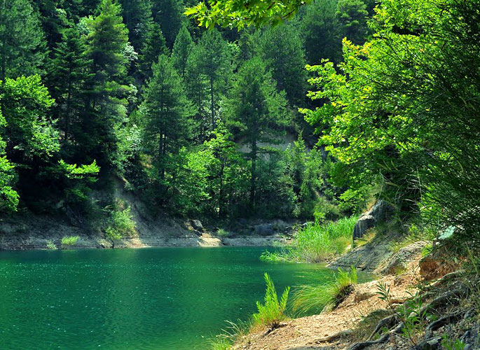
Vouraikos gorge starts at a distance of 3 km from the west foothills of mount Helmos and mount Panachaiko, and leads all the way to Diakopto. Vouraikos River springs from the mountains of Kalavryta and ends at the Corinthian gulf, near the beach of Diakopto. Along its way it has created a deep, unique gorge.
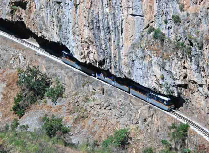
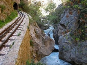 As it runs down to the sea, it receives the waters of several streams forming small lakes and numerous cascades. Its width is constantly changing. The narrowest spot, “Portes”, is located close to Zachlorou. According to the myth, there was a rock there, blocking Hercules passage. Hercules cut the rock in two and created this gateway. The rack railway passes through the gorge.
The region is protected under the European Natura 2000 due to its abundant flora and fauna.
Source: www.mythicalpeloponnese.gr
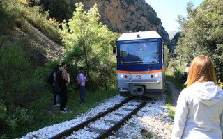
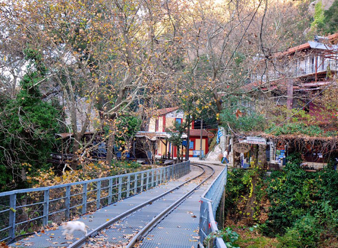
Rack Railway
In 1889, Charilaos Trikoupis, Greece’s Prime Minister at the time, decided to construct the rack railway. Specialized technicians from France and Italy undertook the construction of the track and it lasted seven years. King George I was the first train passenger that took the first journey on March 10th, 1896. The purpose of the railway was to connect the region of Kalavryta to Athens and Patras... read more
Vouraikos Gorge
Vouraikos gorge starts at a distance of 3 km from the west foothills of mount Helmos and mount Panachaiko, and leads all the way to Diakopto. Vouraikos River springs from the mountains of Kalavryta and ends at the Corinthian gulf, near the beach of Diakopto. Along its way it has created a deep, unique gorge. As it runs down to the sea, it receives the waters of several streams forming small lakes... read more
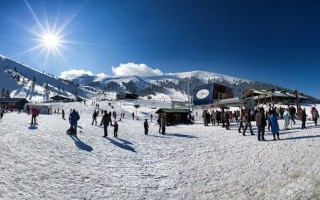
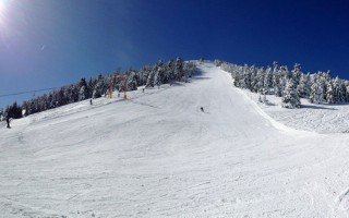
Kalavryta Ski Resort
Kalavryta Ski resort is situated 14km from the town, at an altitude of 1670 to 2328 meters above sea level, on the southern side of mount Helmos. It has 8 lifts, 2 aerial (1 three-seat and 1 two-seat), 3 drag lifts (one of them double), 2 lifts for children and a recreation one. The biggest lift is 1415m long and has a height difference of 472m. The total lift capacity is 5.000 people per hour. The... read more
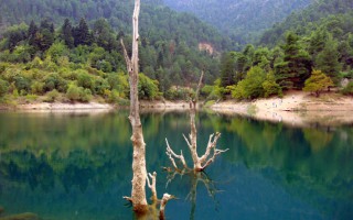
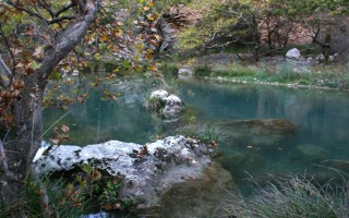
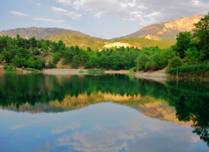
Lake Tsivlou
One of the few lakes in the mountainous region of the Peloponnese, lake Tsivlou is situated at an altitude of 800 m. It was formed following a landslide in 1912 when the ancient river Krathis was blocked. The small yet picturesque lake is located half way from Akrata to Zarouchla. Enjoy a picnic with view the huge branches sprouting out of its surface or chose between walking, mountain biking and off-road... read more
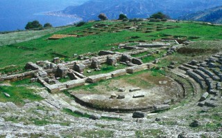
Ancient Theater of Aigeira
The ancient theater is situated near the town of Aigeira at an altitude of 350m above sea level offering a view to the Corinthian gulf. Its construction dates back to 280-250 Β.C. Similar to the orchestra, the koilo is hewn on natural rock and when not available the soil was cut to accommodate stone seats. During the Hellenistic period it consisted of a two storey building. A corridor divides the koilo... read more

The Carnival of Patra
Patra, the capital of the prefecture of Achaea, is without doubt a city with great history and many interesting places for one to discover during a visit. However to the majority of the people the city is best known for its Carnival, which, is, admittedly, the biggest and most impressive carnival out of the dozens that are organized in various areas in Greece. The Carnival of Patra began in the 19th... read more
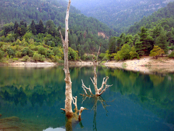
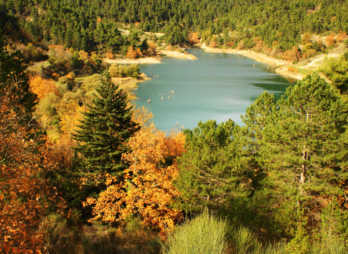
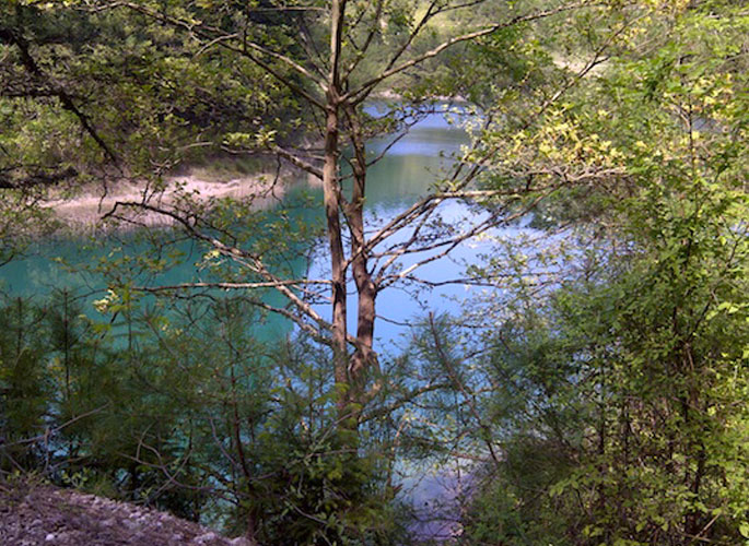
 One of the few lakes in the mountainous region of the Peloponnese, lake Tsivlou is situated at an altitude of 800 m. It was formed following a landslide in 1912 when the ancient river Krathis was blocked.
The small yet picturesque lake is located half way from Akrata to Zarouchla. Enjoy a picnic with view the huge branches sprouting out of its surface or chose between walking, mountain biking and off-road rides along the trail surrounding the lake.
Source: www.mythicalpeloponnese.gr
Rack Railway
In 1889, Charilaos Trikoupis, Greece’s Prime Minister at the time, decided to construct the rack railway. Specialized technicians from France and Italy undertook the construction of the track and it lasted seven years. King George I was the first train passenger that took the first journey on March 10th, 1896. The purpose of the railway was to connect the region of Kalavryta to Athens and Patras... read more
Vouraikos Gorge
Vouraikos gorge starts at a distance of 3 km from the west foothills of mount Helmos and mount Panachaiko, and leads all the way to Diakopto. Vouraikos River springs from the mountains of Kalavryta and ends at the Corinthian gulf, near the beach of Diakopto. Along its way it has created a deep, unique gorge. As it runs down to the sea, it receives the waters of several streams forming small lakes... read more
Kalavryta Ski Resort
Kalavryta Ski resort is situated 14km from the town, at an altitude of 1670 to 2328 meters above sea level, on the southern side of mount Helmos. It has 8 lifts, 2 aerial (1 three-seat and 1 two-seat), 3 drag lifts (one of them double), 2 lifts for children and a recreation one. The biggest lift is 1415m long and has a height difference of 472m. The total lift capacity is 5.000 people per hour. The... read more
Lake Tsivlou
One of the few lakes in the mountainous region of the Peloponnese, lake Tsivlou is situated at an altitude of 800 m. It was formed following a landslide in 1912 when the ancient river Krathis was blocked. The small yet picturesque lake is located half way from Akrata to Zarouchla. Enjoy a picnic with view the huge branches sprouting out of its surface or chose between walking, mountain biking and off-road... read more
Ancient Theater of Aigeira
The ancient theater is situated near the town of Aigeira at an altitude of 350m above sea level offering a view to the Corinthian gulf. Its construction dates back to 280-250 Β.C. Similar to the orchestra, the koilo is hewn on natural rock and when not available the soil was cut to accommodate stone seats. During the Hellenistic period it consisted of a two storey building. A corridor divides the koilo... read more
The Carnival of Patra
Patra, the capital of the prefecture of Achaea, is without doubt a city with great history and many interesting places for one to discover during a visit. However to the majority of the people the city is best known for its Carnival, which, is, admittedly, the biggest and most impressive carnival out of the dozens that are organized in various areas in Greece. The Carnival of Patra began in the 19th... read more