

As soon as you arrive at the settlement of Istron, you turn left in the direction of Prina – Kalamafka. After about 400 metres, right before the bridge, you turn on the left and follow the signs.
The rock Minoas lies at a distance of 2.5 kilometres from there and the rocks Talos and Istronas lie at a distance of 3 kilometres from there. Rocks are also accessible by car until the foot of each of them and it is a five-minutes walk from where you leave the car until the foot of the rock.
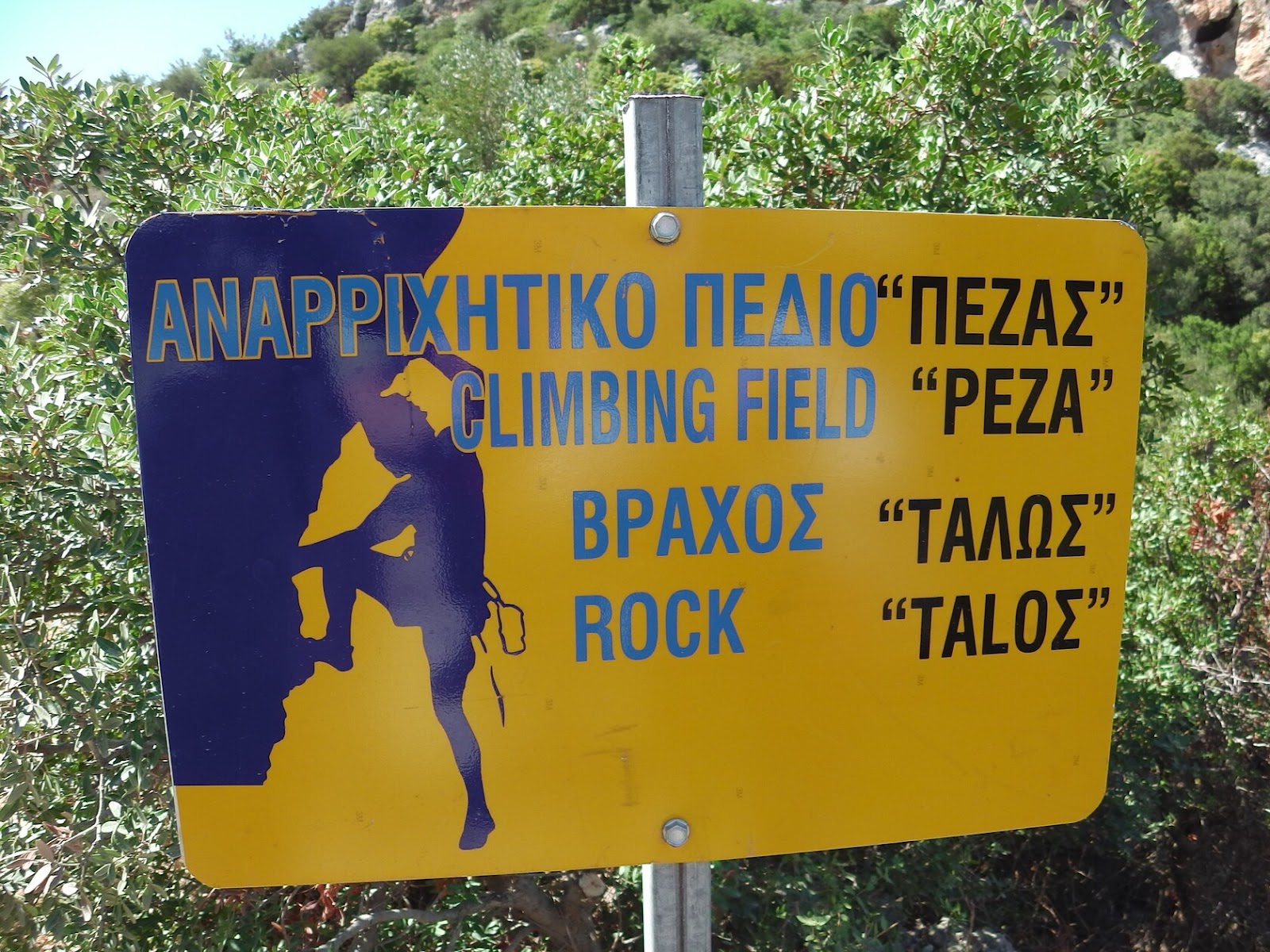
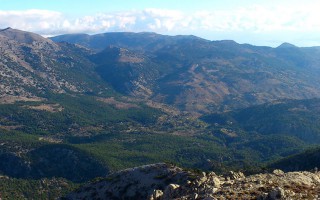
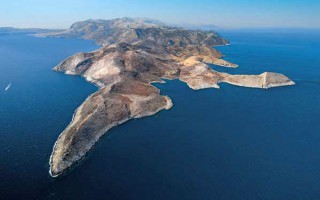
The climbing field of Peza consists of four rocks: Minoas, Talos, Istronas and Panas. It lies to the East of Aghios Nikolaos at an elevation of 300 metres. It is a very important sport climbing field in Crete The orientation of the three of them (Minoas, Talos and Istronas) enables climbers to climb throughout the day, all year round. The development of its circuits varies between 14 to 30 metres; thus a 60-70 metre rope as well as 16 sets are strongly recommended. The bedrock is very good quality solid limestone.
The creation of the field is still in progress, however there are circuits that will satisfy climbers of all levels. All of them are sport circuits, equipped with inox plates and bolts. At the rock Talos, there is Dionysus’ cave, from where circuits of a high grade of difficulty (8a, 8b+) begin. What makes the field so unique, is the bird’s eye view to the Bay of Mirabello and to the peaks of Lasithiotika mountains, the scenic surrounding landscape and the fact that it offers climbers the option to climb all day, since there is always shade due to the rocks.
Source: www.incrediblecrete.gr
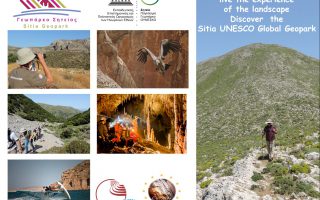
The new aspect of tourism, Sitia Geopark
When the Sitia region became a member of the UNESCO Geopark family, we had no idea just how much positive change this would bring! This new aspect of tourism “Sitia Geopark”, is proving to be a considerable point of interest, especially in the alternative tourism market. The natural environment is no longer an obstacle for tourism development, on the contrary it is a great attraction for visitors. We... read more
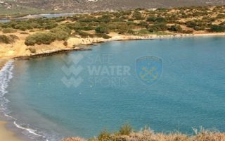
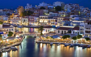
Elouda beach
The nice sandy beach northern to the small port of Elounda is situated at a distance of 11 kilometers far from Aghios Nicolaos at the North, and 70 -77 kilometers eastern to the International Airport of Heraklion, via the New or the Old National road respectively. Protected by the Spinalonga peninsula, the beach is not affected by the winds. Fully organised, the beach offers a wide range of accommodation,... read more
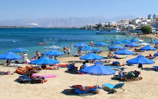
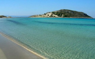
Voulisma beach
Voulisma is the second of the three bays in the beautiful village Istron, about 12km east of Agios Nikolaos and 22km north of Ierapetra. The Voulisma Beach or Golden Sands is located approximately 500m from the village (east). Its length is about 700m and is the largest municipal beach of Kalo Chorio.Voulisma is a very well-organized beach, with rare beauty for a beach located in the Northern part... read more
The Dikti Range
THIS RANGE LIES BETWEEN HERAKLION AND LASSITHI. Its highest summit is Spathi (2.148 m) and there are two more peaks at an altitude of more than 2000m. Lassithi Plateau, the largest in Crete, lies at the heart of the range at an altitude of 850 m. It is surrounded by a series of smaller plateaus such as Katharo, Limnakaro, Mari, Lapathos, Omalos, Erganos and Nisimos. There is a mountain shelter at Limnakaro... read more
Lassithi
Any place in Crete is sure to fascinate visitors. The island is reputed for its amazing mosaic of landscapes – each one, however, retaining its own character, its own identity and beauty. The eastern part of Lassithi is considered to be the low-key aspect of Crete, one of peace, quiet, things being done in a relaxed way, hospitality. It is the corner of Crete with the even-tempered mountains,... read more
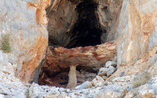
Cave of Pelekita or Cave of the Fig Tree
It lies to the North-Northeast of Kato Zakros. We arrive at the cave either after a one-hour walk from Kato Zakros or from the beach of the same settlement by engine-vessel (20-25 minutes) and after that, we follow a tiresome ascending route (15 minutes walk). The elevation at the entrance attains 105 metres. Stones consist of limestones from the upper Cretaceous and of dolomites from the Triassic... read more
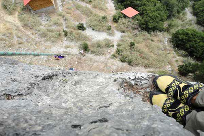
The European Protection, Management and Moderate Tourist Development program set up a climbing sports park in the Lagada region, of mount Taygetus. It contains more than 50 routes developed in four levels and move on slates.
All the routes are sufficiently equipped with 10mm stainless stoppers.The return is possible through rappel. The routes are meant for experienced climbers.
Τhe area is located a few kilometers after the settlement of Trypi. Mid-May until mid-October are considered the period for climbing.
Information: Hellenic Climbing Association of Sparti, Gortsoglou 97, 231 00 Sparti, tel/fax: 27310 22574
Source: www.mythicalpeloponnese.gr

SPARTATHLON HISTORICAL ULTRAMARATHON
SPARTATHLON is a historic ultra-distance foot race that takes place in September of every year in Greece. It is one of the most difficult and satisfying ultra-distance races in the world because of its unique history and background. The Spartathlon revives the footsteps of Pheidippides, an ancient Athenian long distance runner, who in 490 BC, before the battle of Marathon, was sent to Sparta to seek... read more
Mt. Parnonas
Parnonas also known as “Malevos” is the mountain range which divides two large counties of Peloponnese, Arcadia and Laconia. The highest peak of Parnonas is called “Megali Tourla” also known as “Kronio” and has 1936 meters altitude. The mountain ends in Laconia at the Cape Maleas, south of Peloponnese. The natural beauty of the mountain and the traditional villages attract many travelers... read more
E4 European long distance path
The E-path starts at the Pyrenees of Spain, it crosses central Greece, and ends at Larnaka, Cyprus. The southern part of the path begins in Corinth and through Tripoli enters Laconia, crosses Parnon, Sparti and Mystras and climbs the slope of Taygetus and ends in Gytheio. The path follows the route Agios Petros – Karyes – Vresthena – Theologos – Sparti – Mystras – Faneromeni Monastery-... read more
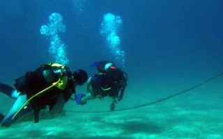
Scuba Diving in Laconia
The crystal clear waters of the Laconian Sea with its rich sea bed offer scuba divers great diving trips. Explore the diverse underwater flora in most of the beaches of the area. In the Laconia region autonomous diving is permitted at the Gulf of Epidaurus Limera that extends from Monemvasia and contains the shores of Myrtoo. In the Laconian gulf free diving is permitted south of cape Psifia, from... read more
Elafonisos
This small, majestic island on the southern edge of Peloponnese is considered to be one of the most famous touristic destinations for the summer period and its characteristics are the beautiful sandy beaches and the crystal waters. It was named Elafonisos (elafi=deer), after the plethora of red deer in the area. According to Pausanias, there were also a lot of sanctuaries dedicated to Goddess Artemis. At... read more
Cape Tenaro
The ancient people believed that at the end of Mani and of the mainland of Europe were the gates to the Underworld. The visitors can reach on foot the Cape Tenaro, which is filled with remains of antiquities, from the path starting from the little church of Agioi Asomatoi which was built using the stones from the Sanctuary of Poseidon Tenarios. If you walk east, you’ll find sculpted on the rock the Psychomanteion... read more