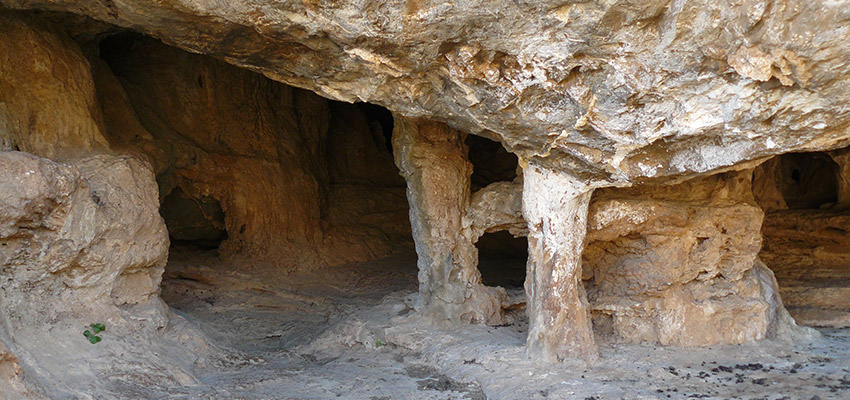
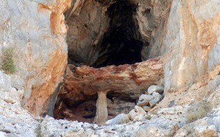
In the area, it is known as Rapas cave. However, it is more widely known as Milatos cave. It lies east of Milatos. From a village, there is a road leading you to the cave area after 2,5 kilometres.
From there, if we follow a path for 15 minutes, we arrive at the entrance of the cave which lies at an elevation of 155 metres. The cave has 8 small and big entrances along 40 metres, arranged on three different horizontal levels.
We use the large central entrance, which is 9 metres in width and 2 metres in height. The rigth entrance (access to the exterior part is difficult) allows for the daylight to illuminate the chamber where the church is situated. Both those entrances lead to the main part of the cave. The others lead to the left smaller part of the cave. In the first part of the main chamber, a church was erected in 1953 dedicated to Saint Thomas.
There, a liturgy (Sunday Mass) is held once a year in commemoration of the Saint, that is on “Thomas Sunday (Second Sunday of Easter). On that day a local celebration of national character takes place in the area.
Near the church, there is an ossuary where some of the sacred relics of victims that died in a battle in 1823 (during the Greek Liberation War against the Turkish Occupation) are kept. After the church, the floor becomes sloping and in the end it becoms horizontal.
In all areas of the cave, there are many small and big pillars arranged in clusters, which constitute an amazing spectacle. Stalagmites are fewer, however very spectacular. Stalactites are scarce. Pillars divide the cave into many chambers.
The cave has been opened up in Cretaceous limestone, at a precession of which lie the entrances. What we can see today are the remains of a bigger undergroung sinkhole that used to expand mainly to the part of the gully. The total length of the cave attains 75 m, the width in the entrance area is 45 metres, which becomes narrower and narrower as we walk further into the cave. The deepest part of the cave is 12 metres lower than the entrance level.
Circulation is easy in many areas. After exploitation of the cave, the walking path will attain 200 metres. The cave has been characterized as a cave of great national interest. It was mapped by El. Platakis on 28th August 1953, while a more detailed mapping was carried out by members of the speleological society led by Anna Petrochilou on 7th December 1969.
Source: www.incrediblecrete.gr
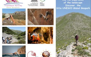
The new aspect of tourism, Sitia Geopark
When the Sitia region became a member of the UNESCO Geopark family, we had no idea just how much positive change this would bring! This new aspect of tourism “Sitia Geopark”, is proving to be a considerable point of interest, especially in the alternative tourism market. The natural environment is no longer an obstacle for tourism development, on the contrary it is a great attraction for visitors. We... read more
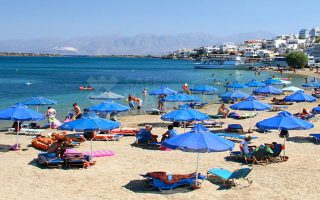
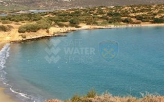
Elouda beach
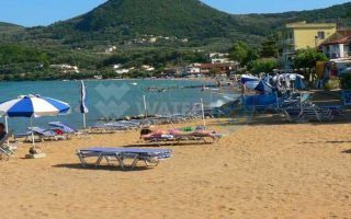
The nice sandy beach northern to the small port of Elounda is situated at a distance of 11 kilometers far from Aghios Nicolaos at the North, and 70 -77 kilometers eastern to the International Airport of Heraklion, via the New or the Old National road respectively. Protected by the Spinalonga peninsula, the beach is not affected by the winds. Fully organised, the beach offers a wide range of accommodation,... read more
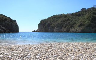
Voulisma beach
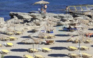
Voulisma is the second of the three bays in the beautiful village Istron, about 12km east of Agios Nikolaos and 22km north of Ierapetra. The Voulisma Beach or Golden Sands is located approximately 500m from the village (east). Its length is about 700m and is the largest municipal beach of Kalo Chorio.Voulisma is a very well-organized beach, with rare beauty for a beach located in the Northern part... read more
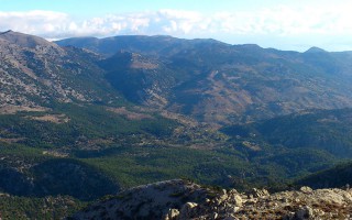
The Dikti Range
THIS RANGE LIES BETWEEN HERAKLION AND LASSITHI. Its highest summit is Spathi (2.148 m) and there are two more peaks at an altitude of more than 2000m. Lassithi Plateau, the largest in Crete, lies at the heart of the range at an altitude of 850 m. It is surrounded by a series of smaller plateaus such as Katharo, Limnakaro, Mari, Lapathos, Omalos, Erganos and Nisimos. There is a mountain shelter at Limnakaro... read more
Lassithi
Any place in Crete is sure to fascinate visitors. The island is reputed for its amazing mosaic of landscapes – each one, however, retaining its own character, its own identity and beauty. The eastern part of Lassithi is considered to be the low-key aspect of Crete, one of peace, quiet, things being done in a relaxed way, hospitality. It is the corner of Crete with the even-tempered mountains,... read more
Cave of Pelekita or Cave of the Fig Tree
It lies to the North-Northeast of Kato Zakros. We arrive at the cave either after a one-hour walk from Kato Zakros or from the beach of the same settlement by engine-vessel (20-25 minutes) and after that, we follow a tiresome ascending route (15 minutes walk). The elevation at the entrance attains 105 metres. Stones consist of limestones from the upper Cretaceous and of dolomites from the Triassic... read more