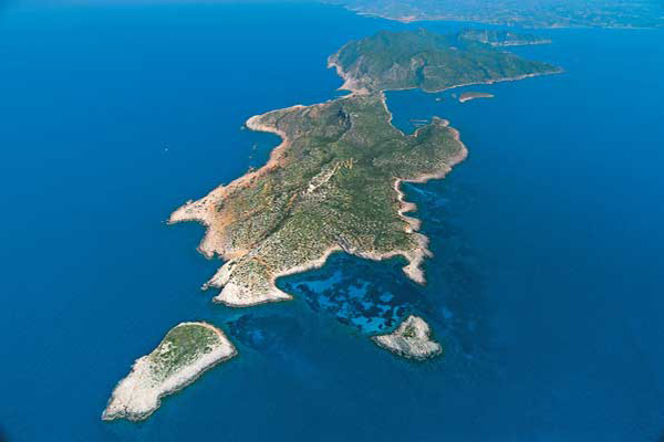
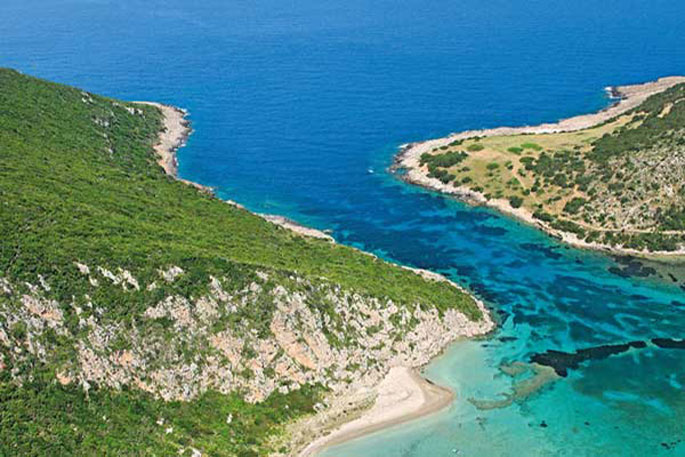
Sapientza is an islet of the Messinian Oinousses cluster and is the second biggest after Schiza. It’s an island with lush vegetation, a rare flora and a total area of 9 square kilometres. In 1986, Sapientza was declared as a “listed natural monument” and it was included in the European Network Natura 2000, together with the neighboring Schiza and the area around cape Akritas.Sapientza in Italian means “wisdom” and, indeed, nature here has revealed all its wisdom. In the center of the island there is a huge area covered with typical Mediterranean vegetation of perennial broadleaf weeds, which however don’t have the usual shape of a bush, but they are trees that surpass 10 meters in height! The fauna of the island is equally interesting and includes the famous Kri-Kri (wild goats) that live here in large herds, as well as wild sheep and many species of birds.
 The islet of Sapientza is located off the southwest shores of Messinia, across from Methoni, and is one of the 7 islands that form the cluster of the Messinian Oinousses. Historically, Sapientza was claimed by many, due to its strategic location -at the crossroads between Italy and the Middle East-, as well as due to its safe harbor. In 1209 it fell into the hands of the Venetians and many centuries later, after the liberation of Greece from the Turks, it was returned to the Greeks. It was claimed by the British, as part of the Ionian Islands between 1847 and 1850, during the notorious “Don Pacifico Affair” that was a conflict between Britain and Greece.
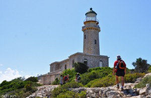
Porto Loggo is the harbor of Sapientza and is a well-protected cove. A trail starts from there, leading to the famous lighthouse of the island, which is an impressive British construction of 1890 with a spectacular view. The famous, unique in Europe, perennial broadleaf forest dominates the center of the island in an area of 240 square metres. This forest was basically the reason the islet was declared as a “listed natural monument” and included in the European Network Natura 2000. The rarity of this forest is that its broadleaf weeds surpass their standard height, creating dense vegetation, which exists there for about 15,000 years!
 In the centre of the island there is a plateau covered by orange-yellow rocks, which was formed by deposits of vast amounts of pollen over thousands of years. This plateau is named Spartolakka and is a substantial source of information for scientists regarding the dating of the forest and the surrounding area. The famous “Well of Oinousses” is located on the southwest side of the island and is actually the deepest point in the Mediterranean at 5,121 metres.
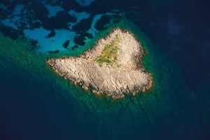 The island has a lovely, well-protected beach, named Ammos, which is located on its northern part and is easily accessible. Findings and traces of shipwrecks were also found on the northern tip of Sapientza and at a shallow depth. The most important one includes the columns from the Grand Peristyle from Caesarea of Palestine, dating back to the first century AD. This exact location, named Cape Karsis, attracts many keen divers due to the interest of the seabed.
Source: www.mythicalpeloponnese.gr
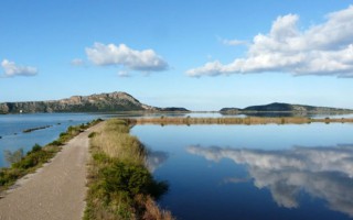
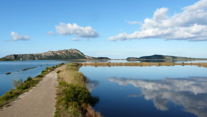
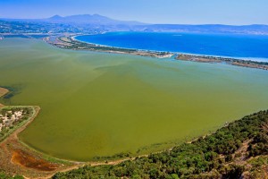 Gialova lagoon is located in Messinia and is one of the most important wetlands not only in Greece, but also in Europe. It probably dates to prehistoric times and owes its creation both to tectonic activity and to a rise in sea level, phenomena which created this ecological zone of unique importance.The Gialova lagoon is the first station in the Balkans that the migratory birds from Africa come across; according to the estimates, these birds are 2 billion in number.
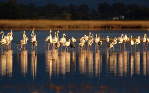 Of the 442 bird species recorded on Greek soil, more than 270 have been recorded in Gialova. Apart from birds, however, the area also hosts an impressive number of mammals, reptiles, amphibians and fish. So, it is no wonder that it should officially be included in the Natura 2000 Network as a Special Protection Area (SPA); it has also been recognized as a Wildlife Sanctuary and an Important Bird Area.
Source: www.mythicalpeloponnese.gr
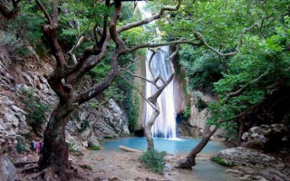
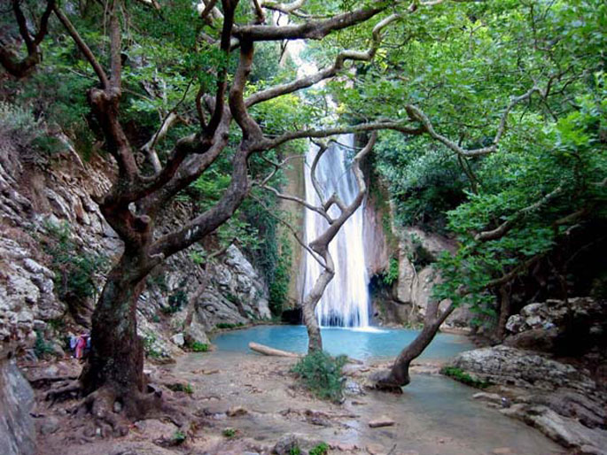
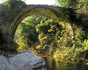 Neda is the only “female” river in Greece. It stems from the foot of Mount Lykaion and flows into the Ionian Sea, more specifically into the Kyparissiakos Gulf. Neda is approximately 32 kilometres long and passes through a stunning fairytale-like landscape.The Valley of Neda was of particular importance to the ancient Greeks and was often mentioned in various myths, while it is surrounded by archaeological remnants. A unique temple, dedicated to God Pan, is located here, while the majestic temple of Epicurean Apollo –a creation of Iktinos– is located in Vasses.
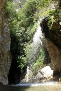 The gorge of the river is equally intriguing and dazzles visitors with its stunning wild natural landscape. The best time to cross it is from May to September, provided it doesn’t rain. Entrance to the gorge is possible at many points, depending on the length of the route one wishes to cover. Nevertheless, the entire route is approximately 20 kilometres long and it would take two days to cover it. Proper preparation is necessary, since beyond its undoubted beauty, the gorge does have several points that require extreme caution.
Source: www.mythicalpeloponnese.gr
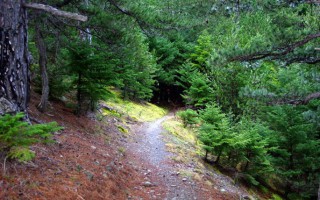
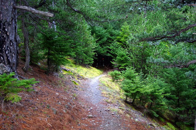
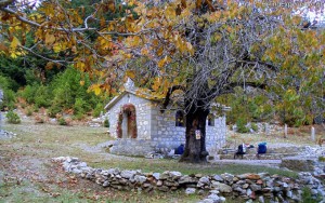 The forest of Vassiliki is located at the southern part of the Taygetus mountain range, 8 km south of its summit, and has an expanse of approximately 11,000 stremmata. It is a relatively secluded forest, surrounded by summits. You can reach it from Eksochori and there is a road in the forest you can follow for 21 km.
Here you will mostly come across fir trees and black pines. During the Italian Occupation a great fire destroyed large expanses of the forest, which managed, however, to resurrect itself. Today one may see there trees as old as 300 years.
Source: www.mythicalpeloponnese.gr
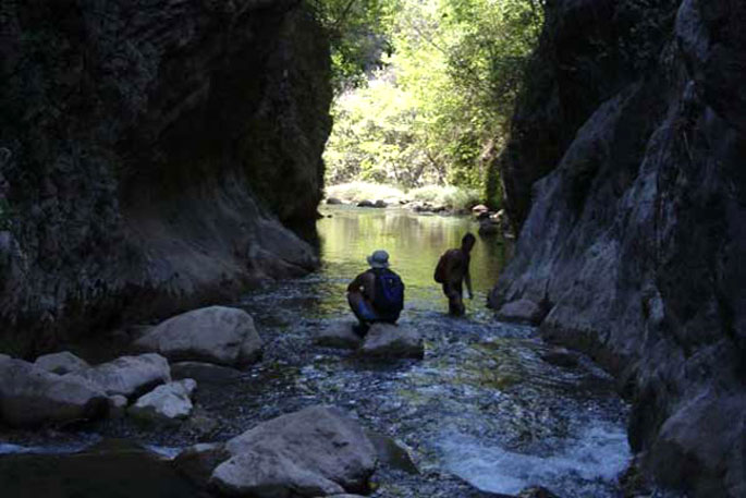
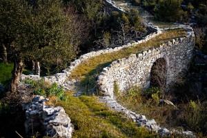 The Gorge of Vyros is one of the many gorges of the Peloponnese and is situated on the western slopes of Mount Taygetos, covering a distance of 19 kilometres and filled with firs, pines, cedars, cypresses and walnut trees. It begins from the village of Agios Panteleimon and ends up in the villages of Exohori and Tseria.
Beyond its obvious natural beauty, this gorge stands out also because of its historical importance. Reportedly, the Royal Route went through this gorge, connecting ancient Sparta with the port of Kardamyli. This route was widely used when the Spartans, during the Messinian Wars, lost the sovereignty of all their ports, except for that of Kardamyli.Crossing the gorge can be a pleasant experience, since apart from the natural beauty there are also remnants from various periods, when people sought refuge here. Depending on the distance one wishes to cover, there are various starting points, each with its own degree of difficulty and peculiarities.
Source: www.mythicalpeloponnese.gr
The wider area of Messinia is filled with impressive natural formations, creating a stunning landscape. Mountains, rivers and gorges compose a unique backdrop that dazzles the eye. One of the many gorges of the area is that of Rintomos, which starts from the peaks of Mount Taygetos and ends up at the shore of Santova on the Messinian Gulf.
The Gorge of Rintomos is truly majestic and is characterized by lush flora, steep ravines, diversified rocks and virtually vertical slopes. Crossing the gorge is very popular among nature lovers, who have two options for a starting point. One is from the village of Anavryti and the other from the lodge of the Greek Mountaineering Club of Sparta in the location Varvara. A hike in the gorge can reveal many wonderful surprises, such as the picturesque settlement of Rintomos, the fields once cultivated by the residents, bridges, caves, as well as remnants from hermitages. The best time to cross it is at the end of spring or the beginning of summer, when weather conditions favour this relatively demanding route.
Source: www.mythicalpeloponnese.gr
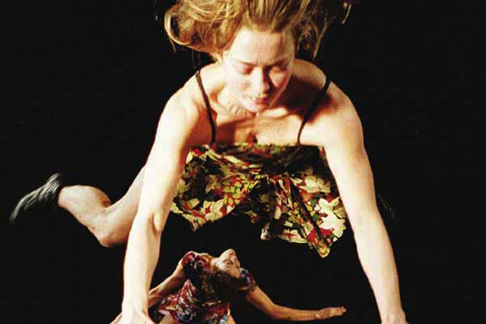
In 2012 took place the 18th Kalamata International Dance Festival, which is organized every summer by the International Dance Centre. The Festival is a permanent, recognised cultural institution, both in Greece and abroad, and it is one of the Prefecture of Messinia’s most important events.
The Festival has contributed to making Kalamata a point of a attraction for thousands of visitors each year, who have associated the name “Kalamata” with modern dance. Another important fact is that it helps promote Greek choreographers, by making their name known also outside of Greece.
Source: www.mythicalpeloponnese.gr
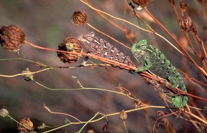 The wetland between the settlement of Gialova and the bay of Voidokilia, which has been declared as an archaeological site, spreads over 6,000 acres of land and is known as Divari (from the Latin vivarium, which means “fish hatchery”); it’s depth does not exceed 4 m. This lagoon is the southernmost stop of the migratory birds of the Balkans travelling to and from Africa. The wetland offers refuge to 254 bird species, such as herons, cormorants, kestrels, Aegean seagulls, flamingos, ospreys, imperial eagles and other aquatic birds. The area also hosts the very rare, almost-extinct in Europe species of the African chameleon.
Apart from the ferrets, foxes and weasels that hunt its eggs, this serpent is mainly endangered from the overwhelming human presence, especially during the summer months, with the large tourist crowds. The Ornithological Society’s observation station gives the visitors the opportunity to learn and to observe this shallow, brackish-water lake, which has been included in the Natura 2000 network, and to roam around the paths that describe Gialova’s different ecosystems.
The wetland between the settlement of Gialova and the bay of Voidokilia, which has been declared as an archaeological site, spreads over 6,000 acres of land and is known as Divari (from the Latin vivarium, which means “fish hatchery”); it’s depth does not exceed 4 m. The wetland can be divided into brackish-water lagoons and fresh-water marshes. Behind them there is an in-between zone of arable land and maquis. The main human occupations are fishing, cattle breeding, agriculture, tourism and hunting. This lagoon is the southernmost stop of the migratory birds of the Balkans travelling to and from Africa. In the autumn the birds stop here, at the southernmost European wetland, before they fly over the Mediterranean and the Sahara, a journey of 3,000 km. In the spring they follow the reverse route, abandoning their winter homes in Central Africa and migrating to Europe in order to breed.
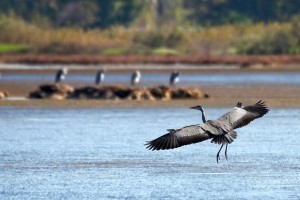
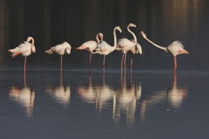 The larger birds, such as the herons, kestrels and Eurasian curlews, arrive at the lagoon in waves during the day and stay only for a few hours, in order to rest. Before dusk, they all fly away together. The smaller birds, such as the charadriiformes, usually arrive at night, stay in the wetland for many hours in order to feed, and most often fly away in the early evening.
The birds, migratory and non, include: herons (Ardea purpurea and Ardeola ralloides), Little Egrets (Egretta garzetta), bitterns (Ixobrychis minutus), storks (C. ciconis), ducks (T. tadorna), flamingos (Phoenicopterus ruber), Marsh sandpipers (Tringa stagnatilis), wood sandpipers (Tringa glareola), Pratincoles (Glareola pratincola), gulls (Larus melanocephalus), terns (Gelochelidon nilotica, Sterna albifrons), Gull-Billed Terns (Sterna nilotica), cormorants (Phalacrocorax carbo), egrets (Egretta garzetta), Great Egrets (Casmerodius albus), Glossy ibis (Plegadis falcinellus). Of the 254 species that have been recorded in recent years, 79 have been recognized as endangered in Europe and 4 as endangered worldwide.
The main threats are fishing, the increased saltiness in the fresh-water marshes –as a result of drawing water for agricultural use, both from the surface and from underground– and also hunting and the filling of the wetland with debris. The low agricultural intensification, coupled with intensive fishing, the drawing of underground water and the ever-increasing development in tourist facilities are the biggest threats to the wetland. The area has been nominated as a Special Conservation Area.
 The wetland offers refuge to 254 bird species, such as herons, kestrels, Aegean seagulls, flamingos, ospreys, imperial eagles and other aquatic birds. The area also hosts the very rare, almost-extinct in Europe species of the African chameleon. Apart from the ferrets, foxes and weasels that hunt its eggs, this serpent is mainly endangered from the overwhelming human presence, especially during the summer months, with the large tourist crowds. The passage of vehicles destroys both the vegetation (bushy-ammophilous), which is the species’ main abode, and the nests, which are formed in the sand along the coast. In recent years, a decrease in the animal’s size, a delay in its breeding and egg-laying and a relocation of its nests towards more remote areas has been observed.
Gialova (it means “flat coast”) is surrounded by olive and citrus trees, as well as gardens and vines that flourish in damp soil. It is a touristically developed area which satisfies the requirements for modern vacations, with its sandy beach pulsating with life, especially during the summer months, something that at the same time becomes the most immediate danger for the survival of the wetland. Not very far, the waves of the Ionian sea created a unique part of the ecosystem, the impressive for its shape, colours, sandy beach and emerald green waters bay of Voidokoilia, one-of-its-kind in the whole of the Mediterranean. The cedars and the sand dunes protect the ground and the sand is preserved, despite the strong winds blowing in the bay. From above it resembles a sea mushroom, with a dark blue jellyfish peeking through its waters.
The Ornithological Society’s observation station gives the visitors the opportunity to learn and to observe this shallow, brackish-water lake, which has been included in the Natura 2000 network, and to roam around the paths that describe Gialova’s different ecosystems.
Source: www.mythicalpeloponnese.gr
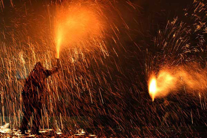
Every year, on the evening of Easter Sunday at 8.30pm on the western beach of Kalamata, at the old slaughterhouses, the locals revive the tradition of Saitopolemos. This peculiar local custom dates back centuries, during the Turkish occupation, when the Greeks displayed great heroism, as well as resourcefulness, during the battles against the Turks. According to the legend, the Messinians managed to stop the Turkish cavalry by constructing shuttles filled with explosives. The Turks outnumbered them, but the Greeks managed to defeat them with their trick.
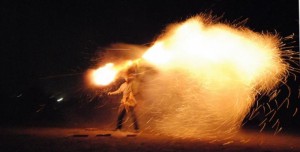 For the Shuttle War, the participants are divided into the so called “mpouloukia” (groups of people), after being properly prepared, by wearing their traditional costumes and armed with the shuttles they themselves constructed by cardboard tubes filled with gunpowder. This tradition is particularly popular among the locals and the visitors during the Holy Week, since it is indeed unique and triggers memories from the glorious struggles of the Greeks.
Source: www.mythicalpeloponnese.gr
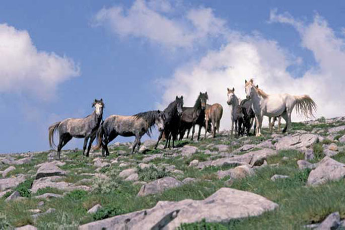
The 13th Peloponnesian Equestrian Games – Show Jumping were successfully conducted in Kalamata in 2012. This is a major equestrian event organized for the 4th consecutive time by the Kalamata Equestrian Club. The games took place in the club’s facilities, which boast the necessary infrastructure to host such an important event.
Athletes from different levels and various equestrian clubs in the Peloponnese participated in the following categories: Junior, for riders between 5 and 6 years old; 0.60 cm obstacle height; 0.80 cm obstacle height; 1 m obstacle height; 1.05 m obstacle height and 1.10 m obstacle height. The equestrian games are well established as a tradition for the city of Kalamata, offering an exciting spectacle and simultaneously promoting the equestrian sport. Admission is free for all spectators.
Source: www.mythicalpeloponnese.gr

