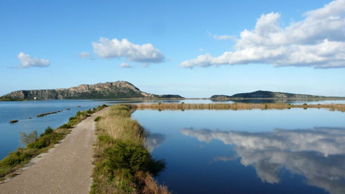
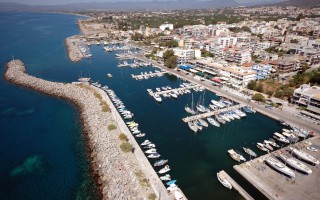
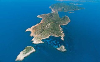
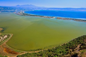
 Gialova lagoon is located in Messinia and is one of the most important wetlands not only in Greece, but also in Europe. It probably dates to prehistoric times and owes its creation both to tectonic activity and to a rise in sea level, phenomena which created this ecological zone of unique importance.The Gialova lagoon is the first station in the Balkans that the migratory birds from Africa come across; according to the estimates, these birds are 2 billion in number.
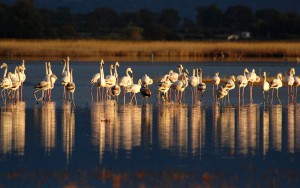 Of the 442 bird species recorded on Greek soil, more than 270 have been recorded in Gialova. Apart from birds, however, the area also hosts an impressive number of mammals, reptiles, amphibians and fish. So, it is no wonder that it should officially be included in the Natura 2000 Network as a Special Protection Area (SPA); it has also been recognized as a Wildlife Sanctuary and an Important Bird Area.
Source: www.mythicalpeloponnese.gr
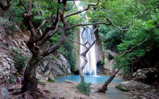
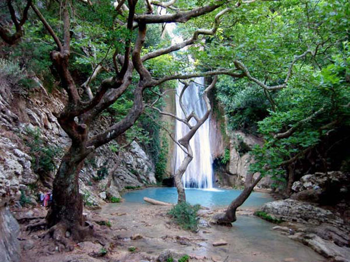
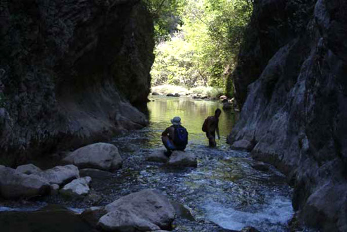
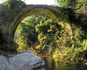 Neda is the only “female” river in Greece. It stems from the foot of Mount Lykaion and flows into the Ionian Sea, more specifically into the Kyparissiakos Gulf. Neda is approximately 32 kilometres long and passes through a stunning fairytale-like landscape.The Valley of Neda was of particular importance to the ancient Greeks and was often mentioned in various myths, while it is surrounded by archaeological remnants. A unique temple, dedicated to God Pan, is located here, while the majestic temple of Epicurean Apollo –a creation of Iktinos– is located in Vasses.
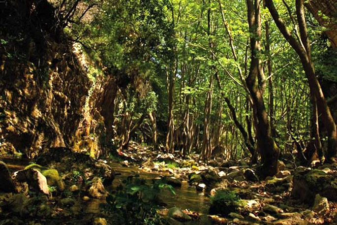
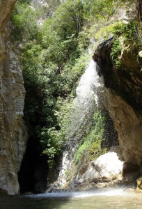 The gorge of the river is equally intriguing and dazzles visitors with its stunning wild natural landscape. The best time to cross it is from May to September, provided it doesn’t rain. Entrance to the gorge is possible at many points, depending on the length of the route one wishes to cover. Nevertheless, the entire route is approximately 20 kilometres long and it would take two days to cover it. Proper preparation is necessary, since beyond its undoubted beauty, the gorge does have several points that require extreme caution.
Source: www.mythicalpeloponnese.gr
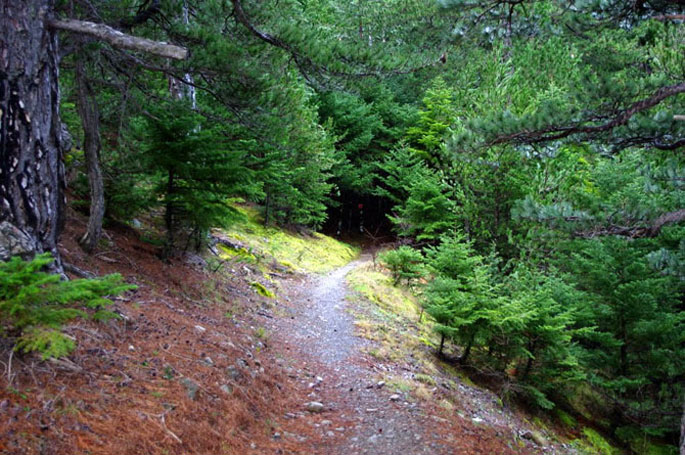
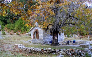 The forest of Vassiliki is located at the southern part of the Taygetus mountain range, 8 km south of its summit, and has an expanse of approximately 11,000 stremmata. It is a relatively secluded forest, surrounded by summits. You can reach it from Eksochori and there is a road in the forest you can follow for 21 km.
Here you will mostly come across fir trees and black pines. During the Italian Occupation a great fire destroyed large expanses of the forest, which managed, however, to resurrect itself. Today one may see there trees as old as 300 years.
Source: www.mythicalpeloponnese.gr
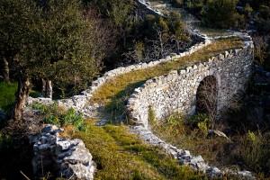 The Gorge of Vyros is one of the many gorges of the Peloponnese and is situated on the western slopes of Mount Taygetos, covering a distance of 19 kilometres and filled with firs, pines, cedars, cypresses and walnut trees. It begins from the village of Agios Panteleimon and ends up in the villages of Exohori and Tseria.
Beyond its obvious natural beauty, this gorge stands out also because of its historical importance. Reportedly, the Royal Route went through this gorge, connecting ancient Sparta with the port of Kardamyli. This route was widely used when the Spartans, during the Messinian Wars, lost the sovereignty of all their ports, except for that of Kardamyli.Crossing the gorge can be a pleasant experience, since apart from the natural beauty there are also remnants from various periods, when people sought refuge here. Depending on the distance one wishes to cover, there are various starting points, each with its own degree of difficulty and peculiarities.
Source: www.mythicalpeloponnese.gr
The wider area of Messinia is filled with impressive natural formations, creating a stunning landscape. Mountains, rivers and gorges compose a unique backdrop that dazzles the eye. One of the many gorges of the area is that of Rintomos, which starts from the peaks of Mount Taygetos and ends up at the shore of Santova on the Messinian Gulf.
The Gorge of Rintomos is truly majestic and is characterized by lush flora, steep ravines, diversified rocks and virtually vertical slopes. Crossing the gorge is very popular among nature lovers, who have two options for a starting point. One is from the village of Anavryti and the other from the lodge of the Greek Mountaineering Club of Sparta in the location Varvara. A hike in the gorge can reveal many wonderful surprises, such as the picturesque settlement of Rintomos, the fields once cultivated by the residents, bridges, caves, as well as remnants from hermitages. The best time to cross it is at the end of spring or the beginning of summer, when weather conditions favour this relatively demanding route.
Source: www.mythicalpeloponnese.gr
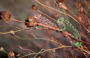 The wetland between the settlement of Gialova and the bay of Voidokilia, which has been declared as an archaeological site, spreads over 6,000 acres of land and is known as Divari (from the Latin vivarium, which means “fish hatchery”); it’s depth does not exceed 4 m. This lagoon is the southernmost stop of the migratory birds of the Balkans travelling to and from Africa. The wetland offers refuge to 254 bird species, such as herons, cormorants, kestrels, Aegean seagulls, flamingos, ospreys, imperial eagles and other aquatic birds. The area also hosts the very rare, almost-extinct in Europe species of the African chameleon.
Apart from the ferrets, foxes and weasels that hunt its eggs, this serpent is mainly endangered from the overwhelming human presence, especially during the summer months, with the large tourist crowds. The Ornithological Society’s observation station gives the visitors the opportunity to learn and to observe this shallow, brackish-water lake, which has been included in the Natura 2000 network, and to roam around the paths that describe Gialova’s different ecosystems.
The wetland between the settlement of Gialova and the bay of Voidokilia, which has been declared as an archaeological site, spreads over 6,000 acres of land and is known as Divari (from the Latin vivarium, which means “fish hatchery”); it’s depth does not exceed 4 m. The wetland can be divided into brackish-water lagoons and fresh-water marshes. Behind them there is an in-between zone of arable land and maquis. The main human occupations are fishing, cattle breeding, agriculture, tourism and hunting. This lagoon is the southernmost stop of the migratory birds of the Balkans travelling to and from Africa. In the autumn the birds stop here, at the southernmost European wetland, before they fly over the Mediterranean and the Sahara, a journey of 3,000 km. In the spring they follow the reverse route, abandoning their winter homes in Central Africa and migrating to Europe in order to breed.
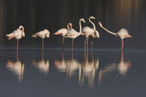 The larger birds, such as the herons, kestrels and Eurasian curlews, arrive at the lagoon in waves during the day and stay only for a few hours, in order to rest. Before dusk, they all fly away together. The smaller birds, such as the charadriiformes, usually arrive at night, stay in the wetland for many hours in order to feed, and most often fly away in the early evening.
The birds, migratory and non, include: herons (Ardea purpurea and Ardeola ralloides), Little Egrets (Egretta garzetta), bitterns (Ixobrychis minutus), storks (C. ciconis), ducks (T. tadorna), flamingos (Phoenicopterus ruber), Marsh sandpipers (Tringa stagnatilis), wood sandpipers (Tringa glareola), Pratincoles (Glareola pratincola), gulls (Larus melanocephalus), terns (Gelochelidon nilotica, Sterna albifrons), Gull-Billed Terns (Sterna nilotica), cormorants (Phalacrocorax carbo), egrets (Egretta garzetta), Great Egrets (Casmerodius albus), Glossy ibis (Plegadis falcinellus). Of the 254 species that have been recorded in recent years, 79 have been recognized as endangered in Europe and 4 as endangered worldwide.
The main threats are fishing, the increased saltiness in the fresh-water marshes –as a result of drawing water for agricultural use, both from the surface and from underground– and also hunting and the filling of the wetland with debris. The low agricultural intensification, coupled with intensive fishing, the drawing of underground water and the ever-increasing development in tourist facilities are the biggest threats to the wetland. The area has been nominated as a Special Conservation Area.
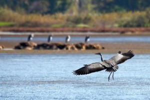 The wetland offers refuge to 254 bird species, such as herons, kestrels, Aegean seagulls, flamingos, ospreys, imperial eagles and other aquatic birds. The area also hosts the very rare, almost-extinct in Europe species of the African chameleon. Apart from the ferrets, foxes and weasels that hunt its eggs, this serpent is mainly endangered from the overwhelming human presence, especially during the summer months, with the large tourist crowds. The passage of vehicles destroys both the vegetation (bushy-ammophilous), which is the species’ main abode, and the nests, which are formed in the sand along the coast. In recent years, a decrease in the animal’s size, a delay in its breeding and egg-laying and a relocation of its nests towards more remote areas has been observed.
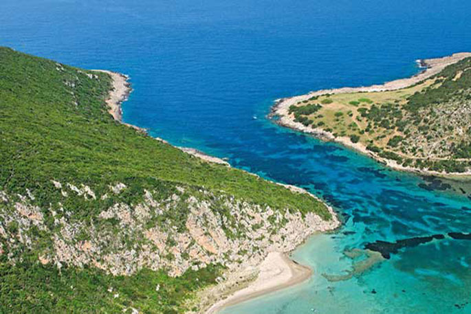
Gialova (it means “flat coast”) is surrounded by olive and citrus trees, as well as gardens and vines that flourish in damp soil. It is a touristically developed area which satisfies the requirements for modern vacations, with its sandy beach pulsating with life, especially during the summer months, something that at the same time becomes the most immediate danger for the survival of the wetland. Not very far, the waves of the Ionian sea created a unique part of the ecosystem, the impressive for its shape, colours, sandy beach and emerald green waters bay of Voidokoilia, one-of-its-kind in the whole of the Mediterranean. The cedars and the sand dunes protect the ground and the sand is preserved, despite the strong winds blowing in the bay. From above it resembles a sea mushroom, with a dark blue jellyfish peeking through its waters.
The Ornithological Society’s observation station gives the visitors the opportunity to learn and to observe this shallow, brackish-water lake, which has been included in the Natura 2000 network, and to roam around the paths that describe Gialova’s different ecosystems.
Source: www.mythicalpeloponnese.gr
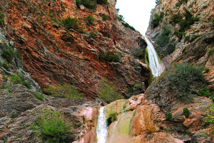
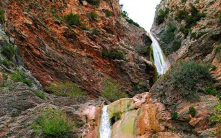
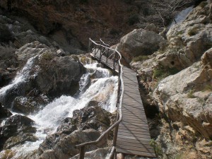 The gorge of Lepida is one of the numerous, impressive natural formations of Mount Parnon, which stands between the prefectures of Arcadia and Laconia. Its length is 500 metres and it is relatively flat. Two hours are required to cross it, during which visitors will have the opportunity to enjoy the unique natural beauty of the landscape, which is filled with rich flora and fauna and boasts two gorgeous waterfalls (ideal for rappel), of 45 and 70 metres respectively, which complement the impressive scenery.
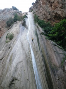 Access to the gorge is possible via the villages of Kato Doliana and Kastritohoria. Crossing is safer during the summer when the level of the waters is low, and this can also be combined with visits to notable attractions, such as Tiryntha, Akronafplia and Mycenae. There are also several lovely beaches close by.
Source: www.mythicalpeloponnese.gr
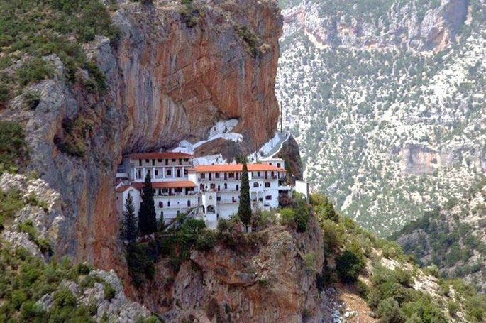
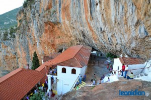 The Monastery of Eloni is a pretty old convent in the prefecture of Arcadia, built in the steep slope of Mount Parnon, at an altitude of 650 metres and about 17 kilometres from the town of Leonidio. Due to its exceptional natural beauty, the area around the monastery has been declared as a protected zone and it’s included in the European Network Natura 2000 under the code GR2520005. It has a long gorge on the east side of the mountain -the gorge of Dafnon-, which starts from the village of Kosmas, passes through the Monastery of Eloni and ends up near Leonidio. The Monastery of Eloni is built onto a steep rock and it looks that it’s literally hanging on the cliffs above the gorge. The view is just spectacular. The gorge is known for its rich flora, which includes some rare species, like the Potentilla arcadiensis, as well four endemic species that can only be found here, hence the need for their protection.
Source: www.mythicalpeloponnese.gr
Ladon is a Peloponnesian river and a tributary of Alfeios. It got its name from the homonymous river in Viotia, when the locals settled in the area around 1307 BC. Ladon is surrounded by a beautiful natural landscape, something confirmed by Pausanias.
It is a calm river, which makes it ideal for many activities, like canoe-kayak, rafting and swimming, even for small children. The lovely scenery is also ideal for hiking and trekking.
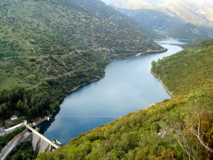
One of the most significant attractions of the area is the river’s hydroelectric dam, which was constructed in 1954 in the location Pidima, at an altitude of 420 metres. This dam created an artificial lake, whose wider area has been declared an ecological park due to its unique natural environment and the rare flora and fauna. In the area around the lake you will also have the opportunity to see the so-called “Kyras to Gefyri” (the Bridge of the Lady), which was built during the Middle Ages and is only visible during the summer months, when the waters of the dam withdraw.
River Ladon originates in the Aroania Mountains, crosses the prefecture of Achaia and flows into Alfeios, in the prefecture of Arcadia. Alfeios then flows into the Kyparissian Gulf. The largest section of the river flows between the mountains of Mainalo and Afrodisio and, as with most of the Greek rivers, it makes its appearance in the Greek Mythology.
 According to the Myths, Artemis was hunting on the banks of Ladon, Dimitra was swimming in its waters and Pan was wandering around, living his endless adventures. On one occasion, Pan saw and fell in love with the nymph Syrigga (Syringe) and started chasing her. Ladon, wanting to protect her, turned her into a reed. Pan cut those reeds down and created his musical instrument, the Syrinx. Ladon was also associated with the murder of Lefkippos, the son of Pisa and Oinomaos. Lefkippos fell in love with the nymph Daphne, daughter of Gaia and Ladon, or, according to another version, of Pineios from Thessaly. Daphne, however, was courted by the God Apollo. With a powerful desire to be near her, Lefkippos disguised as a woman and joined her friends. Apollo got so jealous of his presence that he inspired the nymphs to bathe, something that would force the young man to get naked as well. So, his true gender was revealed, something that enraged the nymphs, who ultimately killed him.
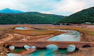 Back in nowadays, Ladon is a very quiet river, surrounded by an incredibly beautiful nature, and offers the opportunity for many activities, like rafting, canoe-kayak, swimming, fishing, hiking and mountain biking around its banks. One of the most important attractions of Ladon is its dam, which is a 104 metres long, 55 metres high, built in the location Pidima at an altitude of 420 metres. The construction of the dam started in 1950, as part of the creation of a hydroelectric power station for PPC. The project was completed 5 years later and became one of the first major power stations in Greece, while the dam was collecting about 50,000,000 cubic metres of water. An Italian company undertook its completion and the cost was covered by the reparations from World War II. The dam led to the creation of an artificial lake in a ravine of Mount Afrodisio, with a total area of 6,000 square metres, set amongst spectacular scenery. This lake was turned into an eco-park and is ideal for many activities, like boating, swimming and fishing, as well as hiking around its shores. An interesting attraction is the “Kyras to Gefyri” (the Lady’s Bridge), which was constructed in the 13th century AD and is only visible during the summer months, when the level of the waters goes down.
Πηγή: www.mythicalpeloponnese.gr
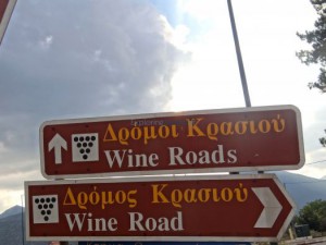
The Peloponnese undeniably holds one of the leading positions in terms of wine production in Greece. It’s no coincidence nor a surprise that many of the most domestically and internationally popular wine varieties have their origins in the Peloponnese (the island of Pelops or ampeloessa, according to Homer), since this geographical district has a production of approximately 1,208 labels and a total vine area that covers 29.1% of the Greek wine map. The Wine Producers Association of the Peloponnese, which is based in Tripolis, had the idea of creating the Wine Routes, in order to promote wine tourism, a sector of substantial importance for Greece.
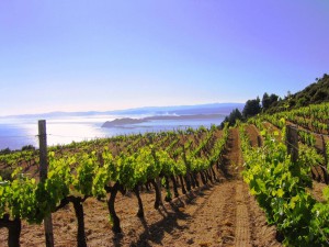 Arcadia has been famous for the quality of its wine since ancient times. According to Theophrastos, “men lost their minds when they drank it and women got pregnant”. So intoxicating was this wine, that it was also popular among the Gods. Pan, for example, the God of vegetation and fertility, who was known for his womanizing behaviour, as well as Dionysos, the God of wine, who was worshiped through rituals and celebrations of ecstatic inebriation, had Arcadian wine at the top of their preferences.
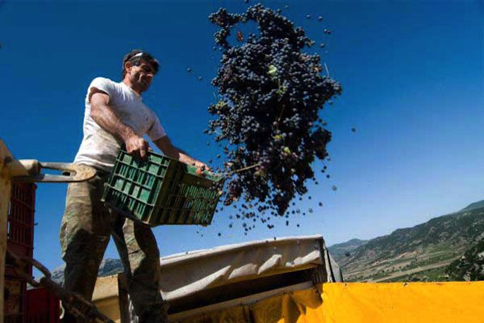
Even nowadays, Arcadia continues to be an important wine-making centre. One of the most famous vineyards in the country extends across the Mantineian Plateau, where, over a total area of 7,000 square metres, the particularly popular variety, Moschofilero – one of the most aromatic Greek wines – is cultivated. This area has been established since 1971 as a zone of the Mantineia PDO, a region that produces wine with a designation of origin of superior quality. During our tour of the Arcadia Wine Routes we will pass through various places where we will have the chance not only to taste the delectable varieties, but also to admire the unique architecture of the buildings where the wine is produced.
 The first stop is the villages of the municipality of Korythio, which boasts around 5,000 square metres of vineyards. From the old Tripolis – Argos national highway, we head to Steno, which is a village with interesting historical sites. The Church of the Assumption of the Blessed Virgin Mary, which was built in 1847, stands at its centre, while on a nearby hill we see the windmill of Bakopoulos, which dates back to 1850. At the beginning of the 1980s, the team of the Ephor of Antiquities, Dr. T. Spyropoulos, brought to light six thermo-metallurgical kilns from the prehistoric and the late roman years (2500 BC – 500 AD). After the village of Steno we arrive at Agiorgitika, where they also discovered a kiln from prehistoric times, which was the biggest ever revealed. After Agiorgitika, we arrive at the historic Mouchli, where one of the most important castle states of the time held power. The castle of Mouchli was established in 1296 by General Andronikos Asan. It was surrounded by a triple wall, and inside they built the church of the Blessed Virgin Mary Mouchliotissa or the Blessed Virgin Mary of Mouchli, remnants of which still exist. In 1460, the castle was destroyed by the Turks and its residents moved to Constantinople. However, for about a century and a half, it was one of the biggest and most important castles in the Peloponnese. Our tour continues to Partheni. Just before the entrance to the village, we will see three windmills –those of Pantelis, Rasiarmos and Gyftogiannis- while in the village we cannot miss the imposing church of Agios Georgios. Further on, we will see a beautiful lush grove, where the chapel of Agia Kyriaki has been located since 1891. In Partheni we will also have the chance to visit the Folk Art Museum, which is housed in the old elementary school and has exhibits from the wider area. Our next stop is Neochori, which has a lovely main square and a fertile valley where they mainly cultivate potatoes. To the north of the village we will stumble upon the Church of the Assumption of the Blessed Virgin Mary, which -according to an inscription- was established in 1696. At a close distance from Neochori we will see the Monastery of Agios Nikolaos of Varsoi, at an altitude of 1,100 metres, which was built around the 11th century and had a brilliant history up until 1460 when its decadence started. Today, important heirlooms are kept in this monastery, as well as the sacred relics of the martyr Dimitrios, and part of the relics of martyr Pavlos
We then make a visit to the biggest vineyard in Mantineia, known for the production of exceptional and delectable wines, which lies ahead after the village of Zevgolatio. The first stop here is Milia, with its important archaeological remnants. We will see the ruins of a temple dedicated to Ippios Posidon, which was built by Trofonios and Agamidis – famous architects from Viotia. Dr. Spyropoulos revealed an impressive building in a nearby spot, which he identified as the tomb of Epaminondas, the great General and politician from Thiva. A little further on, we see the hill of Gortsouli, around which there are numerous archaeological ruins from the early Helladic and the Hellenistic era. Then we visit Artemision, a beautiful village with impressive stone houses and a scenic bridge which dates back to 1890. Our next stop is Pikerni, with the church of Agios Nikolaos, around which Klimis Gkonopoulos built the homonymous monastery in 1822, as well as the remnants of an ancient castle. The village of Sagka has a spectacular view to the mountains of Mainalo and Lyrkeio. From here, you will see the lovely church of Agioi Theodoroi, with its amazing bell tower, which was built by Tinian craftsmen in 1892, as well as the double-arched bridge of Mpouselitza. The municipality of Mantineia is based in Nestani, where we will see remnants of the walls of the ancient acropolis, the Church of the Annunciation of the Blessed Virgin Mary, as well as many mansions and watermills. We will see, the Monastery of the Blessed Virgin Mary of Gorgoepikoou, which was built around 1080 AD by the Emperor Alexius Comnenus. This monastery houses the miraculous icon of the Virgin Mary, which is believed to be the work of Lucas the Evangelist. After the village of Kapsia, where one of the most notable caves in Greece is located, we make our last stop to the scenic village of Simiades with the Chapel of Agios Prokopios and the archaeological ruins, evidence of past inhabitation.
Merely few of the winery-estates you can visit are the following: Mantineia Winery in Zevgolatio, P. Kalogeropoulos & Co. Winery, also in Zevgolatio, Spyropoulos Estate in Mantineia, Kalogri Estate in Kapsia, Bosinakis Winery in Steno, Boutaris Winery outside of Tripolis, Troupis Winery in Fteri Milias, Boutaris Winery in Milia, Papageorgiou Winery in Artemisio, and many more.
Source: www.mythicalpeloponnese.gr

