

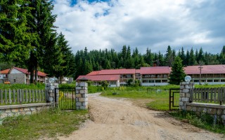
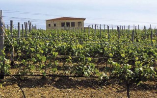
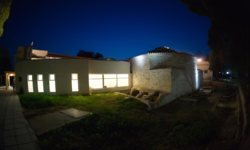
The philosophy of the creators of “Lasinthos” is no other than the revival of our tradition and culture, the manners and customs of our region, the preservation and the elevation of the rare flora and fauna of the Cretan nature, the promotion of the Cretan cuisine as well as the way of making and producing the various Cretan traditional products. “Lasinthos” is prevailed by the Cretan traditional architecture and the natural beauty of the traditional materials (stone, carved marble, tile and wood). In the Park’s 200 acres, we cultivate fruit-bearing trees, garden produce, vineyards, herbs and sweet-smelling plants that fit to the climatic conditions of the region.
Website: lasinthos
Source: www.incrediblecrete.gr
The new aspect of tourism, Sitia Geopark
When the Sitia region became a member of the UNESCO Geopark family, we had no idea just how much positive change this would bring! This new aspect of tourism “Sitia Geopark”, is proving to be a considerable point of interest, especially in the alternative tourism market. The natural environment is no longer an obstacle for tourism development, on the contrary it is a great attraction for visitors. We... read more
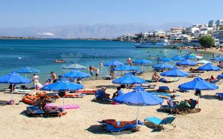
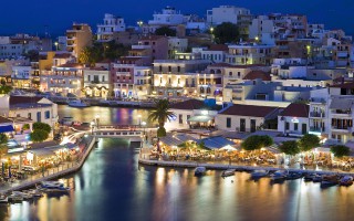
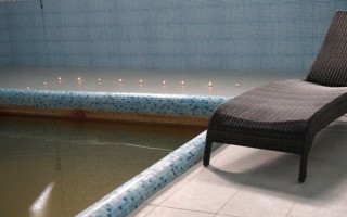
Elouda beach
The nice sandy beach northern to the small port of Elounda is situated at a distance of 11 kilometers far from Aghios Nicolaos at the North, and 70 -77 kilometers eastern to the International Airport of Heraklion, via the New or the Old National road respectively. Protected by the Spinalonga peninsula, the beach is not affected by the winds. Fully organised, the beach offers a wide range of accommodation,... read more
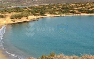
Voulisma beach
Voulisma is the second of the three bays in the beautiful village Istron, about 12km east of Agios Nikolaos and 22km north of Ierapetra. The Voulisma Beach or Golden Sands is located approximately 500m from the village (east). Its length is about 700m and is the largest municipal beach of Kalo Chorio.Voulisma is a very well-organized beach, with rare beauty for a beach located in the Northern part... read more
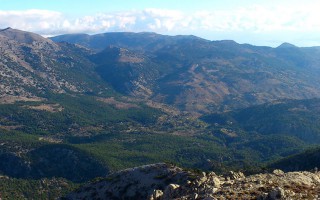
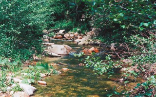
The Dikti Range
THIS RANGE LIES BETWEEN HERAKLION AND LASSITHI. Its highest summit is Spathi (2.148 m) and there are two more peaks at an altitude of more than 2000m. Lassithi Plateau, the largest in Crete, lies at the heart of the range at an altitude of 850 m. It is surrounded by a series of smaller plateaus such as Katharo, Limnakaro, Mari, Lapathos, Omalos, Erganos and Nisimos. There is a mountain shelter at Limnakaro... read more
Lassithi
Any place in Crete is sure to fascinate visitors. The island is reputed for its amazing mosaic of landscapes – each one, however, retaining its own character, its own identity and beauty. The eastern part of Lassithi is considered to be the low-key aspect of Crete, one of peace, quiet, things being done in a relaxed way, hospitality. It is the corner of Crete with the even-tempered mountains,... read more
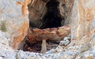
Cave of Pelekita or Cave of the Fig Tree
It lies to the North-Northeast of Kato Zakros. We arrive at the cave either after a one-hour walk from Kato Zakros or from the beach of the same settlement by engine-vessel (20-25 minutes) and after that, we follow a tiresome ascending route (15 minutes walk). The elevation at the entrance attains 105 metres. Stones consist of limestones from the upper Cretaceous and of dolomites from the Triassic... read more
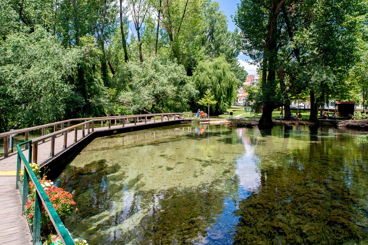
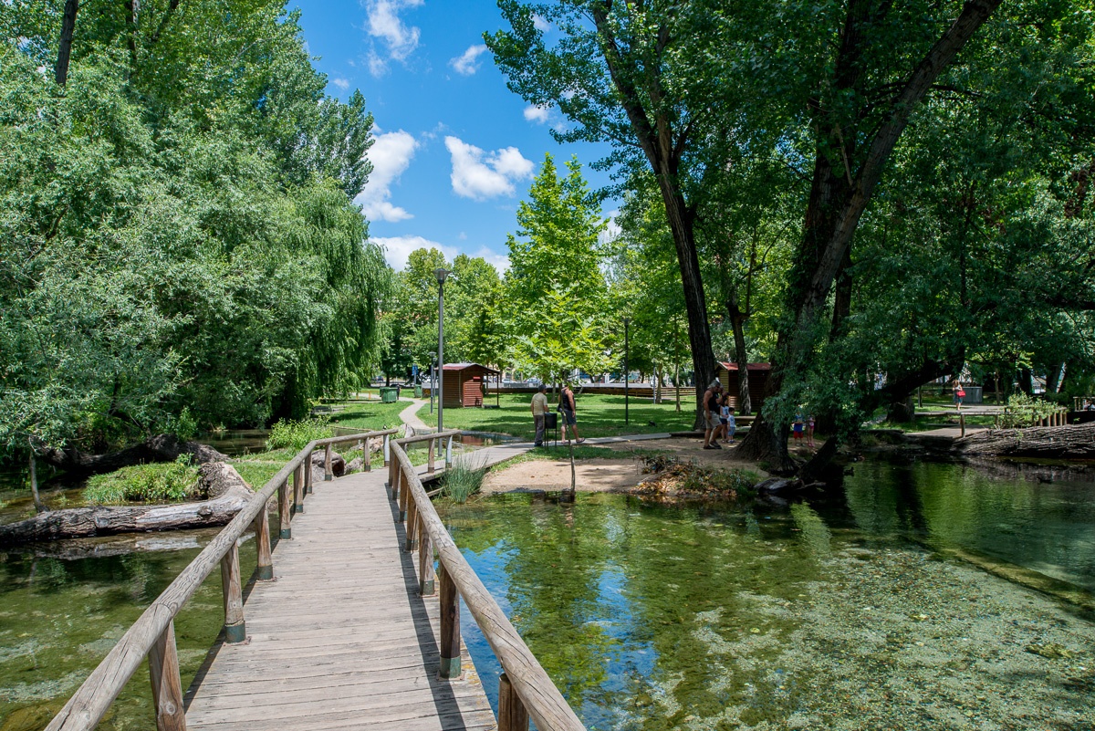
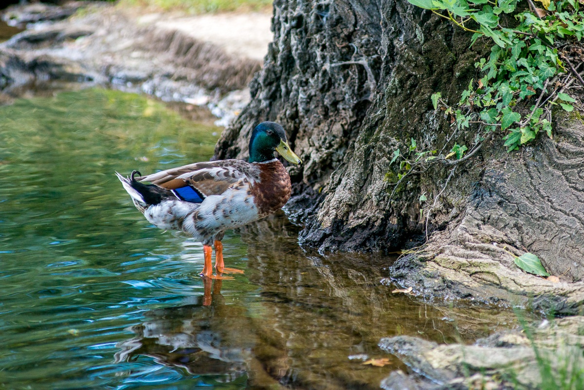
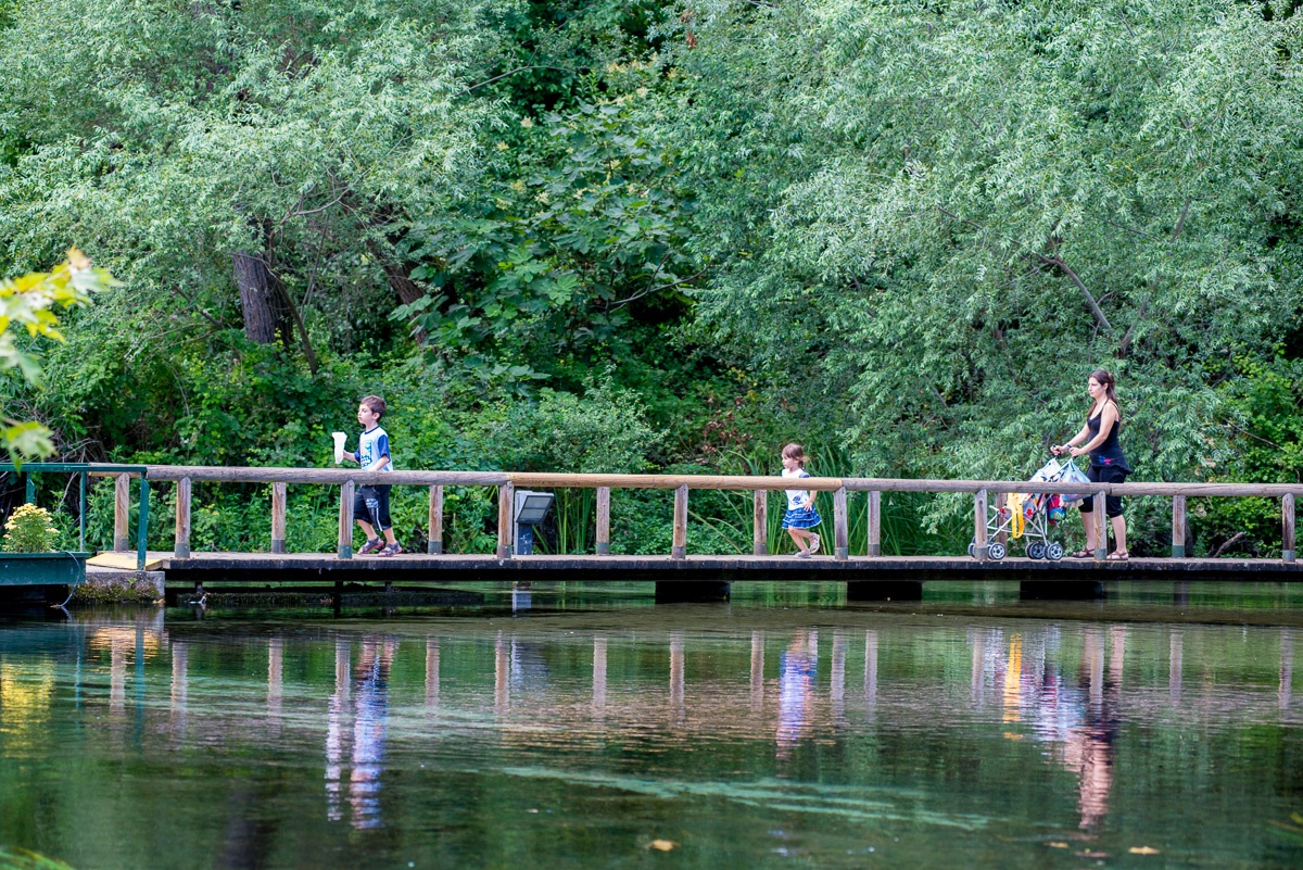
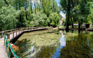
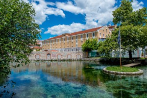 Symbol of Drama, sources of Santa Barbara are exposed in recent years among the 60 best parks in Europe.
It is a magical wetland, a beautiful recreation area about 60 acres in the heart of the city, where residents of Drama often enjoy stroll in the magnificent formed paths that crossing wooden bridges.
Πηγή: Eastern Macedonia & Thrace
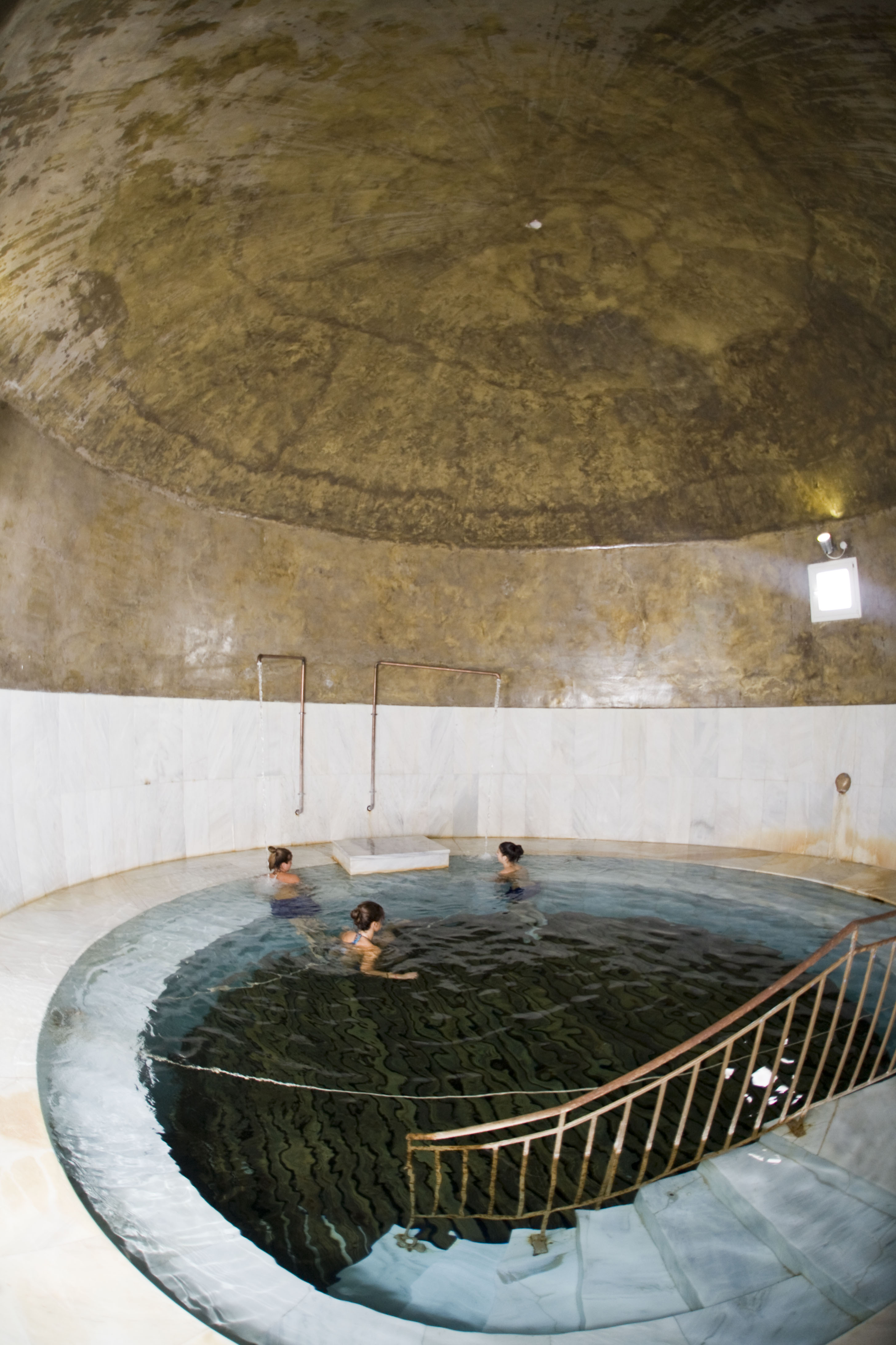
Curative Natural Resource Thermia
The curative spring of Thermia Paranestiou of Drama gushes in an alternating environment, clean and healthy, with lush vegetation and excellent climate conditions. The curative spring is at a distance of 25 km north of Paranesti and the old stone hydrotherapy centre testifies the human presence throughout the centuries. The area is ideal for nature lovers, as it offers routes and excursions to nature.... read more
Elatia forest or Kara Dere
Drama is gifted with rich woodland. In the sierra of Central Rodopi distinguished the forests of Elatia or Kara Dere, in Sidironero district - Skalotis. The place is located in the central and northern part of the county and extends along the Greek-Bulgarian border. Forests cover 37% of the total area of the county and Elatia Forest is the largest forest complex in the country. The rare fir with... read more
Sources of St. Barbara
Symbol of Drama, sources of Santa Barbara are exposed in recent years among the 60 best parks in Europe. It is a magical wetland, a beautiful recreation area about 60 acres in the heart of the city, where residents of Drama often enjoy stroll in the magnificent formed paths that crossing wooden bridges. Πηγή: Eastern Macedonia & Thrace [su_slider source="media: 9941,9942,9943" link="lightbox"... read more
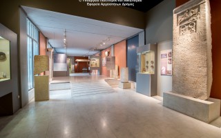
Archaeological Museum of Drama
The Drama Archaeological Museum was built by the Municipality of Drama and beguested to the Ministry of Culture. In this way the local community managed to speed up the procedure for the founding of an Archaeological Museum in the town. Even though the museum is small, marks the beginning of a major effort to systematize archaelogical research and promote the cultural identity of the area. The archaelogical... read more
The Wine Route of Dionysus
In ancient times, Mount Pangeon, famous for its gold and silver mines, was the centre of Dionysian worship. According to the legend, this is where god Dionysus was raised and got the horses of King Lycourgos drunk with local wine. The Route of Dionysus starts at mount Pangeon, from the ancient city of Amphipolis, continuing at Kariani, ta Hatzigeorgiou Estate and at Kokkinohori, at Ktima Vivlia... read more

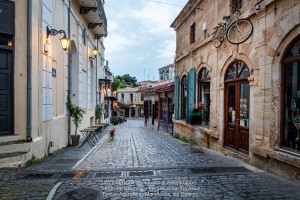 The Old Town of Xanthi is located in the north of Xanthi constituting its historic core and covers an area of 380.000m2. The city is built after 1829. The year that large earthquakes fully deplete the previous settlement. The city is built on the ruins and with core the churches, which were probably from the era of Byzantine Xanthia, as it was called from ancient time the city of Xanthi.
During the 19th century, Xanthi referred to as a town of 8,000 inhabitants, but was economically
flourishing and this is due to the richness of the cultivation, processing, manufacturing and distribution of tobacco and its products, but also for privileged position to major trading roads.
The city is built from Epirus and Macedonian craftsmen, characterized by labyrinthine form of cobbled streets and is full of Balkan houses, inns, shops, typical churches of the last Ottoman period but at the same time a western neoclassical mansions whose owners were mainly merchants tobacco .
Source: Eastern Macedonia & Thrace
Riverside forest Kotza Orman or Large Forest
The riparian forest Kotza Orman or Large Forest isa priceless landscape of ecological value and beauty. It was once one of the largest aquatic of Europe, since the "50s there had been recorded 74,000 acres. However,in 1946, 54,000 acres were out of it and given to farmers for cultivation, leaving a small part, which the Forest Service of Kavala is trying to preserve by fencing perimeter stretches... read more
Aesthetic Forest of Strait of Nestos River
It is located at the borders of Kavala and Xanthi prefectures, south of the town of Stavroupoli, with area of 2,380 hectares. It is one of the most beautiful landscapes of Greece with great ecological interest. The visitors can see the plurality of rare plants such as the agriopaschalia, champerlea, red peony and ramnis of Rhodope. At the same time, the region is rich in fauna, with nesting wolves,... read more
Forest of Chaidou
In the Rhodope Mountains, on the border with Bulgaria, there is the Drimos Forest, also known as Chaidou. The forest Chaidou is an earthly paradise with huge centennial beech of over 30 meters height. Apart from the beech forest there is also a large variety of vegetation that grows in the mountains of Rhodope, such as pines, firs, spruces and yellow lilies. It is also a habitat of bears, wolves... read more
Curative Natural Resource Genisaia (Potamia)
The thermal city of Potamia is situated at the 18th kilometre of the road Xanthi – Komotini. People of the intellect, the arts and literature, like Dimokritos, Protagoras, Leykippos were born and thrived in the historical area of Avdira. In a small distance, lies Vistonida lake, one of the most important wetlands of Greece and a little further is the picturesque port of Porto Lagos. The visitor can combine... read more
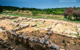
Archaeological site of Avdira
Archaeological site of Avdira, in the cape of Bouloustra includes the northern and southern precincts, the acropolis of the ancient city and its cemeteries, extending mainly to the NW, N and NE, dating from the Archaic, Classical and Hellenistic periods. Place in the northern precinct preserved sections of the wall and one room buildings prior Clazomenia city of Asia Minor, 7th century BC., parts... read more
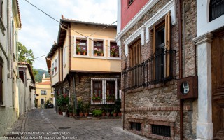
Old Town of Xanthi
The Old Town of Xanthi is located in the north of Xanthi constituting its historic core and covers an area of 380.000m2. The city is built after 1829. The year that large earthquakes fully deplete the previous settlement. The city is built on the ruins and with core the churches, which were probably from the era of Byzantine Xanthia, as it was called from ancient time the city of Xanthi. During... read more
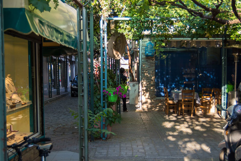
 The old market of Komotini presents a special interest. Bounded by the roads Orpheos, Syntagmatos Kritwn, Vas.Pavloy, Pl. Ifaistou, Kanari, Kilkis, Androutsou, Gravia, Xenophontos and Venizelou.
The market dates back to the Ottoman era, and is included in a Hippodameios planning system with small streets and beautiful pergolas built by the Municipality of Komotini in the 1990s. A special characteristic is the extremely small area of the shops.
Here you will find every kind of shop from antique stores local products, clothes, shoes to taverns and bars.
Source: Eastern Macedonia & Thrace
Medieval bridge in Polyanthos
The bridge is located at the exit of Kompsatos, which stems from mountainous Rodopi, is crossed Thracian valley and empties into Lake Vistonida. In the surrounding area have identified several sites with pre-Christian and Christian antiquities with main Byzantine castle of Polyanthos and an aisled basilica between the village of Polianthos and the bridge. [su_slider source="media: 10115,10116,10117,10118"... read more
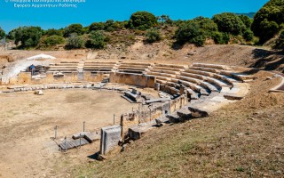
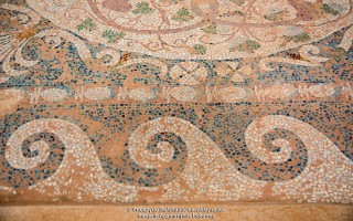
Ancient Theater Maronia
Excavations of the site started in the late 1960's and have brought to light: The theatre of the city, in which two architectural phases are distinguished, dated to the Hellenistic and Roman periods. A sanctuary, probably of Dionysos, dated to the 4th century B.C. , a large Hellenistic house with a mosaic floor, two extensive building complexes, most probably of public function, also dated to the Hellenistic... read more
Megalithic Gate of ancient Ismara
The settlement of Maronia spread over a vast area, from Ismaros Mountain to the Ptelea Lake. Several monuments are today labeled and countless others are scattered throughout the olive groves and the mountainous landscapes of Ismaro. Worth seeing sights are the fortification of Agios Georgios (the megalithic Gate), the complex of Roman times, the walls of the citadel Agios Athanasios (the walls... read more
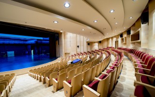
Music Hall at Komotini
The idea to build a large cultural and conference center in Komotini began in the mid of 1980 decade. Finally study commissioned by the famous architect Nikos Valsamaki but construction was delayed due to lack of funding. Eventually a portion of the building was constructed and completed in the year 2010.To Hall Komotini is located in Santa Varvara, near the camp Iliopoulos and is the third of Greece.... read more
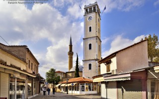
Clock Tower
The Clock Tower was built in 1884, the era of Sultan Abdul Hamid B. In the decade of 1950 became architectural interventions and took its current form. Behind the tower rises the minaret of the mosque of Yeni Mosque from the balcony where the muezzin calls the faithful of Islam to prayer. In the courtyard housed the religious authority of Muslims Rhodope, the Mufti of Komotini. At the southwestern... read more
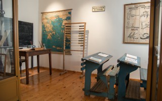
Thracian Museum of Education of the Association...
The Thracian Museum of Education of the Association of Educational Sciences was founded in 1992 to collect and exhibit school objects, documents and books of historical importance, mainly Thracian and of the wider area. Such museums are currently scarce in our country and it is worth noting what, perhaps, is the only rich collection with photographs and a series of wonderful saved school objects that... read more
- 1
- 2