

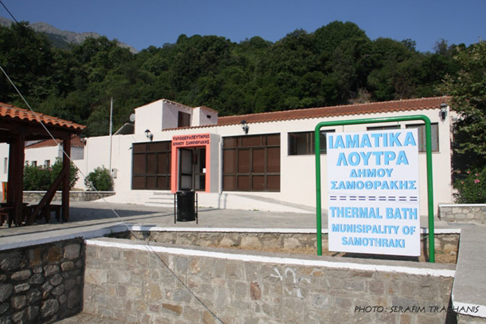
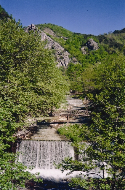
 Samothraki – the Aeolus’s island according to mythology- is a mystical place. The pebbly beaches, the running waters, the unspoilt nature, the celebrated curative springs and unique antiquities compose an idyllic scenery that is breathtaking and fascinating. The hot curative springs are situated at the entrance of the Therma settlement. In Samothraki, visitors, aside from treatment, will be acquainted with archaeological and historic sites, but also with the unique “lagoons” of cold water.
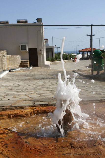
 Curative Water
The temperature of the water that gushes from the spring is around 100ο C
Characterisitcs: Superheated Cl- Na- Ca- K – B- Br- J hypotonic, slightly radioactive curative water of the municipality of Samothraki.
Therapeutic Indications:
Rheumatoid arthritis, chronic rheumatisms, gynecological ailments, peripheral vasculopathies, secondary skin ailments, obesity
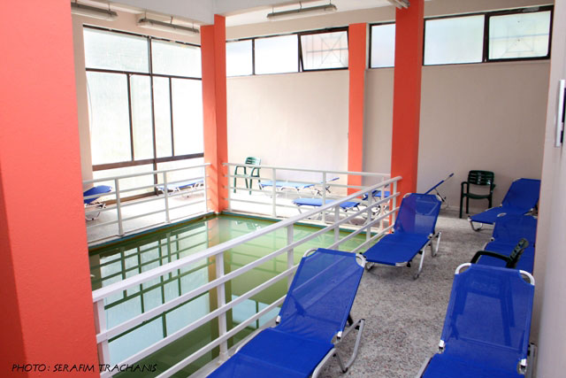
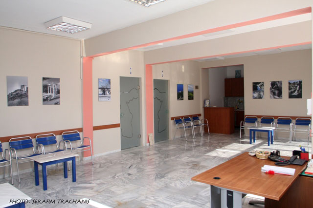
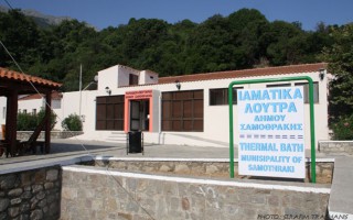
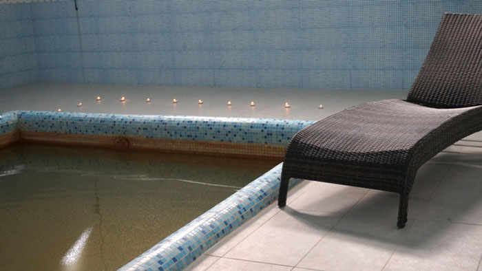
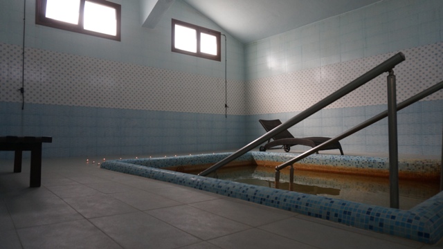
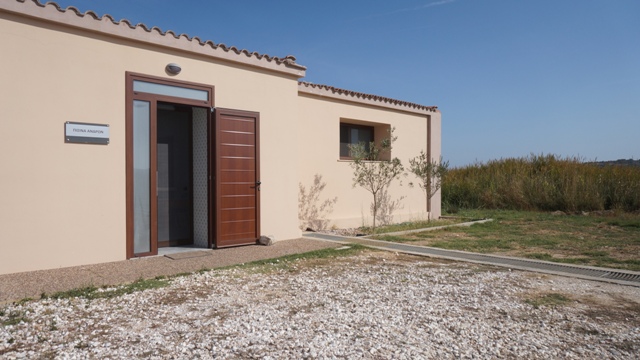
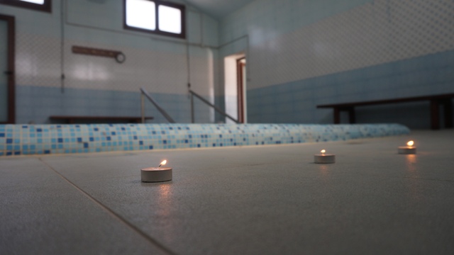
Health thermalism facilities
The baths are located at the foot of Psarotherma hill. They have two pools (men and women) and 13 individual tubs. The temperature of the water in the men’s pool is 40-41ο C and in the women’s 38-39ο C. The facilities are open from June to October and from 09:30 am to 13:30 am and from 17:30 pm to 23:45 pm.
Source: www.thermalsprings.gr
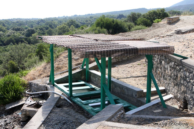
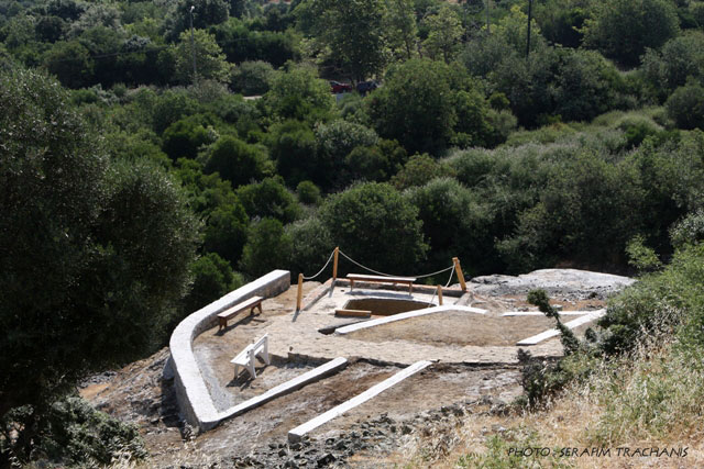
Curative Natural Resource Psarotherma
Samothraki – the Aeolus’s island according to mythology- is a mystical place. The pebbly beaches, the running waters, the unspoilt nature, the celebrated curative springs and unique antiquities compose an idyllic scenery that is breathtaking and fascinating. The hot curative springs are situated at the entrance of the Therma settlement. In Samothraki, visitors, aside from treatment, will be acquainted... read more
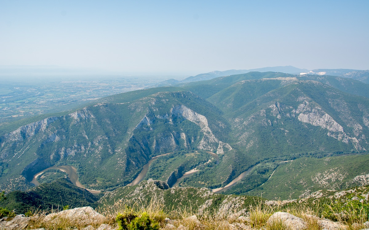
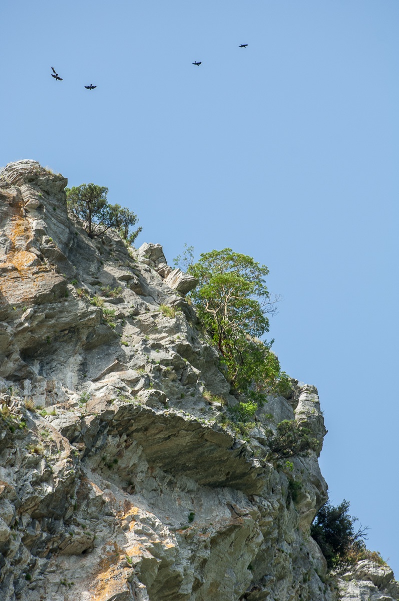
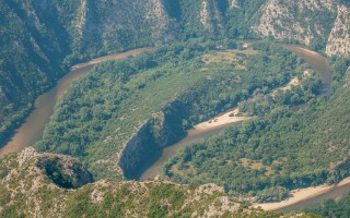
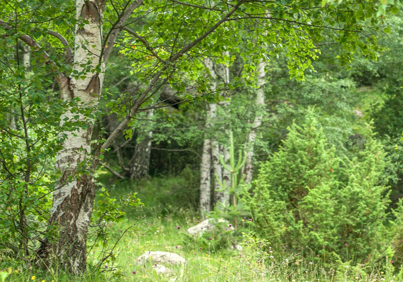
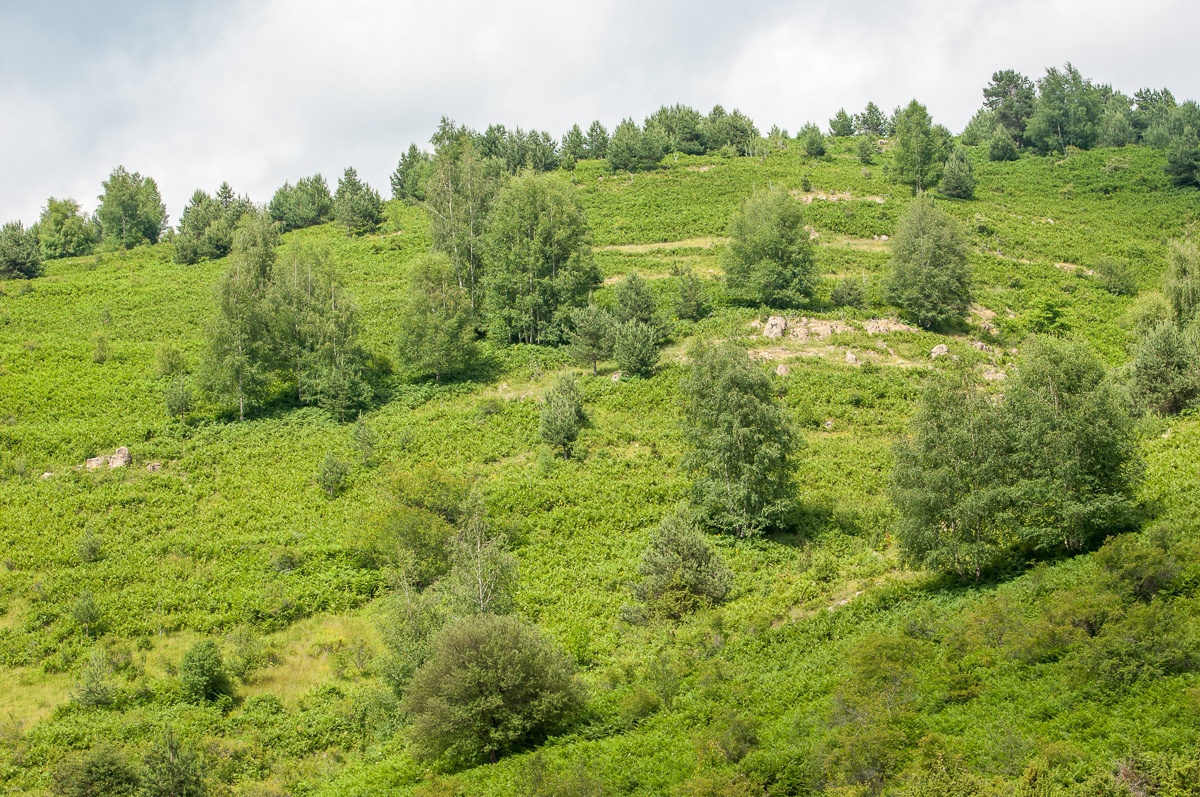
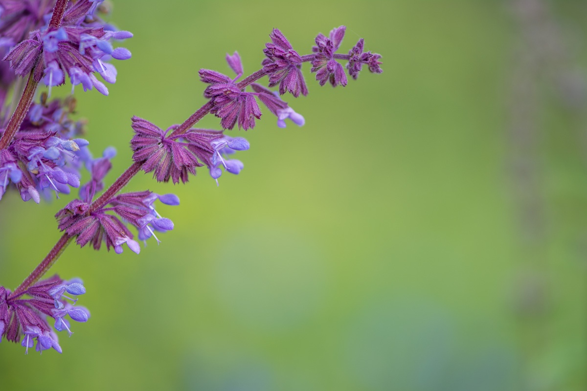
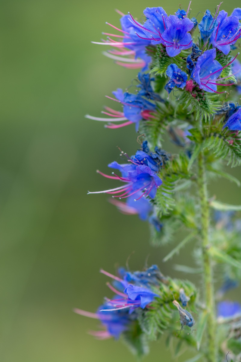
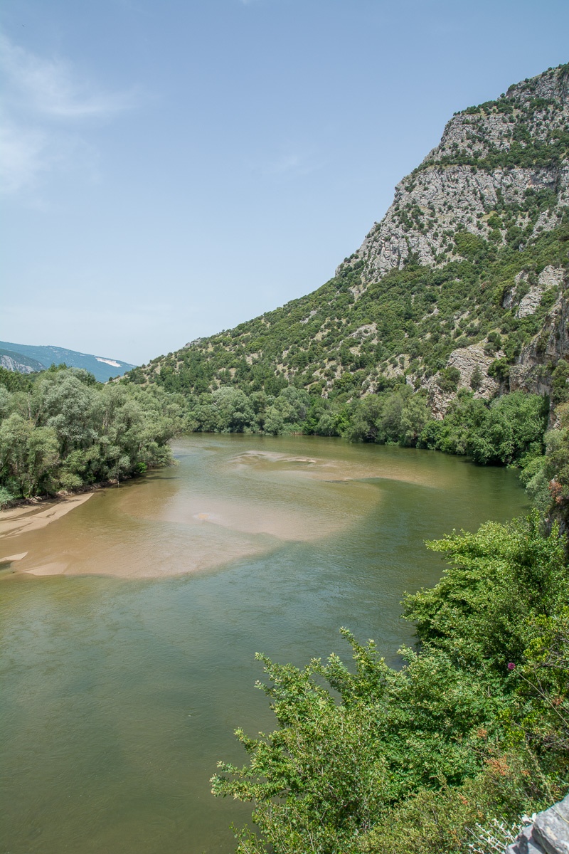 It is located at the borders of Kavala and Xanthi prefectures, south of the town of Stavroupoli, with area of 2,380 hectares. It is one of the most beautiful landscapes of Greece with great ecological interest. The visitors can see the plurality of rare plants such as the agriopaschalia, champerlea, red peony and ramnis of Rhodope.
At the same time, the region is rich in fauna, with nesting wolves, wild cats – which are an endangered species – otters, ferrets, and rare birds such as the black stork, the vulture, the Alkyon, the brown goose and the pygmy cormorant.
Through the Straits of the river passes the railway line that connects Thessaloniki with the cities of Thrace, following an enchanting landscape. But apart from the train there is an etched path, which starts from the village of Galanis and reaches the Stavroupoli and Livaditi.
Source: Eastern Macedonia & Thrace

Riverside forest Kotza Orman or Large Forest
The riparian forest Kotza Orman or Large Forest isa priceless landscape of ecological value and beauty. It was once one of the largest aquatic of Europe, since the "50s there had been recorded 74,000 acres. However,in 1946, 54,000 acres were out of it and given to farmers for cultivation, leaving a small part, which the Forest Service of Kavala is trying to preserve by fencing perimeter stretches... read more
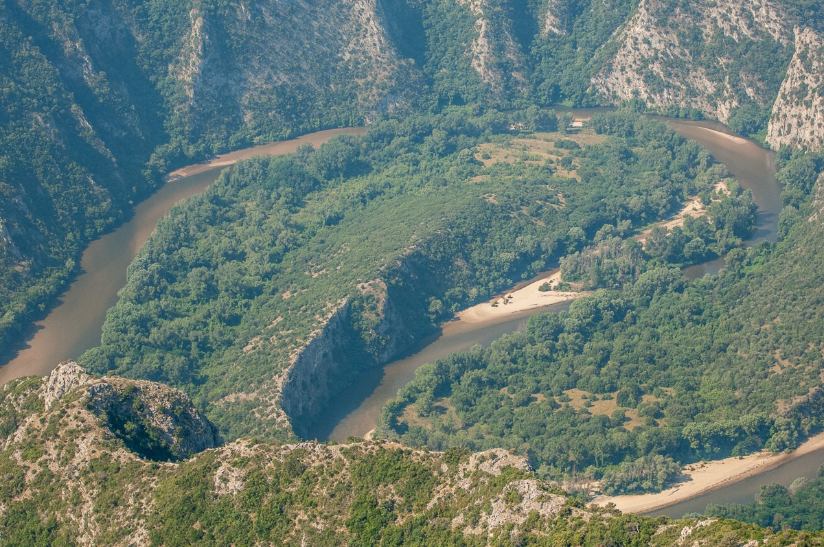
Aesthetic Forest of Strait of Nestos River
It is located at the borders of Kavala and Xanthi prefectures, south of the town of Stavroupoli, with area of 2,380 hectares. It is one of the most beautiful landscapes of Greece with great ecological interest. The visitors can see the plurality of rare plants such as the agriopaschalia, champerlea, red peony and ramnis of Rhodope. At the same time, the region is rich in fauna, with nesting wolves,... read more
Forest of Chaidou
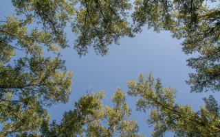
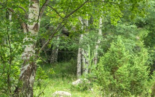
In the Rhodope Mountains, on the border with Bulgaria, there is the Drimos Forest, also known as Chaidou. The forest Chaidou is an earthly paradise with huge centennial beech of over 30 meters height. Apart from the beech forest there is also a large variety of vegetation that grows in the mountains of Rhodope, such as pines, firs, spruces and yellow lilies. It is also a habitat of bears, wolves... read more
Curative Natural Resource Genisaia (Potamia)
The thermal city of Potamia is situated at the 18th kilometre of the road Xanthi – Komotini. People of the intellect, the arts and literature, like Dimokritos, Protagoras, Leykippos were born and thrived in the historical area of Avdira. In a small distance, lies Vistonida lake, one of the most important wetlands of Greece and a little further is the picturesque port of Porto Lagos. The visitor can combine... read more
Archaeological site of Avdira
Archaeological site of Avdira, in the cape of Bouloustra includes the northern and southern precincts, the acropolis of the ancient city and its cemeteries, extending mainly to the NW, N and NE, dating from the Archaic, Classical and Hellenistic periods. Place in the northern precinct preserved sections of the wall and one room buildings prior Clazomenia city of Asia Minor, 7th century BC., parts... read more
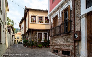
Old Town of Xanthi
The Old Town of Xanthi is located in the north of Xanthi constituting its historic core and covers an area of 380.000m2. The city is built after 1829. The year that large earthquakes fully deplete the previous settlement. The city is built on the ruins and with core the churches, which were probably from the era of Byzantine Xanthia, as it was called from ancient time the city of Xanthi. During... read more
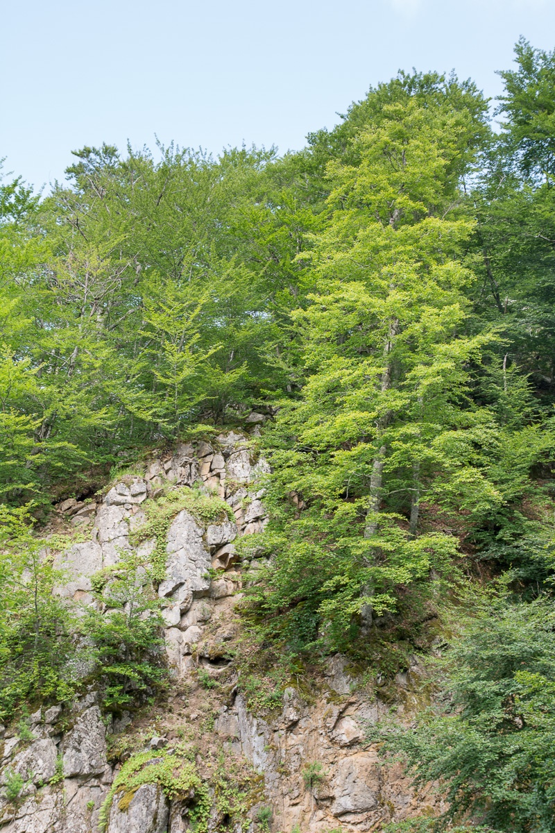 In the Rhodope Mountains, on the border with Bulgaria, there is the Drimos Forest, also known as Chaidou. The forest Chaidou is an earthly paradise with huge centennial beech of over 30 meters height. Apart from the beech forest there is also a large variety of vegetation that grows in the mountains of Rhodope, such as pines, firs, spruces and yellow lilies.
It is also a habitat of bears, wolves and deers. In the 80’s the 180 acres of forest was declared “Natural Monument” and protected area. It can be seen several endemic plants of Rhodope, and other rare species of flora of Greece. There are also rare species of mammals and birds.
In Chaidou threre are bare fields and meadows and bare mountain slopes. Many streams and small rivers flow with fast and cold waters that constitute the zone of trout. It is a centuries-old beech forest, an area of 18 hectares and is located in the mountain Chaidou in the Central Rhodope Mountains, north of the city of Xanthi.
Source: Eastern Macedonia & Thrace
Riverside forest Kotza Orman or Large Forest
The riparian forest Kotza Orman or Large Forest isa priceless landscape of ecological value and beauty. It was once one of the largest aquatic of Europe, since the "50s there had been recorded 74,000 acres. However,in 1946, 54,000 acres were out of it and given to farmers for cultivation, leaving a small part, which the Forest Service of Kavala is trying to preserve by fencing perimeter stretches... read more
Aesthetic Forest of Strait of Nestos River
It is located at the borders of Kavala and Xanthi prefectures, south of the town of Stavroupoli, with area of 2,380 hectares. It is one of the most beautiful landscapes of Greece with great ecological interest. The visitors can see the plurality of rare plants such as the agriopaschalia, champerlea, red peony and ramnis of Rhodope. At the same time, the region is rich in fauna, with nesting wolves,... read more
Forest of Chaidou
In the Rhodope Mountains, on the border with Bulgaria, there is the Drimos Forest, also known as Chaidou. The forest Chaidou is an earthly paradise with huge centennial beech of over 30 meters height. Apart from the beech forest there is also a large variety of vegetation that grows in the mountains of Rhodope, such as pines, firs, spruces and yellow lilies. It is also a habitat of bears, wolves... read more
Curative Natural Resource Genisaia (Potamia)
The thermal city of Potamia is situated at the 18th kilometre of the road Xanthi – Komotini. People of the intellect, the arts and literature, like Dimokritos, Protagoras, Leykippos were born and thrived in the historical area of Avdira. In a small distance, lies Vistonida lake, one of the most important wetlands of Greece and a little further is the picturesque port of Porto Lagos. The visitor can combine... read more
Archaeological site of Avdira
Archaeological site of Avdira, in the cape of Bouloustra includes the northern and southern precincts, the acropolis of the ancient city and its cemeteries, extending mainly to the NW, N and NE, dating from the Archaic, Classical and Hellenistic periods. Place in the northern precinct preserved sections of the wall and one room buildings prior Clazomenia city of Asia Minor, 7th century BC., parts... read more
Old Town of Xanthi
The Old Town of Xanthi is located in the north of Xanthi constituting its historic core and covers an area of 380.000m2. The city is built after 1829. The year that large earthquakes fully deplete the previous settlement. The city is built on the ruins and with core the churches, which were probably from the era of Byzantine Xanthia, as it was called from ancient time the city of Xanthi. During... read more
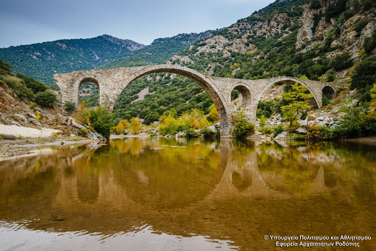
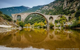
The bridge is located at the exit of Kompsatos, which stems from mountainous Rodopi, is crossed Thracian valley and empties into Lake Vistonida.
In the surrounding area have identified several sites with pre-Christian and Christian antiquities with main Byzantine castle of Polyanthos and an aisled basilica between the village of Polianthos and the bridge.
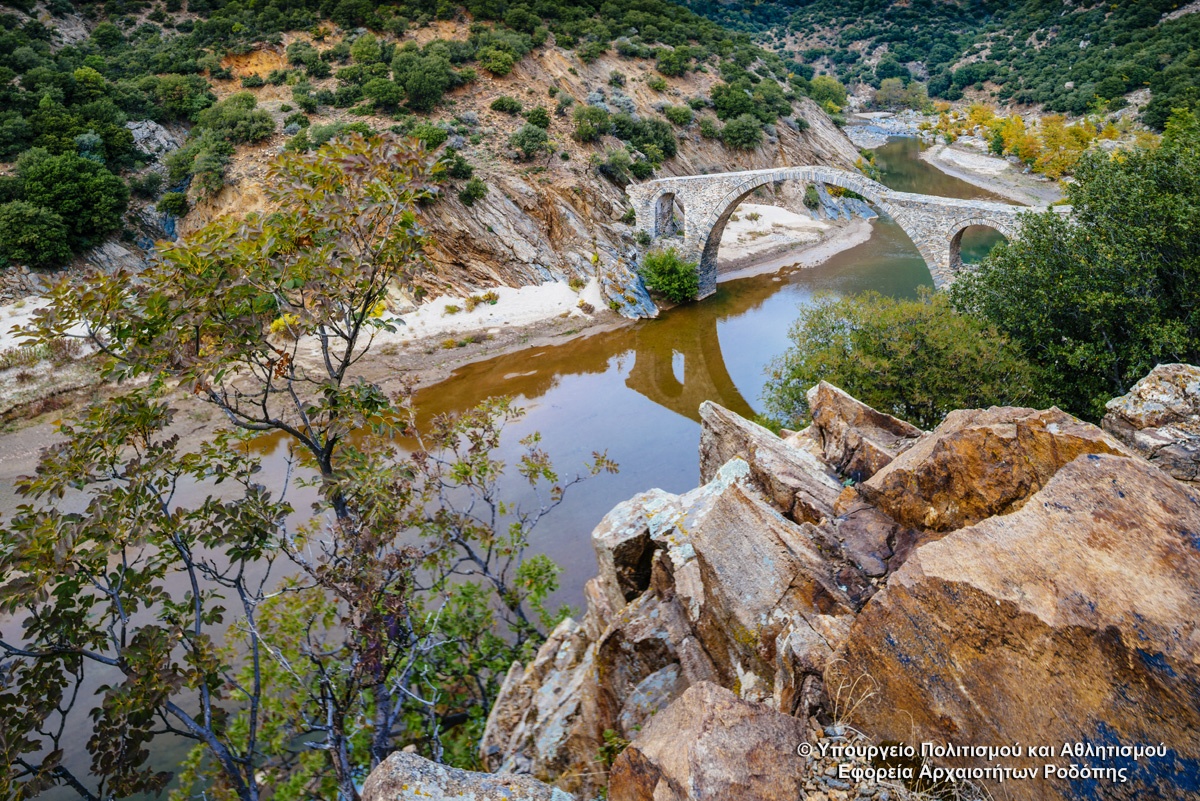
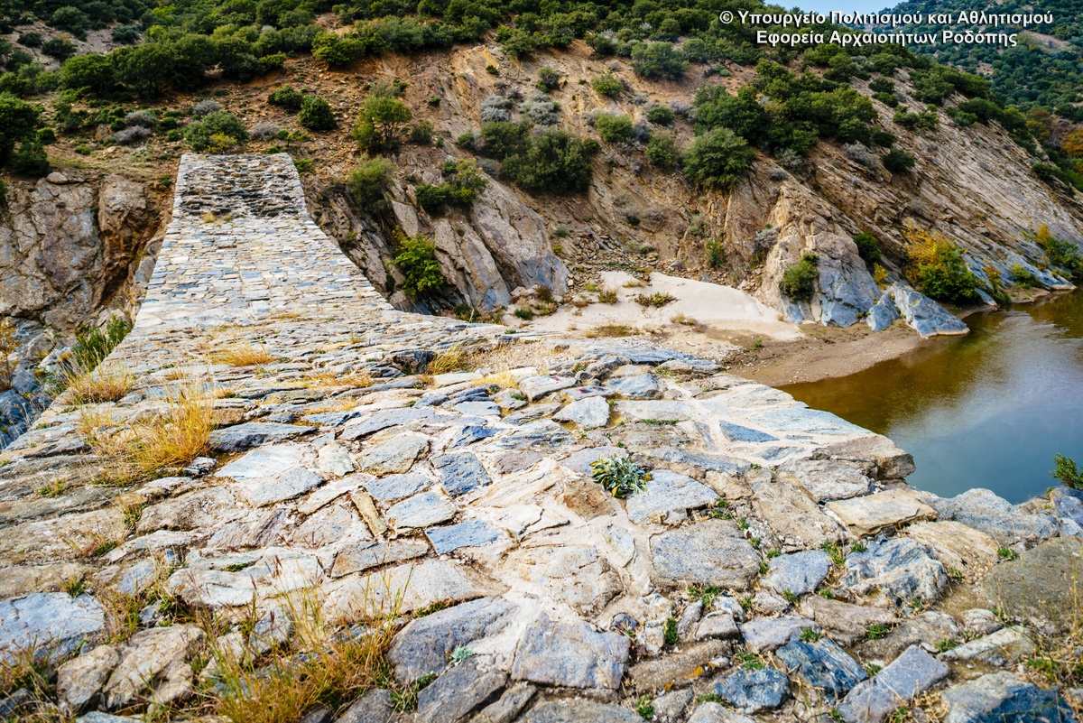
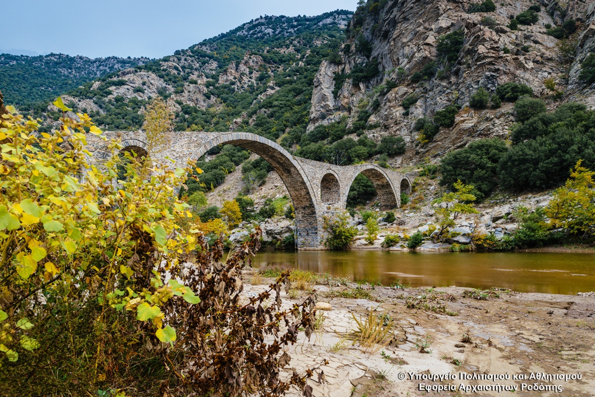
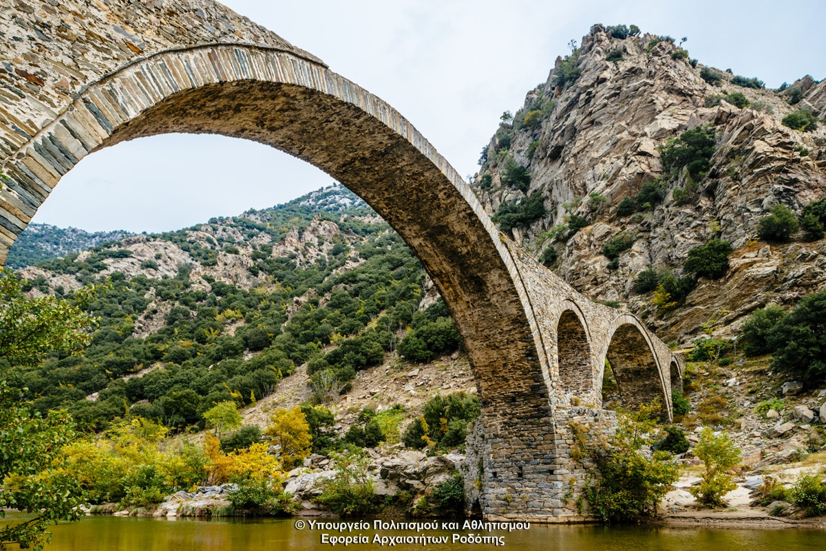
The three-arched bridge was with two piers and two abutments and direction from West to East. Today survives the middle and eastern arc and the eastern abutment. The middle arc which was slightly raised was the larger. Is open 21.80 m and a height of 12 meters The east has opening 17 m. On two piers are relievers openings with flat base and arched roof. Considered a work of craftsmen from Epirus. It dates to 17th-18th century.
Source: Eastern Macedonia & Thrace
Medieval bridge in Polyanthos
The bridge is located at the exit of Kompsatos, which stems from mountainous Rodopi, is crossed Thracian valley and empties into Lake Vistonida. In the surrounding area have identified several sites with pre-Christian and Christian antiquities with main Byzantine castle of Polyanthos and an aisled basilica between the village of Polianthos and the bridge. [su_slider source="media: 10115,10116,10117,10118"... read more
Ancient Theater Maronia
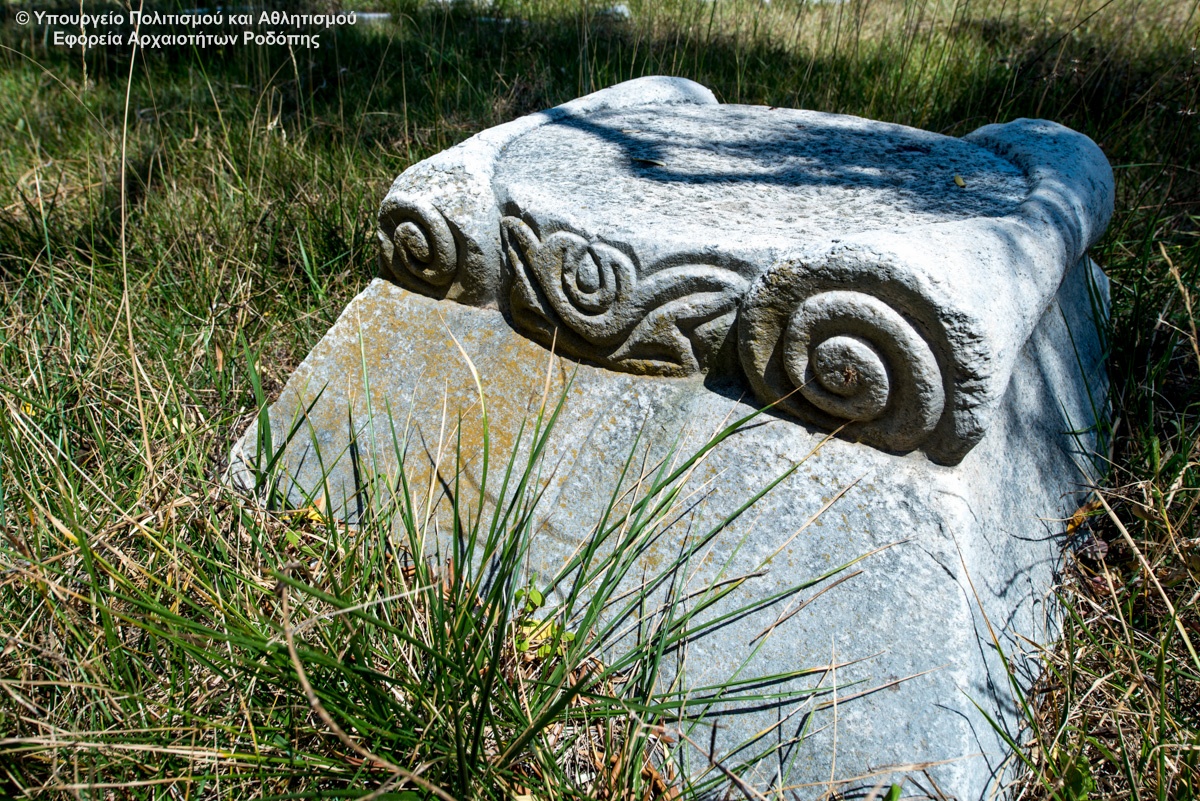
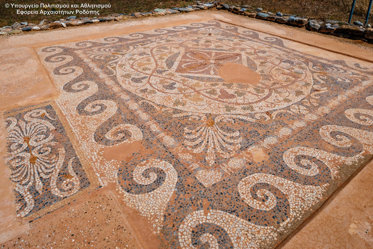
Excavations of the site started in the late 1960's and have brought to light: The theatre of the city, in which two architectural phases are distinguished, dated to the Hellenistic and Roman periods. A sanctuary, probably of Dionysos, dated to the 4th century B.C. , a large Hellenistic house with a mosaic floor, two extensive building complexes, most probably of public function, also dated to the Hellenistic... read more
Megalithic Gate of ancient Ismara
The settlement of Maronia spread over a vast area, from Ismaros Mountain to the Ptelea Lake. Several monuments are today labeled and countless others are scattered throughout the olive groves and the mountainous landscapes of Ismaro. Worth seeing sights are the fortification of Agios Georgios (the megalithic Gate), the complex of Roman times, the walls of the citadel Agios Athanasios (the walls... read more
Music Hall at Komotini
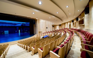
The idea to build a large cultural and conference center in Komotini began in the mid of 1980 decade. Finally study commissioned by the famous architect Nikos Valsamaki but construction was delayed due to lack of funding. Eventually a portion of the building was constructed and completed in the year 2010.To Hall Komotini is located in Santa Varvara, near the camp Iliopoulos and is the third of Greece.... read more
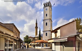
Clock Tower
The Clock Tower was built in 1884, the era of Sultan Abdul Hamid B. In the decade of 1950 became architectural interventions and took its current form. Behind the tower rises the minaret of the mosque of Yeni Mosque from the balcony where the muezzin calls the faithful of Islam to prayer. In the courtyard housed the religious authority of Muslims Rhodope, the Mufti of Komotini. At the southwestern... read more
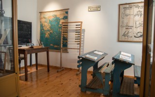
Thracian Museum of Education of the Association...
The Thracian Museum of Education of the Association of Educational Sciences was founded in 1992 to collect and exhibit school objects, documents and books of historical importance, mainly Thracian and of the wider area. Such museums are currently scarce in our country and it is worth noting what, perhaps, is the only rich collection with photographs and a series of wonderful saved school objects that... read more
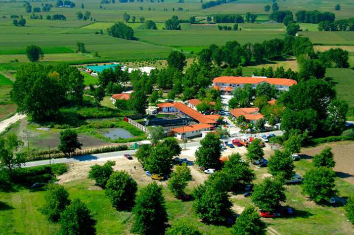
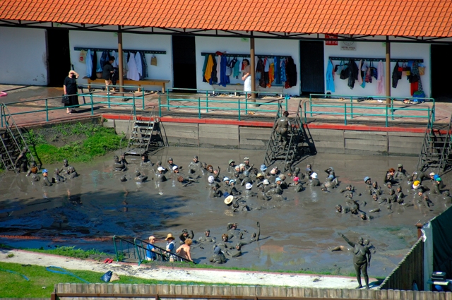
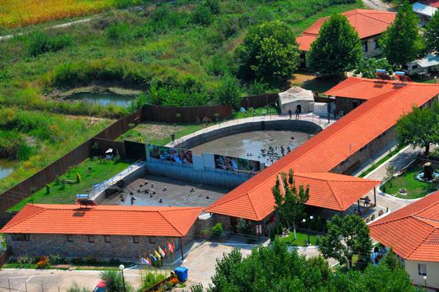
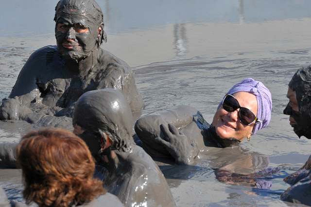
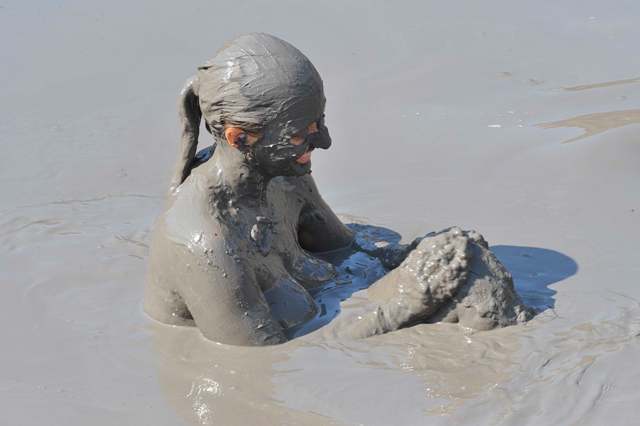
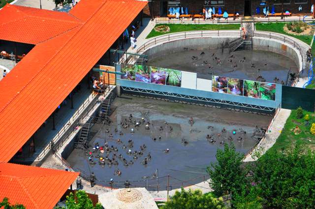 The health place of krinides, with its therapeutic clay and curative water, geographically belongs to a wider area with rich history that begins with the foundation of the city in 360 B.C. One of the most important archaeological sites of eastern Macedonia is situated in Krinides, Kavala. In this historic region one can come across the ancient thermae, the ancient agora, the ancient theatre of Filippoi, Lydia’s place of baptism, the first Christian woman in Europe. So the visitor has the possibility to combine his physical and mental health and well-being with an archaeological tour, a journey through history and time.
Curative Water
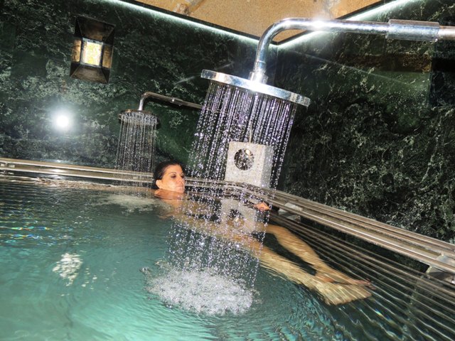
The water that gushes from the spring has a temperature of 29oC. It is suitable for hydrotherapy, in the form of balenotherapy and water mineral drinking therapy.
Characterisation: Tepid Ca- Mg- HCO3 hypotonic curative water
Therapeutic Indications:
Balneotherapy for the ailments of the musculoskeletal system. Mineral water drinking therapy for the gastrointestinal and urinary system.
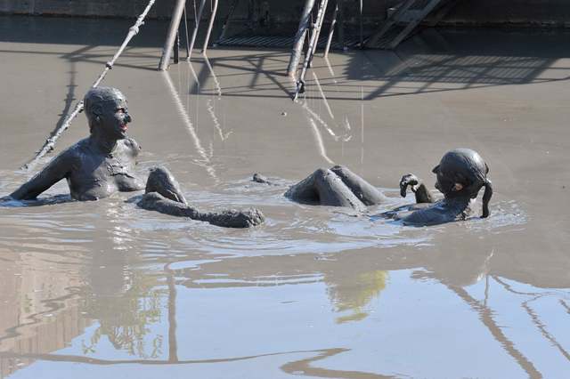
Therapeutic Clay
The therapeutic clay of krinides is the result of natural, biochemical, geochemical and biological procedures that took place in the area of the clay therapy centre, between a solid element, argil, a liquid element, hot mineral water, and an organic element from the plant world. The temperature of the clay reservoirs is 29ο C.
Characterisation: Peaty, argilic, organic therapeutic clay
 Therapeutic Indications:
Autoimmune diseases, rheumatisms and skin ailments.
Health thermalism facilities
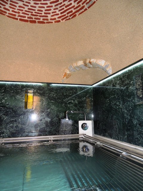
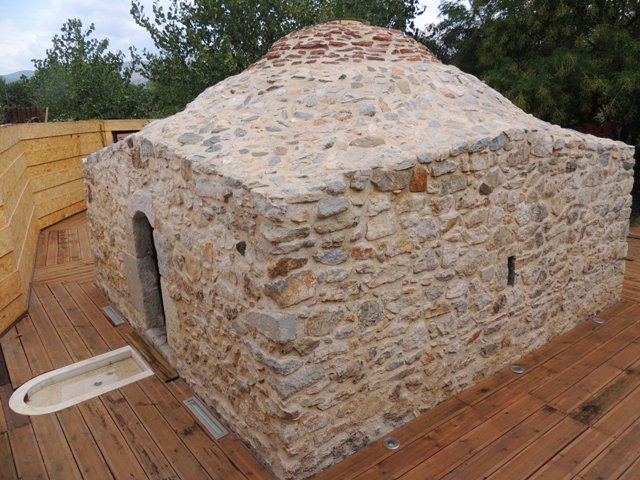
The thermal city has a clay therapy centre, with two group tubs of clay for men and women and a hydrotherapy centre. The hydrotherapy centre is housed in a post byzantine building (old Turkish bath). The facilities are open from the 1st of June to the 15th of October, seven days a week from 08:30 am to 18:00 pm. Visitors can also find accommodation in the premises.
Source: www.thermalsprings.gr
Aesthetic Forest of Strait of Nestos River
It is located at the borders of Kavala and Xanthi prefectures, south of the town of Stavroupoli, with area of 2,380 hectares. It is one of the most beautiful landscapes of Greece with great ecological interest. The visitors can see the plurality of rare plants such as the agriopaschalia, champerlea, red peony and ramnis of Rhodope. At the same time, the region is rich in fauna, with nesting wolves,... read more
Curative Natural Resource Krinides
The health place of krinides, with its therapeutic clay and curative water, geographically belongs to a wider area with rich history that begins with the foundation of the city in 360 B.C. One of the most important archaeological sites of eastern Macedonia is situated in Krinides, Kavala. In this historic region one can come across the ancient thermae, the ancient agora, the ancient theatre of Filippoi,... read more
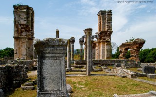
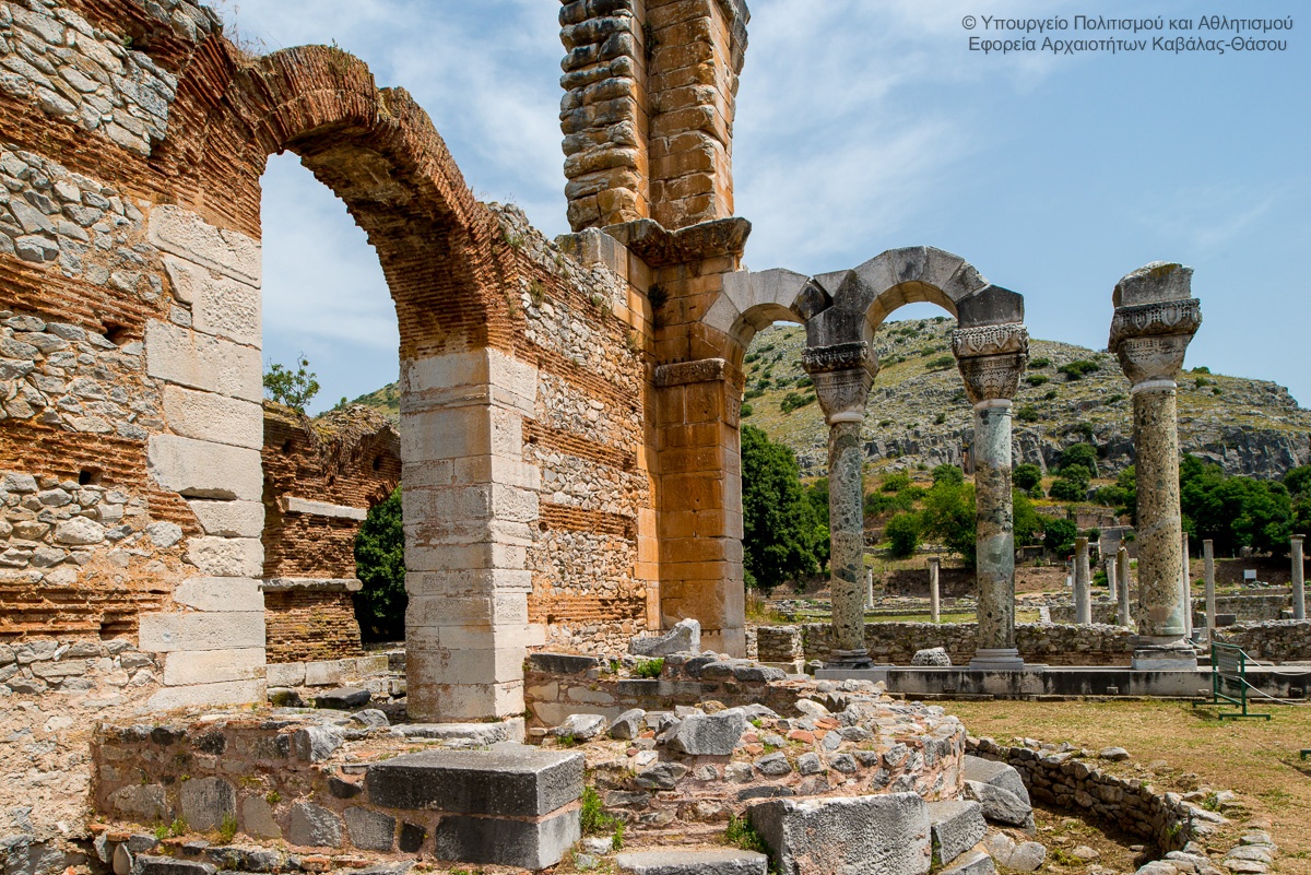
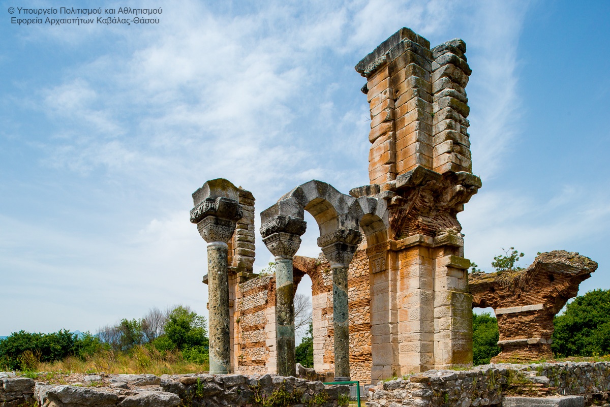
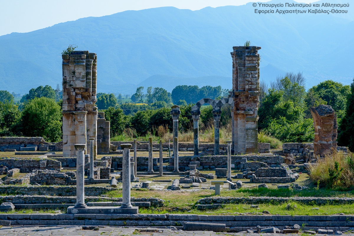
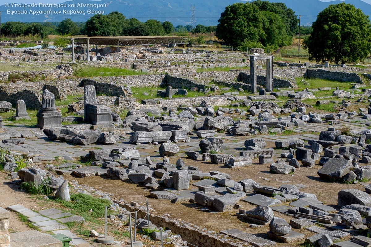
Archaeological site of Philippi
Located 15 km from Kavala in Krinides and is one of the most important historical sites in the area. Founded by the father of the Great Alexander and took his name. Includes, the ancient theater of Philippi (where every summer is organised the homonymous Festival), the Forum and the commercial market, the palaestra, the islands with private houses and early Christian churches. It was founded by Thassian... read more
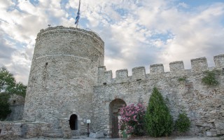
Castle of Kavala
The castle of Kavala is at the top of the peninsula where the old city is built. During Byzantine times and after them successive reconstructions and interventions in the fortification by the Byzantines, Venetians and Turks, have been done. The castle (citadel) in its present form, was built in the first quarter of the 15th century, based on Byzantine foundations. In its external theater are held... read more
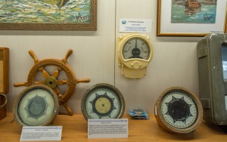
Nautical Museum of Kavala
The Nautical Museum of Kavala was created in 2005 with the aim of preserving the maritime cultural heritage. Currently is underway the creation of space that will house the Maritime Museum. Nevertheless, members of the Museum are being active by visiting schools, participating in the naval week with nautical exhibits and their participation in international conferences. Source: Eastern Macedonia... read more
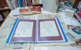
The Historical & Literary Archive of Kavala
The Historical & Literary Archive Kavala was founded in 1996. Its current official legal form and recommendation was made in 1996, when it was obvious that the size was so extended and with important historriacal value that it should be organized with modern methods and standards, based on scientific foundations files, to present a valuable historical material being collected the past 50 years. The... read more
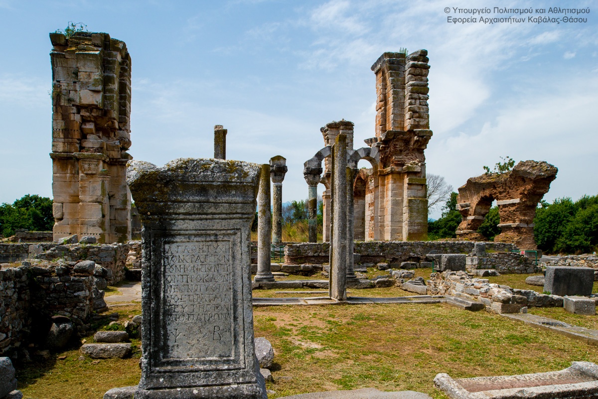
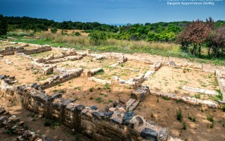
Located 15 km from Kavala in Krinides and is one of the most important historical sites in the area. Founded by the father of the Great Alexander and took his name.
 Includes, the ancient theater of Philippi (where every summer is organised the homonymous Festival), the Forum and the commercial market, the palaestra, the islands with private houses and early Christian churches. It was founded by Thassian settlersin 360 BC. Very soon, in 356 BC, Thassians, as to face the local Thracian tribes sought the help of Philip II, the father of Alexander the Great. Philip B. recognizing the prime location of the city, gave it his name.
The passing of the Egnatia Via through the Philippi area in the 1st century. BC gave the greater weight to the city, and turned it into a benchmark of the region. In 42 BC the Battle of Philippi in the two low hills outside the western city walls caused changes in local and global level. The win of Octavian and Antony, continuing of the policy of Julius Caesar marked the end of democracy , openind the Octavian way for the empire. The site of philippi became a Roman colony (Colonia Augusta Julia Philippensis) who flourished in the second century in 20 sentury AD.
he 49/50 AD Apostole Paul visited the Philippi and founded the first Christian community in Europe. The memory of the visit and his imprisonment remained deeply in the memory and gave an ecumenical Christian pilgrimage character. The city is shrinking in the early of 7th century because of large earthquakes and Slavic raids. Survives in Byzantine times as a fortified castle, keeping its importance due to its location on the main East-West artery land. The complete abandonment occurred with the Turkish conquest in the late of 14th century.
Source: Eastern Macedonia & Thrace
Aesthetic Forest of Strait of Nestos River
It is located at the borders of Kavala and Xanthi prefectures, south of the town of Stavroupoli, with area of 2,380 hectares. It is one of the most beautiful landscapes of Greece with great ecological interest. The visitors can see the plurality of rare plants such as the agriopaschalia, champerlea, red peony and ramnis of Rhodope. At the same time, the region is rich in fauna, with nesting wolves,... read more
Curative Natural Resource Krinides
The health place of krinides, with its therapeutic clay and curative water, geographically belongs to a wider area with rich history that begins with the foundation of the city in 360 B.C. One of the most important archaeological sites of eastern Macedonia is situated in Krinides, Kavala. In this historic region one can come across the ancient thermae, the ancient agora, the ancient theatre of Filippoi,... read more
Archaeological site of Philippi
Located 15 km from Kavala in Krinides and is one of the most important historical sites in the area. Founded by the father of the Great Alexander and took his name. Includes, the ancient theater of Philippi (where every summer is organised the homonymous Festival), the Forum and the commercial market, the palaestra, the islands with private houses and early Christian churches. It was founded by Thassian... read more
Castle of Kavala
The castle of Kavala is at the top of the peninsula where the old city is built. During Byzantine times and after them successive reconstructions and interventions in the fortification by the Byzantines, Venetians and Turks, have been done. The castle (citadel) in its present form, was built in the first quarter of the 15th century, based on Byzantine foundations. In its external theater are held... read more
Nautical Museum of Kavala
The Nautical Museum of Kavala was created in 2005 with the aim of preserving the maritime cultural heritage. Currently is underway the creation of space that will house the Maritime Museum. Nevertheless, members of the Museum are being active by visiting schools, participating in the naval week with nautical exhibits and their participation in international conferences. Source: Eastern Macedonia... read more
The Historical & Literary Archive of Kavala
The Historical & Literary Archive Kavala was founded in 1996. Its current official legal form and recommendation was made in 1996, when it was obvious that the size was so extended and with important historriacal value that it should be organized with modern methods and standards, based on scientific foundations files, to present a valuable historical material being collected the past 50 years. The... read more
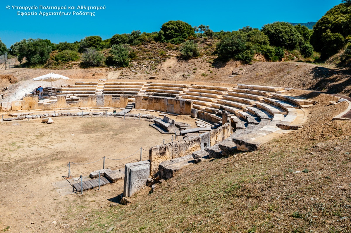
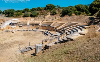
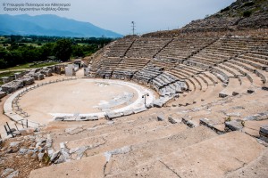
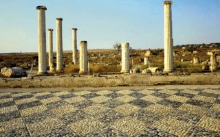
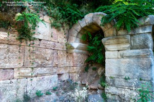 Excavations of the site started in the late 1960’s and have brought to light:
The theatre of the city, in which two architectural phases are distinguished, dated to the Hellenistic and Roman periods.
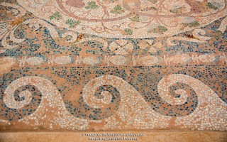
A sanctuary, probably of Dionysos, dated to the 4th century B.C. , a large Hellenistic house with a mosaic floor, two extensive building complexes, most probably of public function, also dated to the Hellenistic period, parts of the fortification wall of the Classical city.
It was constructed in the Hellenistic period and remodelled in Roman times. Preserved are: three rows of stone seats of the cavea, the central and the horseshoe-shaped conduit of the orchestra, and the building of the Roman skene.


Source: Eastern Macedonia & Thrace
Medieval bridge in Polyanthos
The bridge is located at the exit of Kompsatos, which stems from mountainous Rodopi, is crossed Thracian valley and empties into Lake Vistonida. In the surrounding area have identified several sites with pre-Christian and Christian antiquities with main Byzantine castle of Polyanthos and an aisled basilica between the village of Polianthos and the bridge. [su_slider source="media: 10115,10116,10117,10118"... read more
Ancient Theater Maronia
Excavations of the site started in the late 1960's and have brought to light: The theatre of the city, in which two architectural phases are distinguished, dated to the Hellenistic and Roman periods. A sanctuary, probably of Dionysos, dated to the 4th century B.C. , a large Hellenistic house with a mosaic floor, two extensive building complexes, most probably of public function, also dated to the Hellenistic... read more
Megalithic Gate of ancient Ismara
The settlement of Maronia spread over a vast area, from Ismaros Mountain to the Ptelea Lake. Several monuments are today labeled and countless others are scattered throughout the olive groves and the mountainous landscapes of Ismaro. Worth seeing sights are the fortification of Agios Georgios (the megalithic Gate), the complex of Roman times, the walls of the citadel Agios Athanasios (the walls... read more
Music Hall at Komotini
The idea to build a large cultural and conference center in Komotini began in the mid of 1980 decade. Finally study commissioned by the famous architect Nikos Valsamaki but construction was delayed due to lack of funding. Eventually a portion of the building was constructed and completed in the year 2010.To Hall Komotini is located in Santa Varvara, near the camp Iliopoulos and is the third of Greece.... read more
Clock Tower
The Clock Tower was built in 1884, the era of Sultan Abdul Hamid B. In the decade of 1950 became architectural interventions and took its current form. Behind the tower rises the minaret of the mosque of Yeni Mosque from the balcony where the muezzin calls the faithful of Islam to prayer. In the courtyard housed the religious authority of Muslims Rhodope, the Mufti of Komotini. At the southwestern... read more
Thracian Museum of Education of the Association...
The Thracian Museum of Education of the Association of Educational Sciences was founded in 1992 to collect and exhibit school objects, documents and books of historical importance, mainly Thracian and of the wider area. Such museums are currently scarce in our country and it is worth noting what, perhaps, is the only rich collection with photographs and a series of wonderful saved school objects that... read more
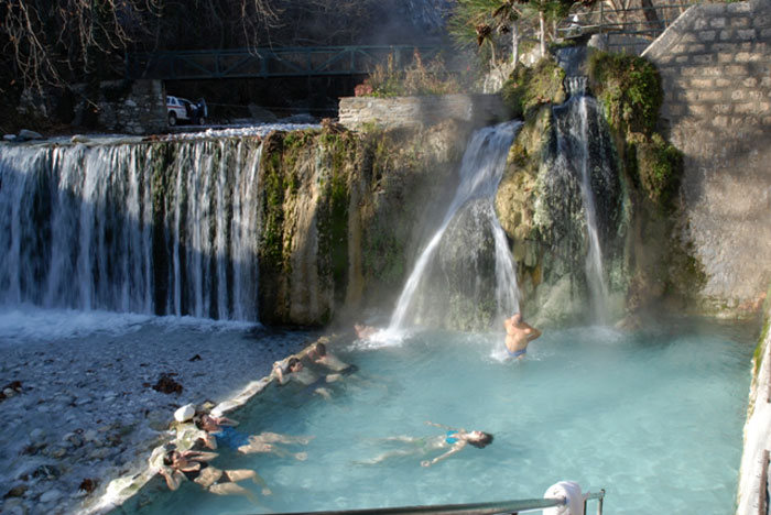
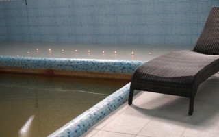
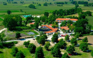
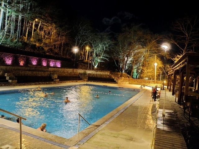
 Loutraki baths (Pozar) are located in the municipality of Almopia, 13 km northwest of Aridaia. The word “pozar” means ember, burning coal. The area of the Pozar Baths is a natural sight, located in a green environment with plane trees and waterfalls. Tile paved paths and constructed wooden bridges aid the visitor follow the mountain paths and reach the complex of the 16 caves.
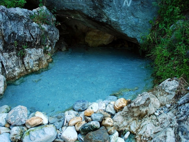
The open pool and the “ponds”, which are naturally shaped in the bank of the hot river, offer the chance of bathing in a fascinating natural scenery. The visitors come to the baths from every corner of Greece either to receive the beneficial properties of the curative waters (therapeutic – relaxing), or to escape in the beautiful mountains with the caves.
 Curative Water
The hot springs gush for the bank of the hot river, with a temperature that reaches 37ο C
Characterisation: Homotherm HCO3- Ca- Mg- K- B- As hyponotic, slightly radioactive curative water of the municipality of Almopia.
Therapeutic Indications: Balneotherapy for rheumatisms, arthritis, ailments of the peripheral nerves, gynecological and skin ailments, sprains, fractures
Health thermalism facilities:
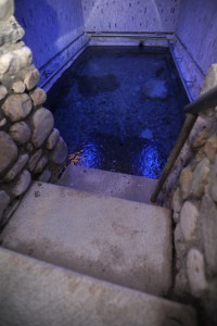
In the new hydrotherapy centre there are private pools, each functioning separately. Their dimensions are 3×3, 1.50 metres deep and temperature of 37 degrees. In the Old Hydrotherapy Centre there are 2 pools with dimensions 3×6 and with a temperature of 37 degrees and 2 smaller pools (Turkish bath like) with a temperature of 38 degrees. Moreover, there are 2 outdoor waterfalls, one of them having a temperature of 37 degrees and the other, which is mixed with cold water, has a temperature of 30 degrees. There is also an outdoor olympic – sized pool with a temperature of 37 degrees in the snack bar area. There are locker rooms in every space.
What’s more, in the area of the thermal city there is a hotel with 10 double rooms and 2 triple rooms and a restaurant as well. It is open the whole year round, day and night.
Springs’ Website: www.loutrapozar.com.gr
Source: www.thermalsprings.gr


Curative Natural Resource Pozar
Loutraki baths (Pozar) are located in the municipality of Almopia, 13 km northwest of Aridaia. The word “pozar” means ember, burning coal. The area of the Pozar Baths is a natural sight, located in a green environment with plane trees and waterfalls. Tile paved paths and constructed wooden bridges aid the visitor follow the mountain paths and reach the complex of the 16 caves. The open pool... read more
Curative Natural Resource Loutrohori
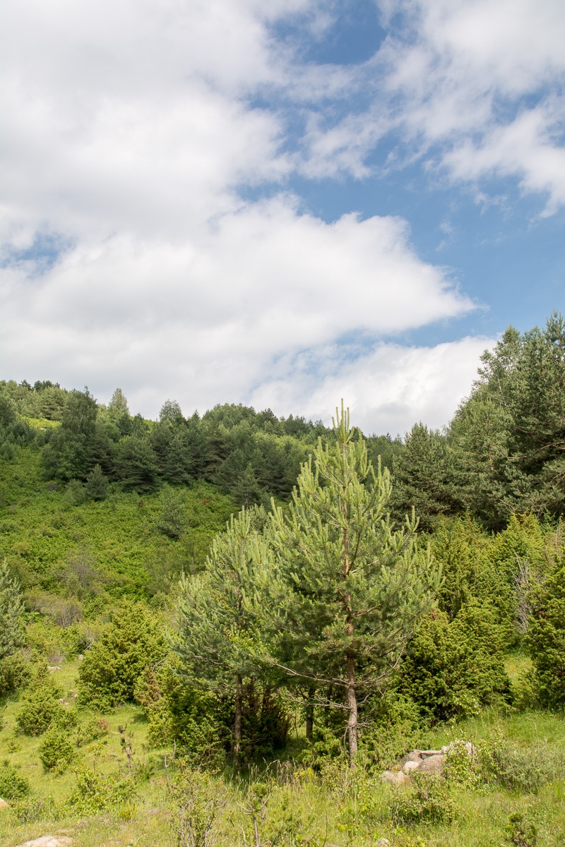
Loutrohori is built on the foot of mount Kamper, on the borders between the prefectures of Pella and Imathia and has an altitude of 90 metres. The beautiful pine forest of the village and the panoramic view of extraordinary beauty that the foot of the hill offers to the tree- covered plain, compose a magnificent scenery. In Loutrohori there are the homonymous curative springs, known throughout Greece... read more
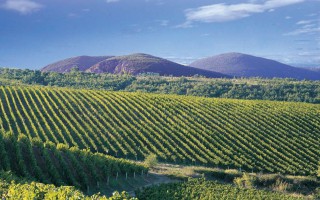
The Wine Route of Pella – Goumenissa
The Wine Route of Goumenissa - Pella, geographically belongs to the Prefectures of Kilkis and Pella and involves the vinicultural regions of Goumenissa and Giannitsa.The wineries of this area are the following: The winery of Tatsis Family, Vaggelis Chatzivaritis and the Boutari Winery in Goumenissa. Goumenissa is a small picturesque town situated at the foot of mount Paiko (1650m.) and was formerly... read more

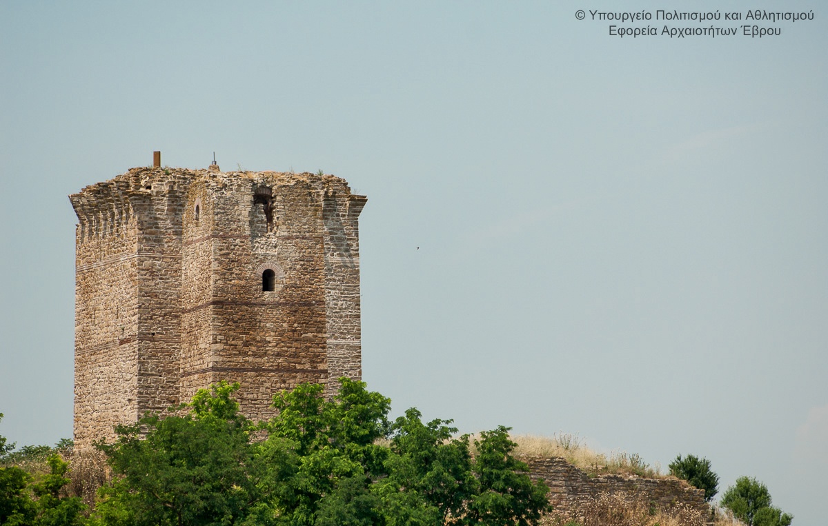
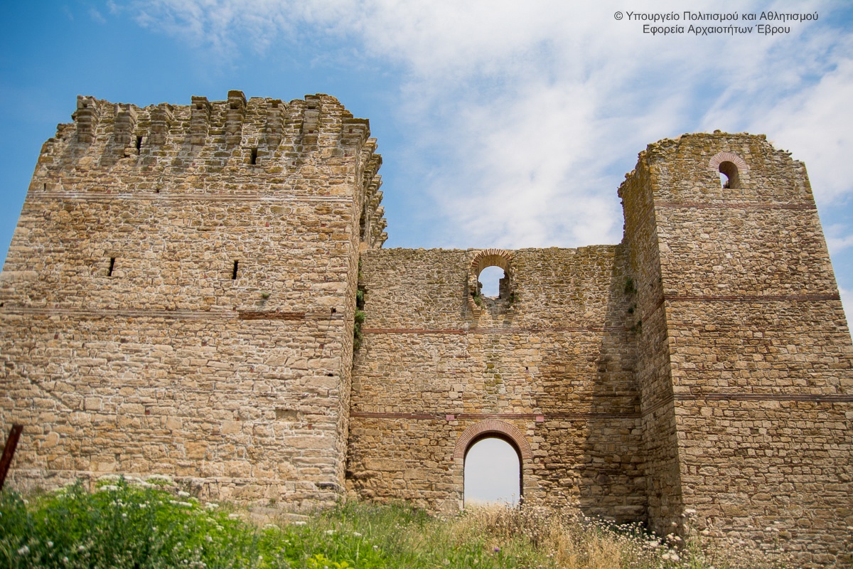
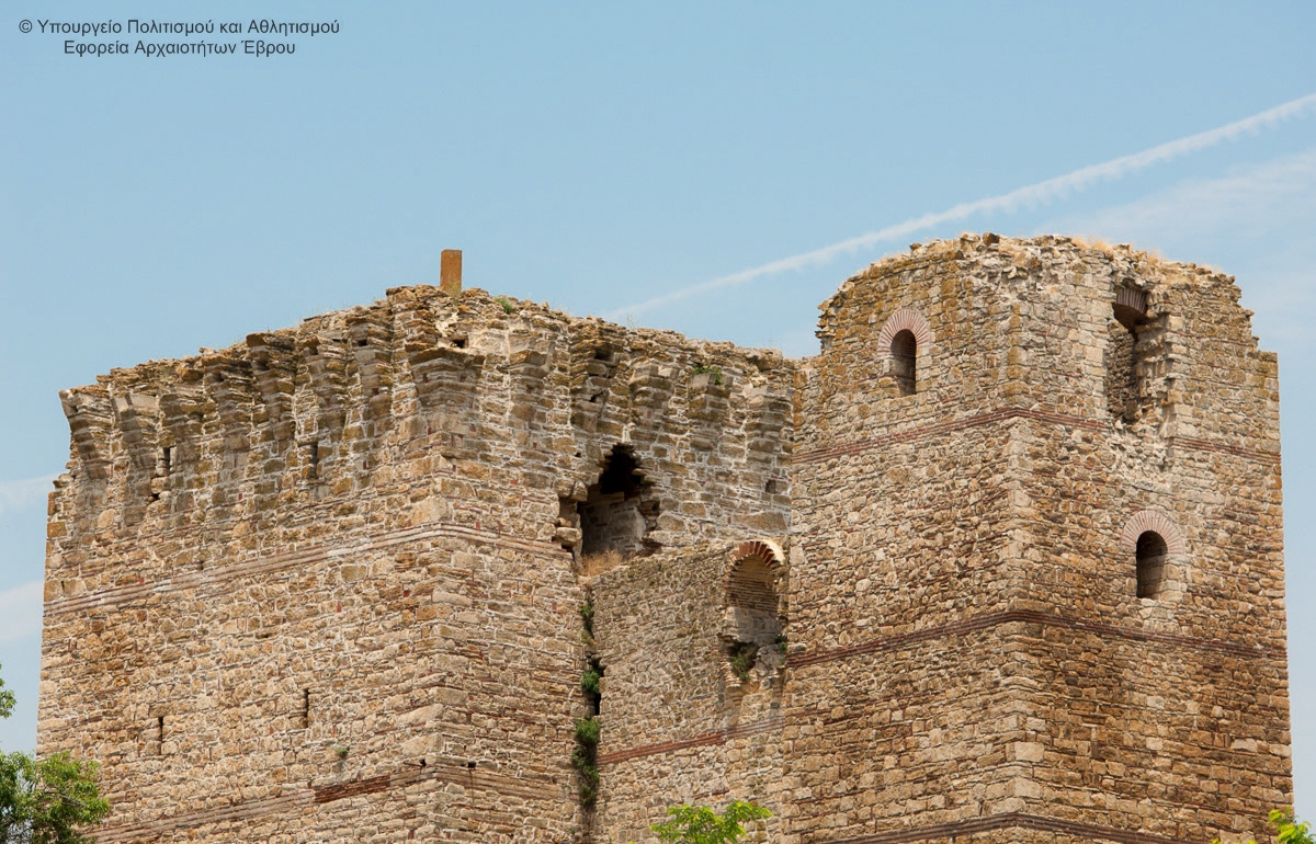
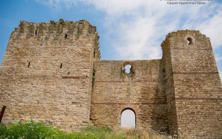
The Castle in Pythio (of the Byzantine Empythio) is located 16 km north of Didymoteicho, near the railway bridge, which enters from the Greek to the Turkish ground.
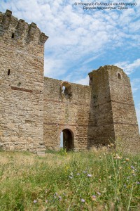 It was built from 1331 to 1341 by Ioannis Kantakouzenos VI, who used it to control the crossings from the valley of the Evros river. Back then, this great river was navigable almost until Filipoypoli and it was the main commercial artery from north to south.
Today, out of the small sized, but strong fort, only two large
towers and some elements of the fortification have survived. This fort was occupied by the Ottomans in 1361, who used it as a base for operations against the Didymoteicho.
Source: Eastern Macedonia & Thrace
Curative Natural Resource Traianoupoli
The hot curative springs of Traianoupoli were a major attraction from ancient times. The city of Traianoupoli was built by the Roman emperor Traianos in the beginning of the 2nd century A.D. According to tradition, Traianos (106/7 A.D.) on his way to and from war for Dakia created “agores”. He founded schools, libraries, baths (thermae). The foundation of Traianoupoli fell within the reconstruction... read more
Castle in Pythion
The Castle in Pythio (of the Byzantine Empythio) is located 16 km north of Didymoteicho, near the railway bridge, which enters from the Greek to the Turkish ground. It was built from 1331 to 1341 by Ioannis Kantakouzenos VI, who used it to control the crossings from the valley of the Evros river. Back then, this great river was navigable almost until Filipoypoli and it was the main commercial artery... read more
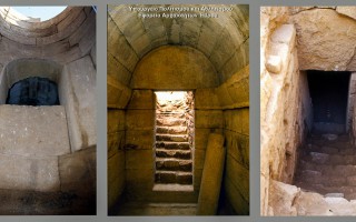
Ancient Plotinoupoli
The hill of Agia Petra in south-eastern side of Didymoteicho has been largely associated with the Roman Plotinopoli. The city was founded by the Roman emperor Trajan, named in honor of his wife Plotina. This hill, in a strategic position, attracted the archaeological interest before the Second World War. In 1965, during the construction of a trench by soldiers was found a hammered gold bust of the Roman... read more
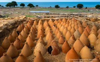
Archaeological Site Zone Messimvria
Messemvria-Zone, a colony of Samothraki the late 7th century BC, initially served the needs of the diocese in agricultural products and commercial communication with the Thracian tribes of the hinterland. But the original rural character passed almost early - in the 6th century B.C. - in a second place, as well as trading and maritime movement of goods proved to be very safe and profitable. So the city... read more
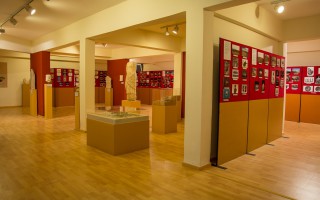
Archaelogical exhibition of Spileo
At the basement of the municipal refreshment of Spileo, at the "Koryfi" (“Top”) area, in a beautiful natural environment, with the view of the plains of Arda and Adrianoupoli, there is the archaeological educational exhibition of Spileo. In a space that was remodeled, after a museological study, with new design and proper lighting, the visitor can see a photographic exhibition of archaeological... read more
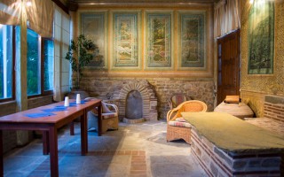
Municipal picture gallery of Didymoteicho
Inside the castle, former residence of Vafeiadis, the renovated building of the Greek interwar, is housed the Municipal Gallery of Didymoteicho. It was founded in 2000 to host the works of the internationally renowned painter Dimitrios Nalbandis. t was decorated internally and externally in eleven months time by the same painter, under voluntary offer to its hometown and the memory of his mother.... read more
 The thermal city of Potamia is situated at the 18th kilometre of the road Xanthi – Komotini. People of the intellect, the arts and literature, like Dimokritos, Protagoras, Leykippos were born and thrived in the historical area of Avdira. In a small distance, lies Vistonida lake, one of the most important wetlands of Greece and a little further is the picturesque port of Porto Lagos. The visitor can combine balneotherapy, with a visit to the Archaeological and Folklore museum of Avdira and go round the picturesque roads of the traditional settlement of Avdira.
Curative Water
The water that gushes from the spring has a temperature of 55-70ο C
Characterisation: Superheated Na-Cl-HCO3-K-B-As-F –acidic, hypotonic, slightly radioactive curative water of the municipality of Avdira
 Therapeutic Indications:
Chronic rheumatisms, gynecological ailments, neuralgia, neuritis, allergic skin ailments
Health thermalism facilities:
The thermal city has hydrotherapy facilities, with two group tubs for men and women. The temperature in the tubs ranges between 39-41ο C.The baths operate from May to January and between the hours 08:30 am – 19:00 pm, except Sunday.
Source: www.thermalsprings.gr
Riverside forest Kotza Orman or Large Forest
The riparian forest Kotza Orman or Large Forest isa priceless landscape of ecological value and beauty. It was once one of the largest aquatic of Europe, since the "50s there had been recorded 74,000 acres. However,in 1946, 54,000 acres were out of it and given to farmers for cultivation, leaving a small part, which the Forest Service of Kavala is trying to preserve by fencing perimeter stretches... read more
Aesthetic Forest of Strait of Nestos River
It is located at the borders of Kavala and Xanthi prefectures, south of the town of Stavroupoli, with area of 2,380 hectares. It is one of the most beautiful landscapes of Greece with great ecological interest. The visitors can see the plurality of rare plants such as the agriopaschalia, champerlea, red peony and ramnis of Rhodope. At the same time, the region is rich in fauna, with nesting wolves,... read more
Forest of Chaidou
In the Rhodope Mountains, on the border with Bulgaria, there is the Drimos Forest, also known as Chaidou. The forest Chaidou is an earthly paradise with huge centennial beech of over 30 meters height. Apart from the beech forest there is also a large variety of vegetation that grows in the mountains of Rhodope, such as pines, firs, spruces and yellow lilies. It is also a habitat of bears, wolves... read more
Curative Natural Resource Genisaia (Potamia)
The thermal city of Potamia is situated at the 18th kilometre of the road Xanthi – Komotini. People of the intellect, the arts and literature, like Dimokritos, Protagoras, Leykippos were born and thrived in the historical area of Avdira. In a small distance, lies Vistonida lake, one of the most important wetlands of Greece and a little further is the picturesque port of Porto Lagos. The visitor can combine... read more
Archaeological site of Avdira
Archaeological site of Avdira, in the cape of Bouloustra includes the northern and southern precincts, the acropolis of the ancient city and its cemeteries, extending mainly to the NW, N and NE, dating from the Archaic, Classical and Hellenistic periods. Place in the northern precinct preserved sections of the wall and one room buildings prior Clazomenia city of Asia Minor, 7th century BC., parts... read more
Old Town of Xanthi
The Old Town of Xanthi is located in the north of Xanthi constituting its historic core and covers an area of 380.000m2. The city is built after 1829. The year that large earthquakes fully deplete the previous settlement. The city is built on the ruins and with core the churches, which were probably from the era of Byzantine Xanthia, as it was called from ancient time the city of Xanthi. During... read more